Area Overview for Leigh Ward
Photos of Leigh Ward


Area Information
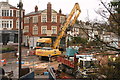
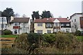
Leigh Ward is a compact district within the borough of Warrington, covering just 4.1 square kilometres. Despite its small footprint, the area accommodates 1,603 residents, creating a tightly knit community where neighbours are likely to know one another. You will find a deep sense of familiarity here, with a population density of 394 people per square kilometre indicating a residential focus rather than sprawling development. Daily life revolves around this concentrated settlement, offering a quieter alternative to the wider surrounding towns. The small scale means amenities are generally within walking distance or a short drive away. Living in Leigh Ward appeals to those who value a defined neighbourhood with a clear sense of place. The area functions as a self-contained unit where the line between private residence and public space feels intimate. This density does not translate to urban chaos; instead, it fosters an environment where residents often know each other by sight or name. The ward represents a specific slice of Warrington, characterised by its manageable size and established community structure. When considering homes in Leigh Ward, you are entering an environment where the overall atmosphere remains steady and predictable. The compact nature of the estate ensures that the area retains a distinct local identity, separate from the broader borough but connected through shared infrastructure and local services.
- Area Type
- District Borough Unitary Ward
- Area Size
- 4.1 km²
- Population
- 1603
- Population Density
- 394 people/km²
Demographics
The community in Leigh Ward reflects a significantly older population compared to the national average. The median age stands at 70 years, indicating that the majority of residents are senior citizens. This demographic profile suggests a mature neighbourhood where daily life moves at a slower pace. You will encounter a community built on long-term residency, with many families likely having lived in the same addresses for decades. The age data confirms that schools near Leigh Ward would primarily serve younger generations arriving from outside the immediate area, as the local birth rate is clearly low. Home ownership levels are high, with 67% of residents owning their property outright or with a mortgage. This figure signals a stable, established community where long-term investment remains the norm. The remaining 33% reside in rented accommodation, creating a housing mix that supports both settled owners and those seeking flexibility. Household composition trends align with the older age profile, pointing towards smaller family units or single-occupancy homes. The ethnic diversity data, while not explicitly detailed in the figures, confirms that the area adheres to broader regional patterns. There is no indication of significant deprivation affects the quality of life here. The low crime risk further supports the conclusion that this is a safe environment for all age groups. Your decision to buy or rent here places you within a quiet, owner-dominated demographic.
Household Size
Accommodation Type
Tenure
Ethnic Group
Religion
Household Composition
Age
Household Deprivation
NS-SEC
Explore more demographic insights in this area
Go to Demographics tabPlanning
Planning Constraints
- Flood RiskPremium
- Ramsar Wetland SitesPremium
- Area of Outstanding Natural BeautyPremium
- Protected Nature ReservePremium
- Protected WoodlandPremium
- Crime RiskPremium