Area Overview for Layham
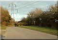
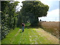
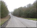
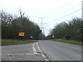
Photos of Layham
Area Information
Living in Layham offers a quiet life within a civil parish that covers an area of 9.9 km². This setting provides a tranquil environment distinct from the faster pace found in larger towns and cities. You will experience a community defined by its relative isolation and established character. The parish status often implies a strong local identity with minimal urban development pressures. Daily life here revolves around local amenities and the natural surroundings that define such small rural parishes. The landscape contributes significantly to the mood, creating a serene backdrop for residents. You can expect a lifestyle where distance plays a key role in accessing services, yet the peace of the countryside remains a primary asset. This area suits those who prioritise stability and quiet over immediate access to major transport hubs. The specific geography of this 9.9 km² footprint ensures that every street is part of a cohesive, small-scale community.
- Area Type
- Parish
- Area Size
- 9.9 km²
- Population
- Not available
- Population Density
- Not available
Demographics
The community in Layham reflects a settled population with a median age of 70 years. This age profile indicates that the parish attracts a significant number of older residents, likely including retirees seeking a calm retirement location. You will find that households here have been established for many years, contributing to the stable social fabric of the area. Home ownership stands at an impressive 79% level, meaning most residents own their properties outright or with a mortgage rather than renting. This high ownership rate suggests long-term commitment to the village. The demographic composition points to a silver community where life moves at a slower pace. While diversity metrics are not detailed in the provided statistics, the high ownership percentage reinforces the picture of a traditional, family- or individual-led village structure. Your neighbours are likely to be long-term residents who value the established order of the parish.
Household Size
Accommodation Type
Tenure
Ethnic Group
Religion
Household Composition
Age
Household Deprivation
NS-SEC
Explore more demographic insights in this area
Go to Demographics tabPlanning
Planning Constraints
- Flood RiskPremium
- Ramsar Wetland SitesPremium
- Protected Nature ReservePremium
- Protected WoodlandPremium
- Crime RiskPremium