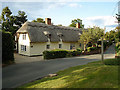
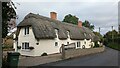
Area Overview for Lamarsh
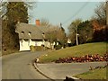
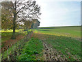
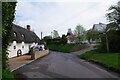
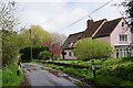
Photos of Lamarsh


Area Information
Living in Lamarsh offers a quiet existence within a built-up area that spans 20.7 hectares. This neighbourhood lies in Suffolk, nestled between the towns of Albury and Cottisford with Bury St Edmunds acting as the nearest significant town. The location provides a rural feel despite being part of a populated district. Most residents enjoy a lifestyle defined by proximity to open spaces and a lower pace of life compared to larger cities. You will find that daily commutes rely heavily on established road networks connecting to wider transport hubs. The area maintains a distinct character separate from crowded urban centres while remaining accessible to nearby amenities. Homes in Lamarsh cater primarily to those seeking stability over urban excitement. You are stepping into a community where local knowledge and established routines define the neighbourhood atmosphere. The layout supports families and individuals looking for a settled life without the complexity of city living. As a built-up area, Lamarsh balances density with the spaciousness required for a peaceful home environment. Prospective buyers find this setting ideal if they prioritise tranquility alongside reasonable access to transport links. The region serves as a practical choice for anyone wanting to live near Suffolk's countryside while retaining access to essential services.
- Area Type
- Built Up Area 250
- Area Size
- 20.7 hectares
- Population
- Not available
- Population Density
- Not available
Living in Lamarsh means enjoying lifestyle convenience through a cluster of nearby amenities. You have access to five key retail outlets within a short distance, ensuring your daily shopping needs are met. Notable names include Co-op Cornard, East of England Co-operative, and Morrisons Daily. These supermarkets provide everything from fresh groceries to household essentials without the need to travel far. Your routine errands can be completed quickly, saving you valuable time. With these options close by, you do not need to drive into central towns for basic purchases. Travel connections also enhance your lifestyle through four rail stations nearby. Bures Railway Station and Sudbury Railway Station offer reliable public transport links for leisure trips or business travel. The closeness of these stations means you can easily reach Suffolk's broader attractions. Retail availability means you will find familiar brands and new products available just steps from your front door. This density of commerce supports a self-sufficient lifestyle where you rarely feel isolated. You do not need a car for every outing, as local shops cover most necessities. The presence of these specific venues ensures that your daily life runs smoothly with minimal hassle.
Amenities
Schools
| Rank | School | Type | Entry gender | Ages |
|---|
Explore more schools in this area
Go to Schools tabDemographics
The community in Lamarsh reflects a clear demographic shift towards older residents. The median age stands at 70, indicating that the population consists primarily of retirees or older adults. This age profile suggests a neighbourhood where life moves at a slower pace and services cater to an older clientele. You will find that the social fabric of Lamarsh revolves around the needs and lifestyles of this age group. Home ownership sits at 80%, meaning four out of five residents own their properties outright or have a significant stake. This high rate indicates long-term stability and a lack of high turnover among households. Accommodation types in Lamarsh largely align with these demographic realities. The majority of homes are likely suited for single occupants or couples who have retired. You should expect a housing stock that includes bungalows and smaller properties rather than large family homes. The population composition points to a relatively homogenous community in terms of life stage. Ethnic diversity and religious figures do not appear as dominant factors in the current data for this specific area. Living in Lamarsh means joining a community where the primary demographic is elderly citizens who value ownership and stability. These facts shape the local culture and the types of services that dominate the high street.
Household Size
Accommodation Type
Tenure
Ethnic Group
Religion
Household Composition
Age
Household Deprivation
NS-SEC
Explore more demographic insights in this area
Go to Demographics tabPlanning
Planning Constraints
- Crime RiskPremium