Area Overview for Knebworth
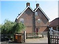
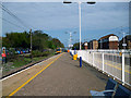
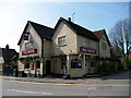
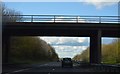
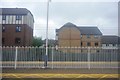
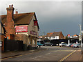
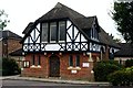
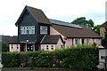
Photos of Knebworth


Area Information
Living in Knebworth offers a distinctive experience within a compact built-up area measuring just 1.3 km². This small town in England presents a quiet alternative to larger metropolitan centres, yet it retains essential connectivity for daily life. The area is defined by its tight-knit nature and proximity to key transport hubs. You will find a residential environment where the physical footprint supports a close relationship between homes and local services. The median age of 70 indicates an older demographic profile, suggesting a community suited to those seeking a slower pace or retirement living. While specific unit counts are not listed, the area functions as a distinct locality with clear boundaries. Daily life here revolves around accessible rail links and local retail without the congestion of bigger cities. Potential homebuyers should note that the small size of 1.3 km² means everything is walkable or a short drive away. This concentrated layout allows for efficient use of space and reduces commute times to nearby employment centres. The area serves as a practical base for commuters accessing Stevenage or Welwyn North while enjoying a degree of seclusion. Knebworth represents a specific choice for buyers prioritising quiet living over urban vibrancy, where the community character is shaped by long-term residents rather than transient populations. ### The community in Knebworth is characterised by a mature population, with a median age of 70 years. This figure places the area well ahead of the national average, indicating that the majority of residents are older adults. The most common age range data suggests a concentration in the senior demographic, though specific breakdowns for younger age groups are not detailed in the available statistics. Home ownership stands at a robust 73%, distinguishing Knebworth as a predominantly owner-occupied locality rather than a rental market. This high percentage implies long-term stability within homes across the town. Household composition and predominant ethnic group data are not broken out in the provided figures, so the general character remains focused on the age profile. The absence of significant rental activity suggests a community where families and retirees have settled permanently. Deprivation metrics are not available for this area, but the high ownership rate often correlates with financial security among residents. You are looking at a neighbourhood where people have likely called Knebworth home for decades. The accommodation type data is not specified, yet the combination of high ownership and older median age points towards detached or semi-detached family housing rather than high-density flats. This demographic snapshot confirms Knebworth as a settled, older community where residents have established deep roots in their local environment. ### Knebworth functions primarily as an owner-occupied market, with home ownership sitting at 73%. This statistic reveals that the vast majority of residents purchase rather than rent their residences. Consequently, the housing stock in Knebworth is likely dominated by freehold properties, typically detached or semi-detached houses suited to the older median age of 70. The high ownership percentage suggests stability and long-term residents who have bought their homes over many years. For buyers examining the market here, the emphasis is on purchase rather than tenancy. There is little indication of a large private or social rental sector within the town itself. The small area size of 1.3 km² further concentrates the housing stock, meaning competing properties may be close together. This concentration can create a tight but manageable market for those looking to acquire a house in Knebworth. The accommodation type data is not explicitly detailed in the provided figures, yet the demographic profile of an older population strongly implies traditional family homes rather than modern apartments or converted flats. When considering homes in Knebworth, you should expect a market where sellers are typically owners downsizing or upgrading, though the specific turnover rate is not recorded. The 73% ownership figure is your primary guide to the nature of transactions in this locality. ### Families considering schools near Knebworth will find one main option within the immediate vicinity. Knebworth Primary and Nursery School is the designated primary institution serving the area. It holds a good Ofsted rating, indicating a standard of education that meets the required benchmarks. As a primary and nursery school, it covers the earliest years of a child's education, from toddlerhood through to the end of the early years foundation stage. There are no secondary schools listed in the data for Knebworth itself, meaning older children will need to travel to neighbouring towns for their high school education. This arrangement is common for small built-up areas in England. You would need to investigate catchment zones for secondary schools in larger towns nearby if you plan to move here with a family. The presence of a single well-rated primary school suggests a quiet academic environment without the competitive pressure of multiple institutions. However, the lack of data on secondary education means you must conduct separate research for older children. For those moving to Knebworth specifically, the school data highlights a good start for young children, supported by the good rating of Knebworth Primary and Nursery School. ### Connectivity in Knebworth is strong, particularly regarding digital infrastructure which is essential for modern living. The fixed broadband quality score reaches 95 out of 100, classifying the connection as excellent. You can expect reliable high-speed internet suitable for working from home or streaming without interruption. Mobile network coverage scores 84 out of 100, which also rates as excellent and ensures you stay connected even while moving around the town. These scores confirm that Knebworth does not suffer from the connectivity gaps found in more rural locations. Residents can work from home with confidence given the superior broadband availability. Public transport links are reinforced by five railway stations in the immediate proximity. Knebworth Railway Station, Stevenage Railway Station, and Welwyn North Railway Station are notable stops, providing easy access to wider networks. These five stations offer frequent services to London and Hertfordshire business hubs. The combination of excellent mobile scores and multiple rail options means you remain connected to both essential services and the rest of the country. Commuters will appreciate the ease of reaching Stevenage or Welwyn North without a car. Digital and physical transport scores both indicate a well-serviced location where Knebworth residents miss little. ### Your daily life in Knebworth benefits from a cluster of amenities within practical reach. Retail options include the Co-op Knebworth and the Co-op Broadwater, alongside the Tesco Woolmer. These three key retailers provide comprehensive shopping for groceries and household essentials. You do not need to travel far for daily necessities as these stores are located nearby. There are five retail venues and five rail stations noted as being close by, ensuring convenience for errands and commutes. The layout supports a lifestyle where you can combine shopping with catching a train to work or leisure activities. Dining and leisure options are not explicitly listed in the data, but the presence of major supermarkets implies a range of food outlets in the vicinity. The area's character is defined by this mix of local village shops and larger chain stores like Tesco. Living in Knebworth means you have immediate access to Co-op Knebworth and Co-op Broadwater for quick visits. The nearby stations at Knebworth, Stevenage, and Welwyn North allow you to use the train for occasional outings to bigger cultural hubs. This balance of local retail and transport access creates a functional lifestyle where you are never more than a short journey from your main needs. ### Safety in Knebworth is a priority for residents, backed by strong performance indicators. The crime risk assessment gives Knebworth a Level PASS status, confirming the area is safe to live in. The safety score is 81 out of 100, where a higher score indicates better safety. This rating places the area below the average crime rate nationally, making it one of the safer neighbourhoods to consider. Living in Knebworth means you can expect low levels of criminal activity compared to urban centres. The data does not specify any particular issues or hotspots, so you can assume a generally secure environment for families and those working from home. There are no warnings included in the assessment, further supporting the conclusion that this is a peaceful place. When evaluating homes in Knebworth, you will not face significant safety concerns based on the current data. The 81/100 score provides objective proof that the area meets high standards for resident security. Whether you are walking your dog at 1.3 km² of local green space or commuting to nearby stations, the environment is designed with your safety in mind. The crime risk level remains consistently low, offering peace of mind for all residents. ### Who typically lives in Knebworth and what is the community feel like?The community is predominantly older adults, with a median age of 70 years. High home ownership at 73% suggests a settled population of local families and retirees. The area offers a quiet, stable environment rather than a transient or student-heavy setting. What schools are available for children living in Knebworth?The only school listed in the immediate area is Knebworth Primary and Nursery School. It holds a 'good' Ofsted rating and serves the early years and primary education needs of local children. Families will need to look to nearby towns for secondary school options as none are listed in Knebworth. How good is the internet and transport connectivity in this area?Digital connectivity is excellent, with a broadband score of 95/100 and a mobile coverage score of 84/100. Transport is supported by five nearby railway stations, including Knebworth, Stevenage, and Welwyn North, providing frequent links to major hubs. Is Knebworth a safe place for families and how easily can I get to shops?The area has a safety score of 81/100 and a 'PASS' crime risk level, indicating lower than average crime. You can access all daily necessities near Co-op Knebworth, Co-op Broadwater, and Tesco Woolmer, which are within practical reach of every home.
- Area Type
- Built Up Area 250
- Area Size
- 1.3 km²
- Population
- Not available
- Population Density
- Not available
Your daily life in Knebworth benefits from a cluster of amenities within practical reach. Retail options include the Co-op Knebworth and the Co-op Broadwater, alongside the Tesco Woolmer. These three key retailers provide comprehensive shopping for groceries and household essentials. You do not need to travel far for daily necessities as these stores are located nearby. There are five retail venues and five rail stations noted as being close by, ensuring convenience for errands and commutes. The layout supports a lifestyle where you can combine shopping with catching a train to work or leisure activities. Dining and leisure options are not explicitly listed in the data, but the presence of major supermarkets implies a range of food outlets in the vicinity. The area's character is defined by this mix of local village shops and larger chain stores like Tesco. Living in Knebworth means you have immediate access to Co-op Knebworth and Co-op Broadwater for quick visits. The nearby stations at Knebworth, Stevenage, and Welwyn North allow you to use the train for occasional outings to bigger cultural hubs. This balance of local retail and transport access creates a functional lifestyle where you are never more than a short journey from your main needs. ### Safety in Knebworth is a priority for residents, backed by strong performance indicators. The crime risk assessment gives Knebworth a Level PASS status, confirming the area is safe to live in. The safety score is 81 out of 100, where a higher score indicates better safety. This rating places the area below the average crime rate nationally, making it one of the safer neighbourhoods to consider. Living in Knebworth means you can expect low levels of criminal activity compared to urban centres. The data does not specify any particular issues or hotspots, so you can assume a generally secure environment for families and those working from home. There are no warnings included in the assessment, further supporting the conclusion that this is a peaceful place. When evaluating homes in Knebworth, you will not face significant safety concerns based on the current data. The 81/100 score provides objective proof that the area meets high standards for resident security. Whether you are walking your dog at 1.3 km² of local green space or commuting to nearby stations, the environment is designed with your safety in mind. The crime risk level remains consistently low, offering peace of mind for all residents. ### Who typically lives in Knebworth and what is the community feel like?The community is predominantly older adults, with a median age of 70 years. High home ownership at 73% suggests a settled population of local families and retirees. The area offers a quiet, stable environment rather than a transient or student-heavy setting. What schools are available for children living in Knebworth?The only school listed in the immediate area is Knebworth Primary and Nursery School. It holds a 'good' Ofsted rating and serves the early years and primary education needs of local children. Families will need to look to nearby towns for secondary school options as none are listed in Knebworth. How good is the internet and transport connectivity in this area?Digital connectivity is excellent, with a broadband score of 95/100 and a mobile coverage score of 84/100. Transport is supported by five nearby railway stations, including Knebworth, Stevenage, and Welwyn North, providing frequent links to major hubs. Is Knebworth a safe place for families and how easily can I get to shops?The area has a safety score of 81/100 and a 'PASS' crime risk level, indicating lower than average crime. You can access all daily necessities near Co-op Knebworth, Co-op Broadwater, and Tesco Woolmer, which are within practical reach of every home.
Amenities
Schools
Families considering schools near Knebworth will find one main option within the immediate vicinity. Knebworth Primary and Nursery School is the designated primary institution serving the area. It holds a good Ofsted rating, indicating a standard of education that meets the required benchmarks. As a primary and nursery school, it covers the earliest years of a child's education, from toddlerhood through to the end of the early years foundation stage. There are no secondary schools listed in the data for Knebworth itself, meaning older children will need to travel to neighbouring towns for their high school education. This arrangement is common for small built-up areas in England. You would need to investigate catchment zones for secondary schools in larger towns nearby if you plan to move here with a family. The presence of a single well-rated primary school suggests a quiet academic environment without the competitive pressure of multiple institutions. However, the lack of data on secondary education means you must conduct separate research for older children. For those moving to Knebworth specifically, the school data highlights a good start for young children, supported by the good rating of Knebworth Primary and Nursery School. ### Connectivity in Knebworth is strong, particularly regarding digital infrastructure which is essential for modern living. The fixed broadband quality score reaches 95 out of 100, classifying the connection as excellent. You can expect reliable high-speed internet suitable for working from home or streaming without interruption. Mobile network coverage scores 84 out of 100, which also rates as excellent and ensures you stay connected even while moving around the town. These scores confirm that Knebworth does not suffer from the connectivity gaps found in more rural locations. Residents can work from home with confidence given the superior broadband availability. Public transport links are reinforced by five railway stations in the immediate proximity. Knebworth Railway Station, Stevenage Railway Station, and Welwyn North Railway Station are notable stops, providing easy access to wider networks. These five stations offer frequent services to London and Hertfordshire business hubs. The combination of excellent mobile scores and multiple rail options means you remain connected to both essential services and the rest of the country. Commuters will appreciate the ease of reaching Stevenage or Welwyn North without a car. Digital and physical transport scores both indicate a well-serviced location where Knebworth residents miss little. ### Your daily life in Knebworth benefits from a cluster of amenities within practical reach. Retail options include the Co-op Knebworth and the Co-op Broadwater, alongside the Tesco Woolmer. These three key retailers provide comprehensive shopping for groceries and household essentials. You do not need to travel far for daily necessities as these stores are located nearby. There are five retail venues and five rail stations noted as being close by, ensuring convenience for errands and commutes. The layout supports a lifestyle where you can combine shopping with catching a train to work or leisure activities. Dining and leisure options are not explicitly listed in the data, but the presence of major supermarkets implies a range of food outlets in the vicinity. The area's character is defined by this mix of local village shops and larger chain stores like Tesco. Living in Knebworth means you have immediate access to Co-op Knebworth and Co-op Broadwater for quick visits. The nearby stations at Knebworth, Stevenage, and Welwyn North allow you to use the train for occasional outings to bigger cultural hubs. This balance of local retail and transport access creates a functional lifestyle where you are never more than a short journey from your main needs. ### Safety in Knebworth is a priority for residents, backed by strong performance indicators. The crime risk assessment gives Knebworth a Level PASS status, confirming the area is safe to live in. The safety score is 81 out of 100, where a higher score indicates better safety. This rating places the area below the average crime rate nationally, making it one of the safer neighbourhoods to consider. Living in Knebworth means you can expect low levels of criminal activity compared to urban centres. The data does not specify any particular issues or hotspots, so you can assume a generally secure environment for families and those working from home. There are no warnings included in the assessment, further supporting the conclusion that this is a peaceful place. When evaluating homes in Knebworth, you will not face significant safety concerns based on the current data. The 81/100 score provides objective proof that the area meets high standards for resident security. Whether you are walking your dog at 1.3 km² of local green space or commuting to nearby stations, the environment is designed with your safety in mind. The crime risk level remains consistently low, offering peace of mind for all residents. ### Who typically lives in Knebworth and what is the community feel like?The community is predominantly older adults, with a median age of 70 years. High home ownership at 73% suggests a settled population of local families and retirees. The area offers a quiet, stable environment rather than a transient or student-heavy setting. What schools are available for children living in Knebworth?The only school listed in the immediate area is Knebworth Primary and Nursery School. It holds a 'good' Ofsted rating and serves the early years and primary education needs of local children. Families will need to look to nearby towns for secondary school options as none are listed in Knebworth. How good is the internet and transport connectivity in this area?Digital connectivity is excellent, with a broadband score of 95/100 and a mobile coverage score of 84/100. Transport is supported by five nearby railway stations, including Knebworth, Stevenage, and Welwyn North, providing frequent links to major hubs. Is Knebworth a safe place for families and how easily can I get to shops?The area has a safety score of 81/100 and a 'PASS' crime risk level, indicating lower than average crime. You can access all daily necessities near Co-op Knebworth, Co-op Broadwater, and Tesco Woolmer, which are within practical reach of every home.
| Rank | School | Type | Entry gender | Ages |
|---|
Explore more schools in this area
Go to Schools tabDemographics
The community in Knebworth is characterised by a mature population, with a median age of 70 years. This figure places the area well ahead of the national average, indicating that the majority of residents are older adults. The most common age range data suggests a concentration in the senior demographic, though specific breakdowns for younger age groups are not detailed in the available statistics. Home ownership stands at a robust 73%, distinguishing Knebworth as a predominantly owner-occupied locality rather than a rental market. This high percentage implies long-term stability within homes across the town. Household composition and predominant ethnic group data are not broken out in the provided figures, so the general character remains focused on the age profile. The absence of significant rental activity suggests a community where families and retirees have settled permanently. Deprivation metrics are not available for this area, but the high ownership rate often correlates with financial security among residents. You are looking at a neighbourhood where people have likely called Knebworth home for decades. The accommodation type data is not specified, yet the combination of high ownership and older median age points towards detached or semi-detached family housing rather than high-density flats. This demographic snapshot confirms Knebworth as a settled, older community where residents have established deep roots in their local environment. ### Knebworth functions primarily as an owner-occupied market, with home ownership sitting at 73%. This statistic reveals that the vast majority of residents purchase rather than rent their residences. Consequently, the housing stock in Knebworth is likely dominated by freehold properties, typically detached or semi-detached houses suited to the older median age of 70. The high ownership percentage suggests stability and long-term residents who have bought their homes over many years. For buyers examining the market here, the emphasis is on purchase rather than tenancy. There is little indication of a large private or social rental sector within the town itself. The small area size of 1.3 km² further concentrates the housing stock, meaning competing properties may be close together. This concentration can create a tight but manageable market for those looking to acquire a house in Knebworth. The accommodation type data is not explicitly detailed in the provided figures, yet the demographic profile of an older population strongly implies traditional family homes rather than modern apartments or converted flats. When considering homes in Knebworth, you should expect a market where sellers are typically owners downsizing or upgrading, though the specific turnover rate is not recorded. The 73% ownership figure is your primary guide to the nature of transactions in this locality. ### Families considering schools near Knebworth will find one main option within the immediate vicinity. Knebworth Primary and Nursery School is the designated primary institution serving the area. It holds a good Ofsted rating, indicating a standard of education that meets the required benchmarks. As a primary and nursery school, it covers the earliest years of a child's education, from toddlerhood through to the end of the early years foundation stage. There are no secondary schools listed in the data for Knebworth itself, meaning older children will need to travel to neighbouring towns for their high school education. This arrangement is common for small built-up areas in England. You would need to investigate catchment zones for secondary schools in larger towns nearby if you plan to move here with a family. The presence of a single well-rated primary school suggests a quiet academic environment without the competitive pressure of multiple institutions. However, the lack of data on secondary education means you must conduct separate research for older children. For those moving to Knebworth specifically, the school data highlights a good start for young children, supported by the good rating of Knebworth Primary and Nursery School. ### Connectivity in Knebworth is strong, particularly regarding digital infrastructure which is essential for modern living. The fixed broadband quality score reaches 95 out of 100, classifying the connection as excellent. You can expect reliable high-speed internet suitable for working from home or streaming without interruption. Mobile network coverage scores 84 out of 100, which also rates as excellent and ensures you stay connected even while moving around the town. These scores confirm that Knebworth does not suffer from the connectivity gaps found in more rural locations. Residents can work from home with confidence given the superior broadband availability. Public transport links are reinforced by five railway stations in the immediate proximity. Knebworth Railway Station, Stevenage Railway Station, and Welwyn North Railway Station are notable stops, providing easy access to wider networks. These five stations offer frequent services to London and Hertfordshire business hubs. The combination of excellent mobile scores and multiple rail options means you remain connected to both essential services and the rest of the country. Commuters will appreciate the ease of reaching Stevenage or Welwyn North without a car. Digital and physical transport scores both indicate a well-serviced location where Knebworth residents miss little. ### Your daily life in Knebworth benefits from a cluster of amenities within practical reach. Retail options include the Co-op Knebworth and the Co-op Broadwater, alongside the Tesco Woolmer. These three key retailers provide comprehensive shopping for groceries and household essentials. You do not need to travel far for daily necessities as these stores are located nearby. There are five retail venues and five rail stations noted as being close by, ensuring convenience for errands and commutes. The layout supports a lifestyle where you can combine shopping with catching a train to work or leisure activities. Dining and leisure options are not explicitly listed in the data, but the presence of major supermarkets implies a range of food outlets in the vicinity. The area's character is defined by this mix of local village shops and larger chain stores like Tesco. Living in Knebworth means you have immediate access to Co-op Knebworth and Co-op Broadwater for quick visits. The nearby stations at Knebworth, Stevenage, and Welwyn North allow you to use the train for occasional outings to bigger cultural hubs. This balance of local retail and transport access creates a functional lifestyle where you are never more than a short journey from your main needs. ### Safety in Knebworth is a priority for residents, backed by strong performance indicators. The crime risk assessment gives Knebworth a Level PASS status, confirming the area is safe to live in. The safety score is 81 out of 100, where a higher score indicates better safety. This rating places the area below the average crime rate nationally, making it one of the safer neighbourhoods to consider. Living in Knebworth means you can expect low levels of criminal activity compared to urban centres. The data does not specify any particular issues or hotspots, so you can assume a generally secure environment for families and those working from home. There are no warnings included in the assessment, further supporting the conclusion that this is a peaceful place. When evaluating homes in Knebworth, you will not face significant safety concerns based on the current data. The 81/100 score provides objective proof that the area meets high standards for resident security. Whether you are walking your dog at 1.3 km² of local green space or commuting to nearby stations, the environment is designed with your safety in mind. The crime risk level remains consistently low, offering peace of mind for all residents. ### Who typically lives in Knebworth and what is the community feel like?The community is predominantly older adults, with a median age of 70 years. High home ownership at 73% suggests a settled population of local families and retirees. The area offers a quiet, stable environment rather than a transient or student-heavy setting. What schools are available for children living in Knebworth?The only school listed in the immediate area is Knebworth Primary and Nursery School. It holds a 'good' Ofsted rating and serves the early years and primary education needs of local children. Families will need to look to nearby towns for secondary school options as none are listed in Knebworth. How good is the internet and transport connectivity in this area?Digital connectivity is excellent, with a broadband score of 95/100 and a mobile coverage score of 84/100. Transport is supported by five nearby railway stations, including Knebworth, Stevenage, and Welwyn North, providing frequent links to major hubs. Is Knebworth a safe place for families and how easily can I get to shops?The area has a safety score of 81/100 and a 'PASS' crime risk level, indicating lower than average crime. You can access all daily necessities near Co-op Knebworth, Co-op Broadwater, and Tesco Woolmer, which are within practical reach of every home.
Household Size
Accommodation Type
Tenure
Ethnic Group
Religion
Household Composition
Age
Household Deprivation
NS-SEC
Explore more demographic insights in this area
Go to Demographics tabPlanning
Planning Constraints
- Crime RiskPremium