Area Overview for Kirtling
Photos of Kirtling

Area Information
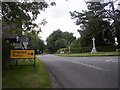
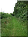
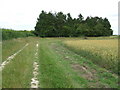
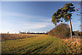
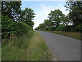
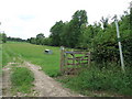
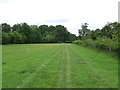
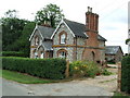
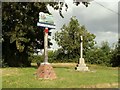
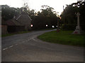
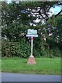
Kirtling is a scattered civil parish situated on the south-eastern edge of Cambridgeshire, covering an area of 12.7 km². This quiet settlement sits on the border with Suffolk, just a few miles south of Newmarket, and includes the distinct locations of Kirtling Green and Kirtling Towers. The community comprises three main parts: Kirtling, Kirtling Green, and Kirtling Towers. Historically, the area has deep roots, with the manor once owned by King Harold before being rebuilt into Kirtling Hall by the North family. While the grand hall was demolished in 1801, the overnighting of King Harold might feel alive in the surviving moated site. You will find yourself living in a neighbourhood that retains a distinct medieval character, defined by protected woodland and a large Tudor gatehouse known as Kirtling Tower. The population figures for the civil parish are included within Woodditton, meaning current census data for Kirtling specifically relies on the broader Woodditton estimates. For a prospective buyer, this translates to a very small, low-density environment where the past shapes the present. Living in Kirtling means existing in a rural hamlet where the daily rhythm follows the seasons rather than a commercial schedule, offering a stark contrast to the busy racecourses of Newmarket nearby.
- Area Type
- Parish
- Area Size
- 12.7 km²
- Population
- Not available
- Population Density
- Not available
Demographics
The community profile suggests a settled, older population, with a median age of 70 years. This figure indicates that the area is primarily inhabited by retirement-age residents rather than young families or working professionals seeking a dynamic, youth-centric environment. Unlike many suburban towns, Kirtling lacks a large school-age demographic within its immediate parish boundaries. Home ownership stands at 55%, a rate that places the area squarely in the middle ground but leans characteristic of rural communities where long-term residents have accumulated equity. The remaining 45% of residents rely on the rental market. Household composition and accommodation type data are reported as totals without further breakdown, suggesting a traditional mix of owner-occupied family homes and rental properties. There is no specific data on ethnicity or religion available for the parish, so the community appears to reflect the general national average rather than a distinct minority or majority concentration. Living in Kirtling offers a demographic environment of stability and quiet, ideal for those seeking a tranquil retirement setting. However, the high median age could impact local services, as the active school-age population is likely drawn from neighbouring larger villages like Upend to the north.
Household Size
Accommodation Type
Tenure
Ethnic Group
Religion
Household Composition
Age
Household Deprivation
NS-SEC
Explore more demographic insights in this area
Go to Demographics tabPlanning
Planning Constraints
- Flood RiskPremium
- Ramsar Wetland SitesPremium
- Area of Outstanding Natural BeautyPremium
- Protected Nature ReservePremium
- Protected WoodlandPremium
- Crime RiskPremium