Area Overview for Kirby Cross
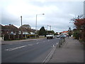
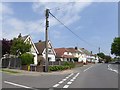
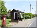
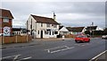
Photos of Kirby Cross
Area Information
Kirby Cross is a compact built-up area covering just 1.7 square kilometres. It sits as a residential hub where daily life revolves around practical accessibility and established community roots. The location's small footprint means that most essential services and transport links are within a short stroll or drive. Residents here typically value convenience above all else, preferring a setting where the station and supermarkets are immediately nearby rather than requiring long commutes solely for basic needs. The area functions as a quiet, established neighbourhood rather than a sprawling town centre, offering a calm environment for those seeking a slower pace of life. Living in Kirby Cross offers a distinct contrast to larger urban centres due to its limited size and high levels of long-term residency. The community feels grounded, with a strong emphasis on stability and familiarity. You will find that the neighbourhood does not change rapidly; instead, it maintains a consistent character defined by its existing housing stock and resident base. This stability makes the area attractive to buyers who prioritise predictability and a sense of belonging over the constant evolution found in growing cities. The layout supports a lifestyle where local facilities form the centre of daily activity, allowing you to manage your household needs without extensive travel.
- Area Type
- Built Up Area 250
- Area Size
- 1.7 km²
- Population
- Not available
- Population Density
- Not available
Daily life in Kirby Cross centres on practical amenities located within a short distance of your doorstep. You have five retail and transport facilities immediately accessible, offering both convenience and variety. The nearest supermarkets include Tesco Kirby and the Tesco in Frinton on Sea, alongside Iceland Frinton, ensuring you can stock your weekly groceries with ease. These retail outlets are clustered near the residential core, meaning you rarely need to travel far to buy food or household essentials. Rail connectivity is another pillar of local lifestyle, with five relevant rail stations nearby, including Kirby Cross Railway Station and platforms serving Frinton, Walton. This transport network allows you to access wider regions quickly when choosing to leave the neighbourhood. Beyond shopping and travel, the area supports a straightforward existence where routine tasks are manageable. Living in this built-up area means you do not need a large car for daily errands, as the designated shops and stations are within practical reach. The combination of these five retail sites and rail options creates a self-sufficient environment where the local area provides for the vast majority of your needs.
Amenities
Schools
Families living in or considering Kirby Cross have access to two primary institutions directly within the locality. Kirby Primary School serves as one of the local educational options, providing early childhood and primary education for young children. A second option is Kirby Primary Academy, which holds an Ofsted rating of 'good'. This rating indicates that the academy meets expected standards for education, behaviour, and personal development. Having two primary schools nearby simplifies the process for parents who must choose an educational setting without needing to commute to other towns for schooling. This mix of schooling options caters specifically to the younger residents within the wider community, even if the median age suggests a larger population of older adults. For those moving to Kirby Cross with children, the presence of a school rated 'good' offers a tangible assurance of educational quality without the need for complex catchment area calculations involving distant institutions. The proximity of these schools means that walking and cycling are viable transport methods for getting to and from class. You do not need to seek out schools outside the immediate vicinity to find a suitable first or second education provider for your child.
| Rank | School | Type | Entry gender | Ages |
|---|---|---|---|---|
| 1 | Kirby Primary School | primary | N/A | N/A |
| 2 | Kirby Primary Academy | primary | N/A | N/A |
Explore more schools in this area
Go to Schools tabDemographics
The community in Kirby Cross reflects a settled, mature population. You will find that the median age here stands at 70 years, indicating a significant presence of older residents compared to the national average. The most common age range broadly spans the total population, suggesting a diverse distribution rather than a narrow spike in youth or retirement demographics. Consequently, the area may see less frenetic energy than younger urban zones but offers a peaceful atmosphere for those in similar life stages. Home ownership is exceptionally high within the neighbourhood, with 82% of households owning their property outright or with a mortgage. This statistic signals that Kirby Cross is primarily an owner-occupied area rather than a rental market. The high rate of ownership suggests that families and individuals have deeply rooted themselves in the locality, delaying moves and investing in their immediate environment. Because so many residents own their homes, the social fabric tends to remain stable, with neighbours knowing one another for decades. This demographic profile creates a quiet but engaged community where property values often reflect long-term stability and investor confidence.
Household Size
Accommodation Type
Tenure
Ethnic Group
Religion
Household Composition
Age
Household Deprivation
NS-SEC
Explore more demographic insights in this area
Go to Demographics tabPlanning
Planning Constraints
- Crime RiskPremium