Area Overview for Kinsbourne Green
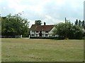
Photos of Kinsbourne Green


Area Information
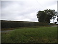
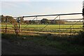
Kinsbourne Green is a defined built-up area situated within the town of Harpenden in Hertfordshire, England. It occupies a compact footprint of 33 hectares, classifying it as a distinct residential zone rather than a sprawling village. Living in Kinsbourne Green means engaging with a mature settlement where daily routines are shaped by proximity to larger transport hubs and local retail centres. The area functions as a practical community for those seeking established housing options close to the M1 corridor. Residents benefit from being approximately 250 metres from the edge of this built-up design, ensuring reasonable accessibility without the noise of a dense urban core. This locality attracts buyers who value straightforward access to the wider Harpenden network while maintaining a separate identity. The residential character is defined by its integration with nearby arterial routes like the A5173, facilitating quick commutes to London or Luton. You can expect a neighbourhood that prioritises functionality, offering a balance between quiet domestic life and efficient connectivity to airports and railway stations. The area is not isolated; it thrives on its connection to Harpenden Railway Station and Luton Airport Parkway Railway Station. For anyone looking at homes in Kinsbourne Green, the reality is a community built on convenience and established infrastructure rather than new development. It remains a stable part of the Harpenden landscape, offering a proven mix of accommodation types for those ready to settle down.
- Area Type
- Built Up Area 250
- Area Size
- 33.0 hectares
- Population
- Not available
- Population Density
- Not available
Daily life in Kinsbourne Green benefits from a small radius of practical amenities within walking distance. Retail options include a Spar M6, Tesco Harpenden, and M&S Townsend BP, providing access to groceries, clothing, and fuel without needing a car for basic errands. Four rail stations are in close reach, ensuring that commuting to London or Luton does not require long journeys. With two London Luton Airports nearby, business travellers and holidaymakers can depart quickly from this location. This concentration of services means you can combine leisure and necessities efficiently. The availability of these specific venues shapes a lifestyle oriented towards independence and convenience. Residents do not need to travel far to find food, transport, or retail support. As you consider living in Kinsbourne Green, you will appreciate how the Spar M6 and Tesco Harpenden form the backbone of your weekly shop. The proximity to Harpenden Railway Station allows for flexible work schedules, while Luton Railway Station offers a critical link to the broader region. Although 33 hectares may seem small for a town, the strategic positioning of these amenities maximises utility. You will find that the core needs of life are met nearby, reducing the time spent commuting to the high street. This arrangement supports a balanced routine where daily tasks are completed efficiently.
Amenities
Schools
| Rank | School | Type | Entry gender | Ages |
|---|
Explore more schools in this area
Go to Schools tabDemographics
The community within Kinsbourne Green is predominantly composed of older residents, with a median age of 70 years. This age profile suggests a neighbourhood favoured by retirees or long-term families who have grown older together. Households in the area are characterised by high levels of stability, evidenced by a home ownership rate of 92%. This figure indicates that mortgage pressure is uncommon here, and the majority of residents have secured their tenure over many years. Approximately 8% of households remain rented, likely comprising the minority of younger professionals or those transitioning into the area temporarily. The population distribution shows that the 'Total' age category represents the most common grouping, reflecting a comprehensive snapshot of the entire community rather than a skewed demographic slice. Regarding accommodation types and ethnic diversity, the available information for these specific metrics is not detailed in the current dataset, but the overwhelming dominance of owner-occupied tenure paints a picture of a settled population. The low presence of rental properties reinforces the idea that this is a place for those staying permanently. As you explore living in Kinsbourne Green, you will find a neighbourhood where the prevailing sentiment is one of long-term residence. This demographic structure supports a calm atmosphere, where community bonds are often forged over generations rather than fleeting tenancies. The high ownership rate also suggests residents are more likely to be involved in maintaining the local estate and participating in area-wide improvements.
Household Size
Accommodation Type
Tenure
Ethnic Group
Religion
Household Composition
Age
Household Deprivation
NS-SEC
Explore more demographic insights in this area
Go to Demographics tabPlanning
Planning Constraints
- Crime RiskPremium