Area Overview for Kingsbrook Ward
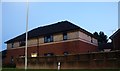
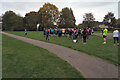
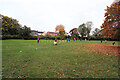
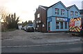
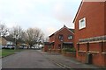
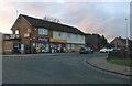
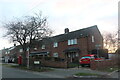
Photos of Kingsbrook Ward

Area Information
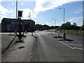
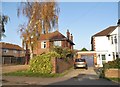
Kingsbrook Ward is a compact district within Bedford Borough, covering an area of just 4.1 km² and serving a population of 3,398 residents. The location sits at coordinates 52.1267, -0.4402, placing it firmly within the Bedford area of the Eastern region while bordering Milton Keynes to the south. This proximity connects the ward to a larger urban centre without sacrificing its distinct local identity as a Unitary Authority ward. Life here is defined by density rather than sprawling space, with a population density of 830 people per km². This figure places Kingsbrook Ward well above the national average, suggesting a neighbourhood where services are within walking distance but joint community life is the norm. You are entering an established community where generations have settled, existing in electoral generations 50 through 59. The ward offers a practical lifestyle for those seeking a setting near major employment hubs like Milton Keynes. Daily life revolves around established patterns typical of a long-standing electoral area. The patchwork of properties from these decades creates a familiar streetscape. There are no amenities listed in the provided data, so you rely on the established infrastructure of Bedford Borough for broader services. The ward is not a blank canvas; it is a defined administrative and residential zone ready for new residents.
- Area Type
- District Borough Unitary Ward
- Area Size
- 4.1 km²
- Population
- 3398
- Population Density
- 830 people/km²
Demographics
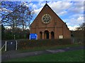
The community profile of Kingsbrook Ward reflects a mature population with a median age of 70 years. You will find this ward predominantly occupied by older residents compared to the national average. The demographic data indicates a concentration in the 'Age: Total' category, highlighting that the entire population aligns with this older profile. This suggests daily life in the area moves at a slower pace and focuses heavily on retirement needs and quiet neighbourhoods. Home ownership figures show that 47% of residents own their homes outright or with a mortgage. This means that roughly half the population consists of owners-occupiers, while the other half likely rents or lives in social housing. The household composition data is recorded as 'total', confirming that the area supports various family structures alongside single-person households typical of retirement residents. Accommodation types follow a similar 'total' categorisation, indicating a standard mix of residential housing rather than specialised blocks. Ethnically, the predominant group is recorded as 'total', signifying a relatively homogenous community without significant minority percentages exceeding the general baseline. Religious affiliation in the ward is listed as 'total', suggesting a non-sectarian distribution common in urban wards. Overall, the community is stable, defined by its senior citizen population and a standard split between ownership and renting.
Household Size
Accommodation Type
Tenure
Ethnic Group
Religion
Household Composition
Age
Household Deprivation
NS-SEC
Explore more demographic insights in this area
Go to Demographics tabPlanning
Planning Constraints
- Flood RiskPremium
- Ramsar Wetland SitesPremium
- Area of Outstanding Natural BeautyPremium
- Protected Nature ReservePremium
- Protected WoodlandPremium
- Crime RiskPremium