Area Overview for Kimberley and Carleton Forehoe
Photos of Kimberley and Carleton Forehoe
Area Information
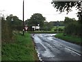
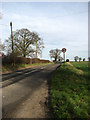
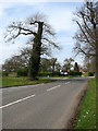
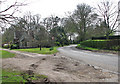
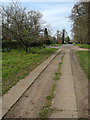
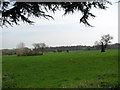
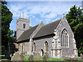
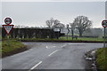
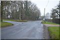
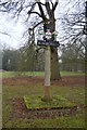
Living in Kimberley and Carleton Forehoe offers a distinctly rural experience within a defined civil parish. This settlement spans 9.3 km², providing a secluded setting that appeals to those seeking space away from urban congestion. The area functions as an independent parish, granting it a specific administrative identity separate from larger neighbouring towns. Daily life here revolves around the quiet rhythm of village living, characterised by open skies and a close-knit social environment. You will find a community focused on tradition and stability rather than rapid urban development. The small size of the parish means residents often know one another well, fostering a predictable and secure atmosphere. There are no major commercial hubs within the immediate parish boundaries, which means your daily needs rely on local amenities or trips to nearby towns. This structured simplicity defines the lifestyle here. You gain privacy and access to green spaces without the density of a larger town centre. The environment supports a slower pace of life, ideal for those who prioritise tranquility over city convenience. Kimberley and Carleton Forehoe presents a clear choice for homebuyers valuing a traditional countryside existence with defined boundaries and a low-profile community structure.
- Area Type
- Parish
- Area Size
- 9.3 km²
- Population
- Not available
- Population Density
- Not available
Demographics
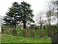
The community in Kimberley and Carleton Forehoe represents a mature population structure. The median age of residents is 70, which is significantly higher than the national average. This statistic confirms that the area primarily houses older adults, likely retirees or long-term residents who have remained throughout their lives. The most common age range spans the total population, indicating that while there are younger residents, the demographic weight heavily skews towards the elderly. You can expect a neighbourhood where life moves to the pace of its oldest members. Home ownership in Kimberley and Carleton Forehoe stands at 75 per cent. This high rate suggests a stable population where families have put down roots over many years rather than moving frequently to seek new opportunities. The lack of data regarding household composition types means you cannot determine the specific ratio of singles to families, but the high ownership rate implies settled living arrangements. Similarly, information on predominant ethnic groups, religion, and accommodation specifics is not available in current records. However, the demographic profile clearly points to an ageing society. This concentration of older residents can influence local service provision and social activities, catering specifically to the needs of a 70-year-old median resident. Living here means joining a community defined by longevity and stability.
Household Size
Accommodation Type
Tenure
Ethnic Group
Religion
Household Composition
Age
Household Deprivation
NS-SEC
Explore more demographic insights in this area
Go to Demographics tabPlanning
Planning Constraints
- Flood RiskPremium
- Ramsar Wetland SitesPremium
- Area of Outstanding Natural BeautyPremium
- Protected Nature ReservePremium
- Protected WoodlandPremium
- Crime RiskPremium