Area Overview for Keysoe Row
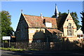
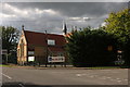
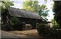
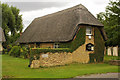
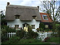
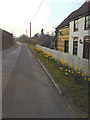
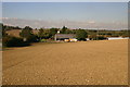
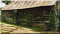
Photos of Keysoe Row


Area Information
Living in Keysoe Row offers a defined residential experience within a built-up area of roughly twenty-six hectares. You can expect a consolidated neighbourhood feel rather than a sprawling rural expanse, making daily routines manageable. The area sits in England, providing a stable location for those seeking a quiet, established community. With a median age of seventy years old, the demographic profile suggests a mature population where retirement living or multi-generational families may be common. This age distribution often correlates with a slower pace of life, away from the intensity of younger urban centres. Daily life in Keysoe Row revolves around proximity to essential services and registered schools. The neighbourhood size means travel distances to local shops and parks are generally short. You will find that the area functions as a self-contained unit, supported by nearby retail options and educational facilities. The focus is on stability and comfort. Prospective residents should note that this is a small but distinct settlement with its own character. The built-up nature ensures that infrastructure is present, while the size prevents large-scale anonymity. You are getting a specific type of English suburbia where neighbours are likely to know one another by name. This makes Keysoe Row suitable for those who value a settled environment over rapid development.
- Area Type
- Built Up Area 250
- Area Size
- 26.4 hectares
- Population
- Not available
- Population Density
- Not available
Daily life in Keysoe Row is supported by a range of retail amenities within practical reach. You have access to five notable shops in the immediate vicinity. These include Budgens Kimbolton, Co-op Eaton, and Tesco Eaton. These venues provide everything from fresh groceries to household essentials without the need for long car journeys. Living in Keysoe Row means your weekly shop is a short drive or a brief walk away, depending on your location within the twenty-six-hectare zone. The retail concentration ensures that routine errands are efficient. Residents can rely on these three specific chains for their main shopping needs. While dining or leisure options are not explicitly listed beyond retail, the presence of major supermarkets like Tesco and Co-op often surrounds ancillary services such as newsagents and pharmacies. This creates a self-sufficient lifestyle where you can manage most domestic tasks locally. The accessibility of Budgens and the two Eaton stores means you do not need to travel to larger towns for basic supplies. This convenience factor is a significant part of the local lifestyle, allowing you to focus your time on home and community rather than extensive travel.
Amenities
Schools
Families considering schools in Keysoe Row have one clear primary option readily available. Kymbrook Primary School operates within the immediate vicinity. The school holds a Ofsted rating of 'good', indicating a standard of education that meets national expectations. This rating suggests a reliable learning environment with competent staff and appropriate resources for children's development. For those looking at Keysoe Row, this single primary school serves as the central educational hub. There is no data listed for secondary schools or alternative types of provision in the immediate coverage area. Consequently, families must plan for secondary education outside the direct neighbourhood boundary. The presence of a 'good' rated primary school provides a solid foundation for early education. However, parents should investigate transport links to secondary institutions, as these are not specified in the local data. The school choice is limited but quality-assured at the primary level. Kymbrook Primary School anchors the educational landscape for the twenty-six hectares of Keysoe Row.
| Rank | School | Type | Entry gender | Ages |
|---|
Explore more schools in this area
Go to Schools tabDemographics
The community in Keysoe Row is defined by a significant home ownership rate of eighty-three percent. This figure indicates that the vast majority of residents live in properties they own outright or are paying off with a mortgage, rather than renting. Such a high level of ownership typically results in a stable population with long-term residents. The median age stands at seventy years, which is exceptionally high compared to the national average. This data point reveals an area where older adults form the backbone of the community. You will find that most households are likely composed of older couples or solo retirees, given the age profile. The demographics suggest a low turnover of families with young children, although the few families present would benefit from the available primary schooling. There is no data on the specific ethnic breakdown or religious composition, but the homogeneity of the age and ownership statistics suggests a traditional community structure. Eighty-three percent ownership means you are likely to buy from someone looking to downsize or move away, rather than from a transient tenant. This environment offers a sense of permanence that rental-heavy areas cannot match. The demographic reality is clear: this is a region for those seeking a quiet, owner-occupied sanctuary.
Household Size
Accommodation Type
Tenure
Ethnic Group
Religion
Household Composition
Age
Household Deprivation
NS-SEC
Explore more demographic insights in this area
Go to Demographics tabPlanning
Planning Constraints
- Crime RiskPremium