Area Overview for Kersey
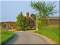
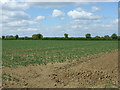
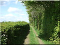
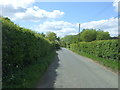
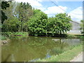
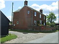
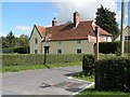
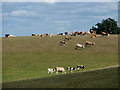
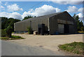
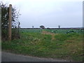
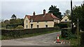
Photos of Kersey
Area Information
Kersey is a civil parish located in Suffolk, covering a total area of 7.8 km². This relatively compact settlement forms a distinct residential community within the broader region of eastern England. Living in Kersey involves navigating a small-scale environment where the built footprint is tightly defined by its geographical boundaries. The local character is shaped by its status as a parish rather than a larger town or city, which influences the daily rhythm of life for its residents. You will find yourself in an area where the proximity of neighbours is inherent due to the limited space available within the parish limits. The physical layout supports a contained existence, meaning that access to nearby villages or towns relies heavily on road networks radiating from these 7.8 km² of land. Daily life here is dictated by the scale of the locality, which fosters a quieter experience compared to more urbanised zones. There are no large commercial high streets within the parish itself, so residents typically rely on the surrounding areas for extensive shopping or leisure activities. This geographical constraint defines the community structure, as life here is often organised around travel to neighbouring hubs for services that do not exist within the parish boundaries. Whether you are considering homes in Kersey or simply visiting, the compact nature of the settlement ensures that the environment remains intimate and manageable. The area does not sprawl, so your horizon is frequently defined by the immediate local landscape rather than distant cityscapes. This confinement creates a specific lifestyle where the house and the village centre are often mere moments apart, reinforcing a traditional sense of locality.
- Area Type
- Parish
- Area Size
- 7.8 km²
- Population
- Not available
- Population Density
- Not available
Demographics
The community in Kersey is defined by a notably older population profile. The median age stands at exactly 70 years old, indicating that the area is predominantly populated by senior residents. This demographic reality shapes the local culture, as the daily life of the parish revolves around the needs and patterns of an elderly populace. The most common age bracket described in available records is simply 'Age: Total', which reflects the broad distribution skewed heavily towards older adults rather than families with young children. Consequently, the local amenities and social interactions you encounter will align with this age composition. Home ownership levels in Kersey are exceptionally high, with 80% of households owning their property outright. This statistic confirms that the housing stock is primarily occupied by residents who have secured their own homes, contrasting sharply with areas dependent on large rental sectors. The remaining 20% of households likely comprise the minority of renters, mobile professionals, or those unable to purchase locally. While the house ownership data points to stability, the absence of specific data on house prices means the financial pressure on new buyers remains an external consideration. The area is not noted for significant ethnic or religious diversity within the reported metrics, suggesting a long-established, homogenous community. For those researching schools near Kersey, it is important to note that the dominant age range implies fewer young families with school-aged children residing permanently within the parish boundaries. Living in Kersey means entering a neighbourhood where generational continuity and established tenure are the defining features of community life.
Household Size
Accommodation Type
Tenure
Ethnic Group
Religion
Household Composition
Age
Household Deprivation
NS-SEC
Explore more demographic insights in this area
Go to Demographics tabPlanning
Planning Constraints
- Flood RiskPremium
- Ramsar Wetland SitesPremium
- Area of Outstanding Natural BeautyPremium
- Protected Nature ReservePremium
- Protected WoodlandPremium
- Crime RiskPremium