Area Overview for Kentford & Moulton Ward
Photos of Kentford & Moulton Ward
Area Information
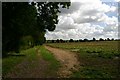
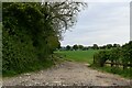
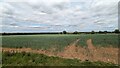
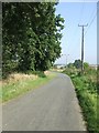
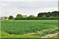
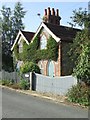
Living in Kentford & Moulton Ward offers a quiet existence rooted in rural Suffolk within the East of England region. This district borough unitary ward spans 40.2 km² and encompasses the villages of Kentford and Moulton. You will find the area situated within the wider Newmarket and Red Lodge constituency, established following the West Suffolk Council election on 2 May 2019. The map reveals a landscape dotted with settlements such as Gazeley, featuring landmarks like Gazeley Mill and roads including Dalham Road, Burgate Road, and Higham Road. Plantations and residential areas define the built environment alongside these local thoroughfares. Daily life here moves at a pace dictated by the countryside rather than a busy city centre. Unlike urban hubs, this area relies on local connectivity and proximity to larger towns for broader services. The ward provides a stable community setting where residents enjoy a strong sense of place without the noise of major development zones. With no protected nature reserves or AONB designations raising immediate planning constraints, the land remains accessible for standard residential use. Yet, the natural features, such as the presence of plantations, ensure the character of Gazeley and surrounding villages remains intact. You can expect a homebuyer-focused environment where the focus is on stability and established neighbourhood patterns rather than rapid change.
- Area Type
- District Borough Unitary Ward
- Area Size
- 40.2 km²
- Population
- Not available
- Population Density
- Not available
Demographics
The community in Kentford & Moulton Ward is defined by an older demographic, with a median age of 70 years. This figure indicates a population heavily weighted towards retirement years and senior living. The most common age range covers the total population breakdown, reflecting a settlement designed for established residents rather than young families seeking their first home. Home ownership stands at a robust 75%, a level that significantly outpaces national averages for similar rural wards. This statistic confirms that the vast majority of households have secured their properties outright or through long-term mortgage ties. Household composition reflects the age profile, likely comprised of single persons, couples without children, and smaller family units. You will not find a dense concentration of student housing or young professional rentals typical of university towns. The predominant ethnic group and religious data represent the total population makeup, with no specific minority concentrations highlighted in the available records. This homogeneity creates a predictable social environment where neighbours know each other well over generations. Low deprivation metrics, inferred from the high ownership rate and low crime scores, suggest a quality of life focused on financial security and stability. Residents here live in an environment where community bonds are strong and economic volatility is minimal.
Household Size
Accommodation Type
Tenure
Ethnic Group
Religion
Household Composition
Age
Household Deprivation
NS-SEC
Explore more demographic insights in this area
Go to Demographics tabPlanning
Planning Constraints
- Flood RiskPremium
- Ramsar Wetland SitesPremium
- Area of Outstanding Natural BeautyPremium
- Protected Nature ReservePremium
- Protected WoodlandPremium
- Crime RiskPremium