Area Overview for Kentford
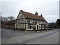
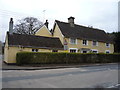
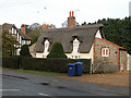
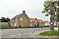
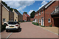
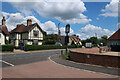
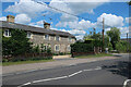
Photos of Kentford


Area Information
Living in Kentford means residing in a built-up area defined by small scale yet solid infrastructure. You will find yourself within a community spread across 74.3 hectares, situated in England. This specific footprint creates a defined neighbourhood where the boundary between domestic peace and surrounding access points remains clear. The area is identified as a town, offering a structure that supports local life without the overwhelming sprawl of larger cities. Residents experience daily routines anchored by proximity to key transport hubs while maintaining a distinct residential character. The environment supports a steady pace of life where commute times to nearby Newmarket or other regional centres are managed through established rail networks. You access essential services such as Tesco Red and Waitrose Newmarket without travelling deep into congested cityscapes. The physical layout of Kentford ensures that homes remain accessible to both quiet rear gardens and the vitality of local high streets. Your everyday movement involves frequent use of routes connecting to Kennett Railway Station and the broader network extending toward Newmarket Railway Station. This configuration places you within a practical radius of RAF Mildenhall as well, should aviation interests or specific logistics matter for your life. The area functions as a self-contained unit where quality of life depends heavily on the efficiency of these connecting veins rather than inward expansion.
- Area Type
- Built Up Area 250
- Area Size
- 74.3 hectares
- Population
- Not available
- Population Density
- Not available
Your lifestyle in Kentford benefits from a curated selection of amenities located within practical reach of the built-up area. Shopping conveniences include Tesco Red and M&S Hyperion BP, providing immediate access to food and household necessities without long journeys into town. Larger retail options such as Waitrose Newmarket are nearby, offering a wider range of products for those preferring premium shopping experiences. Commuting and travel are simplified by the presence of four rail stations close to the community, including Entrance2 and the mainline connections at Kennett Railway Station and Newmarket Railway Station. These stations link you to broader regional networks efficiently, making business trips or weekend getaways straightforward. For residents interested in aviation or logistics, RAF Mildenhall sits at one airport facility within reach, though this remains a notable landmark rather than a daily commuting hub. The local high street environment blends these commercial entities into a cohesive operational zone that supports daily routine. You can plan your week around visits to these specific venues, knowing they are consistently staffed and stocked to meet local demands. This setup ensures that essential errands take minimal time, leaving more of your day for personal pursuits within the quiet surroundings of Kentford.
Amenities
Schools
| Rank | School | Type | Entry gender | Ages |
|---|
Explore more schools in this area
Go to Schools tabDemographics
The community in Kentford reflects a demographic profile dominated by older residents, signalling a shift away from typical youthful population growth patterns. The median age in the area stands at 70 years, a figure that fundamentally shapes the social fabric and local service requirements. This age distribution indicates that Kentford is a place where long-term settlement is the norm rather than a transit point for young professionals seeking temporary housing. Home ownership plays a central role in this social structure, with 67% of households owning their dwellings outright or with a mortgage. This high proportion of owners suggests financial stability among residents and a deep investment in the local status of their properties. The area does not show data regarding specific ethnic groups or predominant religious affiliations, meaning the community composition relies on the established historical population trends rather than newer migration flows. You will likely encounter a neighbourhood where generational knowledge of Kentford runs deep, passed down through families who have lived here for decades. This stability creates a predictable environment where local customs and expectations remain consistent year after year. For anyone considering homes in Kentford, understanding this age-heavy profile is crucial for planning social interactions, service use, and future community engagement. The household composition data confirms a population adapted to life in this specific stage of adulthood.
Household Size
Accommodation Type
Tenure
Ethnic Group
Religion
Household Composition
Age
Household Deprivation
NS-SEC
Explore more demographic insights in this area
Go to Demographics tabPlanning
Planning Constraints
- Crime RiskPremium