Area Overview for Kelvedon
Photos of Kelvedon

Area Information
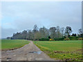
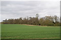
Kelvedon is a civil parish situated in the Braintree District of Essex, covering 13.0 square kilometres. You will find this village nine miles south-west of Colchester and twelve miles north-east of Chelmsford. At the time of the 2021 census, the parish recorded a population of 3,648 people. The settlement has deep roots, standing partly on the site of a Roman location known as Canonium. Archaeological finds, including British Celtic coins from the Trinovantes tribe, confirm habitation in this area for over 2,000 years. Today, Kelvedon forms a single built-up area with the neighbouring village of Feering. The character of the village reflects its historical layers, from the early 12th-century St Mary the Virgin Church to significant Victorian expansion. The arrival of the Norwich to London railway drove growth in the Victorian era, making Kelvedon a commuter location. Suburbanisation accelerated in the 1980s with major developments like Riverside Park, which introduced hundreds of new homes. While the village centre along the High Street remains the historical commercial core, modern residential expansion continues alongside these historical features. Residents live in a setting where 1750s packhorse bridges and medieval streets coexist with contemporary housing estates. This blend defines daily life for those seeking homes in Kelvedon.
- Area Type
- Parish
- Area Size
- 13.0 km²
- Population
- Not available
- Population Density
- Not available
Demographics
The community profile in Kelvedon shows a clear age skew towards older residents. The median age stands at seventy years, indicating that the population is significantly older than the national average. Consequently, the total age range encompasses a large proportion of elderly neighbours, which shapes the local social fabric. Approximately 54% of households in Kelvedon are owner-occupied, meaning more than half of the residents hold the title to their properties. This high level of ownership suggests a stable community where long-term investment is common rather than transient renting. The household composition and accommodation type data indicate a standard residential mix typical for an established village in Essex. Specific figures suggest that the area is not dominated by young families or first-time buyers seeking rental accommodation. Instead, the demographic weight lies with established households. The ethnic and religious breakdown data are not specified in the available census details, but the age and ownership statistics paint a picture of a settled, mature community. Deprivation levels are not explicitly detailed in the current dataset, yet the economic history of seed growing, led by firms like Kings Seeds, provides context for local affluence. Understanding these figures helps you determine if Kelvedon aligns with your lifestyle needs regarding age peers and property stability.
Household Size
Accommodation Type
Tenure
Ethnic Group
Religion
Household Composition
Age
Household Deprivation
NS-SEC
Explore more demographic insights in this area
Go to Demographics tabPlanning
Planning Constraints
- Flood RiskPremium
- Ramsar Wetland SitesPremium
- Area of Outstanding Natural BeautyPremium
- Protected Nature ReservePremium
- Protected WoodlandPremium