Area Overview for IP9 2QT
Photos of IP9 2QT
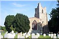
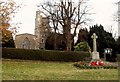
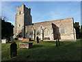
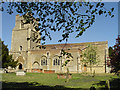
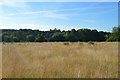
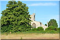
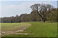
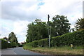
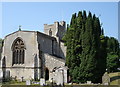
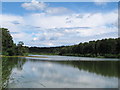
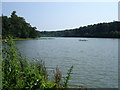
42 photos from this area
Area Information
Key information about the IP9 2QT including its size, population, and administrative classification.
- Area Type
- Postcode
- Area Size
- 22.0 hectares
- Population
- 2456
- Population Density
- 157 people/km²
House Prices in IP9 2QT
34
Properties
£470,609
Average Sold Price
£187,500
Lowest Price
£1,512,500
Highest Price
Showing 34 properties
| Address | Type | Beds | Baths | Last Sale Price | Last Sale Date | |
|---|---|---|---|---|---|---|
| Redcote, Ipswich Road, Holbrook, IP9 2QT | Bungalow | 3 | 2 | £335,000 | Feb 2024 | |
| Red Roofs, Ipswich Road, Holbrook, IP9 2QT | Bungalow | - | - | £400,000 | Dec 2022 | |
| Clovelly, Ipswich Road, Holbrook, IP9 2QT | Bungalow | - | - | £485,000 | Jun 2021 | |
| Lowlands, Ipswich Road, Holbrook, IP9 2QT | Bungalow | 3 | 1 | £530,000 | Mar 2021 | |
| Elm Cottage, Ipswich Road, Holbrook, IP9 2QT | house | - | - | £522,500 | Jul 2019 | |
| Willows, Ipswich Road, Holbrook, IP9 2QT | Detached | 4 | 2 | £540,000 | May 2019 | |
| Blackmore Barn, Ipswich Road, Holbrook, IP9 2QT | Bungalow | - | - | £427,500 | May 2018 | |
| The White House, Ipswich Road, Holbrook, IP9 2QT | Detached | 6 | - | £825,000 | May 2017 | |
| Endymion, Ipswich Road, Holbrook, IP9 2QT | Semi-detached | 3 | 1 | £275,000 | Mar 2017 | |
| Pettwood, Ipswich Road, Holbrook, IP9 2QT | Detached | 6 | - | £1,512,500 | Dec 2016 |
Page 1 of 4
Energy Efficiency in IP9 2QT
Amenities
Schools
| Rank | School | Type | Entry gender | Ages |
|---|
Explore more schools in this area
Go to Schools tabDemographics
Household Size
Two person
most common
Accommodation Type
Houses
most common
Tenure
72
majority
Ethnic Group
White
most common
Religion
N/A
most common
Household Composition
N/A
most common
Age
47
median
Adults (30-64 years)
most common
Household Deprivation
N/A
with no deprivation
NS-SEC
43
in Lower managerial occupations
Explore more demographic insights in this area
Go to Demographics tabPlanning
Planning Constraints
- Flood RiskPremium
- Ramsar Wetland SitesPremium
- Area of Outstanding Natural BeautyPremium
- Protected Nature ReservePremium
- Protected WoodlandPremium