Area Overview for IP9 1LF
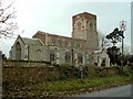
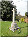
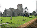
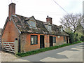
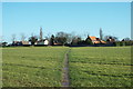
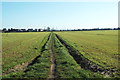
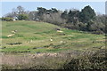
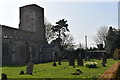
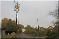
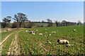
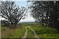
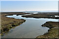
Photos of IP9 1LF
Area Information
IP9 1LF defines a specific postcode cluster covering 10.9 hectares, yet it supports a distinct population of 2,151 residents. You will find a tight-knit residential community where daily life revolves around the immediate neighbourhood and accessible local services. The area functions as a well-defined pocket within the wider region, offering a balance of private living space and proximity to broader transport links. Residents enjoy the convenience of having their essential needs within practical reach, from grocery stores to rail access points. This compact footprint means you can walk or drive quickly to other parts of Ipswich or the surrounding countryside when required. The mix of housing, predominantly consisting of houses, suggests a layout designed for ground-level living rather than high-rise living. Living in IP9 1LF affords you a sense of local identity supported by a stable population density of 93 people per square kilometre. You are part of a settled environment where the layout supports a family-oriented pace of life.
- Area Type
- Postcode
- Area Size
- 10.9 hectares
- Population
- 2151
- Population Density
- 93 people/km²
Homes in IP9 1LF are characterised by a market heavily weighted toward owner-occupation, with 69% of residents owning their property. This statistic confirms the area functions as a stable, established residential zone rather than a volatile rental hub. The accommodation type is exclusively houses, meaning you will not find flats or high-rise apartments within this specific postcode cluster. This structure appeals to buyers seeking ground-level privacy and traditional garden space, features that typically attract families and longer-term occupants. The absence of rental infrastructure suggests a lower turnover of residents compared to market-led estates. For those looking to buy, the high ownership rate implies that existing neighbours likely have strong ties to the locality. This stability can lead to a more predictable living environment with established social networks. Buying here means entering a market defined by permanence and asset retention rather than short-term rental yields.
House Prices in IP9 1LF
Showing 6 properties
| Address | Type | Beds | Baths | Last Sale Price | Last Sale Date | |
|---|---|---|---|---|---|---|
| Kilmorey, Shotley Road, Erwarton, IP9 1LF | Bungalow | - | - | £225,000 | Dec 2024 | |
| Tower House, Shotley Road, Erwarton, IP9 1LF | Detached | 4 | 2 | £620,000 | Dec 2024 | |
| Gable End, Shotley Road, Erwarton, IP9 1LF | house | - | - | £589,950 | Jan 2021 | |
| Winston Lodge, Shotley Road, Erwarton, IP9 1LF | Bungalow | 3 | - | £280,000 | Nov 2014 | |
| Lulworth, Shotley Road, Erwarton, IP9 1LF | Detached | - | - | £250,000 | Feb 2007 | |
| Boyton, Shotley Road, Erwarton, IP9 1LF | Detached | - | - | - | - |
Energy Efficiency in IP9 1LF
Residents of IP9 1LF benefit from practical access to five retail outlets and three transport hubs within practical reach. You can shop at Morrisons Upper, Lidl Upper, and the East of England Co-operative Co for your daily grocery needs without travelling far. Additional transport options include five railway connections, making Harwich International Railway Station, Harwich Town Railway Station, and Dovercourt Railway Station easy destinations for commuting or travel. Three ferry landings, including Shotley Point Marina Ferry Landing, Harwich Harbour Ferry Landing, and Felixstowe for Harwich Ferry Landing, provide spread connectivity to the EU and mainland Europe. This combination of rail and sea access makes IP9 1LF ideal for anyone who values flexible travel options alongside local convenience. Your lifestyle is supported by the immediate availability of trade goods and major transport arteries. You do not need to leave the postcode cluster for basic tasks, yet you have international links at your fingertips.
Amenities
Schools
Families considering IP9 1LF have access to a specific list of educational institutions nearby. Chelmondiston Church of England Voluntary Controlled Primary School serves the local area as a state-funded primary option. Woolverstone Hall School also operates as a primary school, providing another state option for younger children. Chelmondiston Church of England Primary School holds a 'good' Ofsted rating, offering a verified standard of education for parents in the vicinity. For independent education, Ipswich High School is available as a nearby choice, though it operates outside the state system. This mix allows you to select between state-funded primary education with known ratings or independent schooling depending on your preferences. You can choose institutions that align with your values, ranging from church-controlled state schools to fee-paying academies. The presence of these specific named schools ensures that educational choices are clear and accessible.
| Rank | School | Type | Entry gender | Ages |
|---|
Explore more schools in this area
Go to Schools tabDemographics
The community in IP9 1LF reflects a mature maturity with a median age of 47 years. Most residents fall into the adult age range of 30 to 64 years, indicating a stable workforce and established families rather than a transient student population. This age profile often correlates with higher levels of personal responsibility and financial stability in the neighbourhood. Home ownership stands at 69%, meaning nearly seven out of ten residents own their property outright or with a mortgage. This high rate signals a long-term commitment to the area and creates a residential environment dominated by homeowners rather than short-term renters. Houses make up the primary accommodation type, reinforcing the character of this cluster as a traditional family setting. The predominant ethnic group is White, which defines the cultural fabric of the immediate locale. You should expect a community where generations have taken root, resulting in quiet streets and established routines.
Household Size
Accommodation Type
Tenure
Ethnic Group
Religion
Household Composition
Age
Household Deprivation
NS-SEC
Explore more demographic insights in this area
Go to Demographics tabPlanning
Planning Constraints
- Flood RiskPremium
- Ramsar Wetland SitesPremium
- Area of Outstanding Natural BeautyPremium
- Protected Nature ReservePremium
- Protected WoodlandPremium