Area Overview for IP9 1BN
Photos of IP9 1BN
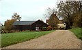
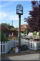
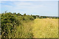
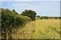
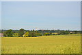
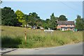
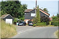
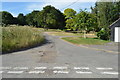
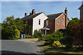
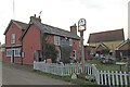
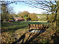
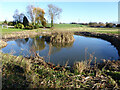
64 photos from this area
Area Information
Key information about the IP9 1BN including its size, population, and administrative classification.
- Area Type
- Postcode
- Area Size
- 2.8 hectares
- Population
- 2456
- Population Density
- 157 people/km²
House Prices in IP9 1BN
15
Properties
£357,000
Average Sold Price
£170,000
Lowest Price
£560,000
Highest Price
Showing 15 properties
| Address | Type | Beds | Baths | Last Sale Price | Last Sale Date | |
|---|---|---|---|---|---|---|
| Long Reach, The Street, Harkstead, IP9 1BN | house | 3 | - | £550,000 | Jun 2021 | |
| Lingfield, The Street, Harkstead, IP9 1BN | house | - | - | £560,000 | Dec 2018 | |
| The Old Post Office, The Street, Harkstead, IP9 1BN | house | - | - | £170,000 | Oct 2018 | |
| Fennel Cottage, The Street, Harkstead, IP9 1BN | Semi-detached | 4 | 2 | £452,500 | Feb 2018 | |
| Haven Cottage, The Street, Harkstead, IP9 1BN | Cottage | 2 | - | £230,000 | Apr 2015 | |
| Windyridge, The Street, Harkstead, IP9 1BN | house | 2 | - | £325,000 | Aug 2014 | |
| Willem Cottage, The Street, Harkstead, IP9 1BN | Terraced | 3 | - | £240,000 | Aug 2014 | |
| Hill Cottage, The Street, Harkstead, IP9 1BN | house | 5 | - | £365,000 | May 2014 | |
| Broadwaters, The Street, Harkstead, IP9 1BN | Detached | - | - | £320,500 | Jun 2002 | |
| Headland House, The Street, Harkstead, IP9 1BN | house | - | - | - | - |
Page 1 of 2
Energy Efficiency in IP9 1BN
Amenities
Schools
| Rank | School | Type | Entry gender | Ages |
|---|
Explore more schools in this area
Go to Schools tabDemographics
Household Size
Two person
most common
Accommodation Type
Houses
most common
Tenure
72
majority
Ethnic Group
White
most common
Religion
N/A
most common
Household Composition
N/A
most common
Age
47
median
Adults (30-64 years)
most common
Household Deprivation
N/A
with no deprivation
NS-SEC
43
in Lower managerial occupations
Explore more demographic insights in this area
Go to Demographics tabPlanning
Planning Constraints
- Flood RiskPremium
- Ramsar Wetland SitesPremium
- Area of Outstanding Natural BeautyPremium
- Protected Nature ReservePremium
- Protected WoodlandPremium