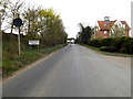
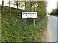
Area Overview for IP8 4DF
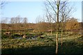
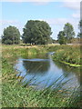
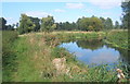
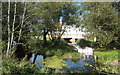
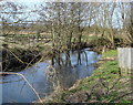
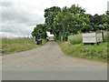
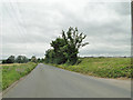
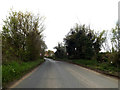
Photos of IP8 4DF
Area Information
IP8 4DF is a small, tightly knit residential area in England, home to 1,726 people spread across a low-density neighbourhood. With just 103 people per square kilometre, it offers a quiet, uncluttered living environment, typical of smaller rural or semi-rural clusters. The area’s character is defined by its modest scale and proximity to practical amenities. Residents benefit from nearby retail options, including Lidl Ipswich and Asda Ipswich, as well as rail links such as Westerfield Railway Station, which connects to broader regional networks. The community is predominantly composed of adults aged 30–64, with a median age of 47, suggesting a mature, stable population. This demographic profile, combined with high home ownership (83%) and a focus on single-family houses, creates a distinct local identity centred on private living and long-term residency. While the area lacks major urban infrastructure, its compact size and accessible transport options make it appealing for those seeking a balance between seclusion and connectivity.
- Area Type
- Postcode
- Area Size
- Not available
- Population
- 1726
- Population Density
- 103 people/km²
The property market in IP8 4DF is characterised by a high rate of home ownership (83%), with houses forming the predominant accommodation type. This suggests a community where private, long-term residency is the norm, rather than a rental-driven market. The small size of the area means the housing stock is limited, likely consisting of a mix of older and newer properties suited to family living. Buyers should consider the area’s compact nature, which may mean fewer options for larger homes or developments. The focus on single-family houses aligns with the demographic profile of mature, established residents. While the market may lack the dynamism of larger urban areas, the low population density and strong home ownership suggest a stable, low-turnover environment. Proximity to rail links and retail amenities further enhances the appeal for those prioritising convenience over extensive property choice.
House Prices in IP8 4DF
No properties found in this postcode.
Energy Efficiency in IP8 4DF
Living in IP8 4DF offers access to a range of nearby amenities that support daily life. The area’s retail sector includes five notable stores, such as Lidl Ipswich, Asda Ipswich, and the East of England Co-operative Co, providing convenience for shopping and essential services. Rail connectivity is robust, with five stations, including Westerfield Railway Station, offering links to broader transport networks. While the area lacks large-scale leisure or entertainment venues, the proximity to retail and rail hubs suggests a practical, community-focused lifestyle. The presence of multiple retail outlets and accessible train services enhances the area’s appeal for those prioritising ease of access over sprawling urban amenities. The modest scale of the area means its character is defined by simplicity and proximity to essential services, catering to residents who value convenience and a slower pace of life.
Amenities
Schools
| Rank | School | Type | Entry gender | Ages |
|---|
Explore more schools in this area
Go to Schools tabDemographics
The population of IP8 4DF is 1,726, with a median age of 47, reflecting a mature community where adults aged 30–64 make up the largest age group. Home ownership is high at 83%, indicating a strong presence of owner-occupied properties. The area is predominantly composed of houses, with no data suggesting a significant rental market. The predominant ethnic group is White, though no specific figures for other groups are provided. The population density of 103 people per square kilometre suggests a low-rise, spread-out settlement pattern. This demographic profile implies a community focused on stability and long-term residency, with limited reliance on transient populations. The absence of detailed diversity statistics means the area’s cultural makeup remains largely unexplored in the data, but the high home ownership and age demographics suggest a cohesive, locally rooted population.
Household Size
Accommodation Type
Tenure
Ethnic Group
Religion
Household Composition
Age
Household Deprivation
NS-SEC
Explore more demographic insights in this area
Go to Demographics tabPlanning
Planning Constraints
- Flood RiskPremium
- Ramsar Wetland SitesPremium
- Area of Outstanding Natural BeautyPremium
- Protected Nature ReservePremium
- Protected WoodlandPremium