Area Overview for IP7 5DN
Photos of IP7 5DN
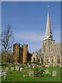

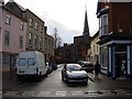
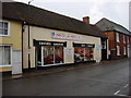
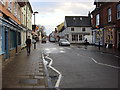
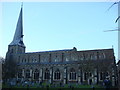

100 photos from this area
Area Information
Key information about the IP7 5DN including its size, population, and administrative classification.
- Area Type
- Postcode
- Area Size
- 1.8 hectares
- Population
- 1982
- Population Density
- 4446 people/km²
House Prices in IP7 5DN
19
Properties
£420,500
Average Sold Price
£63,000
Lowest Price
£895,000
Highest Price
Showing 19 properties
| Address | Type | Beds | Baths | Last Sale Price | Last Sale Date | |
|---|---|---|---|---|---|---|
| Toppesfield Hall, Market Place, Hadleigh, IP7 5DN | Semi-detached | 6 | 3 | £895,000 | Feb 2021 | |
| Lion House, Market Place, Hadleigh, IP7 5DN | house | - | - | £290,000 | Sep 2020 | |
| 8 Market Place, Hadleigh, IP7 5DN | Semi-detached | - | - | £567,500 | Aug 2007 | |
| 6 Market Place, Hadleigh, IP7 5DN | Terraced | - | - | £495,000 | Sep 2006 | |
| 4 Market Place, Hadleigh, IP7 5DN | Office | 2 | 1 | £212,500 | Sep 2004 | |
| 8A Market Place, Hadleigh, IP7 5DN | Semi-detached | 3 | 1 | £63,000 | May 1998 | |
| Toppesfield Manor, Market Place, Hadleigh, IP7 5DN | Semi-detached | 4 | 4 | - | - | |
| Accelerate Cleaning Solutions Ltd, First Floor, Corn Exchange Business Centre, Market Place, Hadleigh, IP7 5DN | Office | - | - | - | - | |
| Corn Exchange Business Centre Ltd, Ground Floor Kitchen, Corn Exchange Business Centre, Market Place, Hadleigh, IP7 5DN | Office | - | - | - | - | |
| Corn Exchange Business Centre Ltd, Part Ground Floor, Corn Exchange Business Centre, Market Place, Hadleigh, IP7 5DN | Office | - | - | - | - |
Page 1 of 2
Energy Efficiency in IP7 5DN
Amenities
Schools
| Rank | School | Type | Entry gender | Ages |
|---|
Explore more schools in this area
Go to Schools tabDemographics
Household Size
Two person
most common
Accommodation Type
Houses
most common
Tenure
50
majority
Ethnic Group
White
most common
Religion
N/A
most common
Household Composition
N/A
most common
Age
47
median
Adults (30-64 years)
most common
Household Deprivation
N/A
with no deprivation
NS-SEC
27
in Lower managerial occupations
Explore more demographic insights in this area
Go to Demographics tabPlanning
Planning Constraints
- Flood RiskPremium
- Ramsar Wetland SitesPremium
- Area of Outstanding Natural BeautyPremium
- Protected Nature ReservePremium
- Protected WoodlandPremium