Area Overview for IP6 9XB
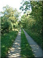
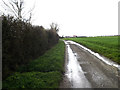
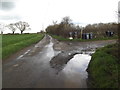
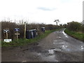
Photos of IP6 9XB
Area Information
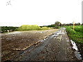
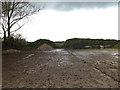
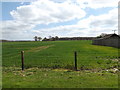
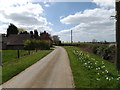
Living in IP6 9XB offers a quiet, residential lifestyle in a small cluster of homes spread across rural England. With a population of 2282 and a low density of 64 people per square kilometre, the area feels unspoiled by urban sprawl. The community is predominantly composed of adults aged 30–64, many of whom own their homes—83% of properties are owner-occupied. This suggests a stable, long-term resident base rather than a transient population. Daily life here is characterised by proximity to local amenities, including four nearby railway stations and five retail outlets, such as Tesco Stowmarket and Budgens. The area’s safety is notable, with a crime risk score of 74, indicating below-average crime rates. While there are no protected natural sites or flood risks, the lack of major infrastructure or transport hubs means it caters to those seeking a peaceful, low-traffic environment. For buyers, IP6 9XB represents a chance to live in a compact, well-maintained community with access to essential services without the pressures of larger towns.
- Area Type
- Postcode
- Area Size
- Not available
- Population
- 2282
- Population Density
- 64 people/km²
The property market in IP6 9XB is dominated by owner-occupied homes, with 83% of properties owned outright. This high ownership rate indicates a community of long-term residents rather than a rental market. The accommodation type is exclusively houses, which is unusual for a small postcode area but aligns with the rural, low-density nature of the region. The limited number of properties suggests a constrained market, where buyers may need to look beyond the immediate area for more options. For those considering purchase, the focus on owner-occupation means fewer short-term rental properties, potentially offering more stable value retention. However, the small size of the area may limit scope for development or expansion. Buyers should also consider the proximity to nearby towns like Stowmarket, where additional amenities and transport links might be necessary. The mix of residential and semi-rural character makes IP6 9XB appealing to those seeking a quiet, stable environment.
House Prices in IP6 9XB
No properties found in this postcode.
Energy Efficiency in IP6 9XB
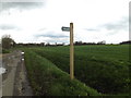
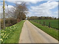
Daily life in IP6 9XB revolves around local shops and transport links. The five nearby retail outlets, including Tesco Stowmarket and East of England Co-operative Co, provide access to groceries, fuel, and everyday services. While there are no detailed mentions of dining or leisure venues, the presence of multiple retail stores suggests a basic level of convenience for residents. The four railway stations, such as Stowmarket, connect the area to broader networks, though the nearest major towns may be necessary for more extensive shopping or entertainment. The absence of parks or recreational spaces in the data means outdoor activities may require travel to nearby areas. The lifestyle here is defined by simplicity: a quiet, residential setting with minimal urban amenities, ideal for those prioritising peace and proximity to essential services over a vibrant social scene. The character of the area is one of practicality, where convenience is measured in proximity to local shops and rail connections rather than sprawling leisure options.
Amenities
Schools
Residents of IP6 9XB have access to three schools within practical reach. Creeting St Mary Church of England Voluntary Aided Primary School and Stonham Aspal Church of England Voluntary Aided Primary School both hold Ofsted ratings of ‘good’, offering reliable primary education options. Greenfield School, a special school, provides tailored support for students with specific needs. The combination of mainstream and special education facilities ensures families have choices, whether for general schooling or specialist support. The presence of two primary schools with strong ratings is a key advantage for parents, though no secondary schools are listed in the data. This means families may need to consider commuting to nearby towns for secondary education. The schools’ proximity to residential areas suggests a community focused on local provision, though the absence of higher education institutions or further schools could be a limitation for growing families.
| Rank | School | Type | Entry gender | Ages |
|---|---|---|---|---|
| 1 | Creeting St Mary Church of England Voluntary Aided Primary School | primary | N/A | N/A |
| 2 | Stonham Aspal Church of England Voluntary Aided Primary School | primary | N/A | N/A |
| 3 | Greenfield School | special | N/A | N/A |
Explore more schools in this area
Go to Schools tabDemographics
The population of IP6 9XB is 2282, with a median age of 47, reflecting a mature demographic skewed towards adults aged 30–64. This age group constitutes the majority, suggesting a community with established careers and families. Home ownership is high at 83%, indicating a preference for long-term residency over rental properties. The accommodation type is primarily houses, which aligns with the area’s low density and rural character. The predominant ethnic group is White, though no specific data on diversity or deprivation is provided. The absence of younger demographics or younger households may influence local services and amenities, which seem tailored to older, settled residents. This profile implies a community focused on stability, with limited demand for student housing or family-oriented developments. The age range also suggests a population with fewer children, which may affect school catchment sizes and the need for childcare facilities.
Household Size
Accommodation Type
Tenure
Ethnic Group
Religion
Household Composition
Age
Household Deprivation
NS-SEC
Explore more demographic insights in this area
Go to Demographics tabPlanning
Planning Constraints
- Flood RiskPremium
- Ramsar Wetland SitesPremium
- Area of Outstanding Natural BeautyPremium
- Protected Nature ReservePremium
- Protected WoodlandPremium
- Crime RiskPremium