Area Overview for IP6 0DE
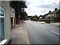
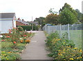
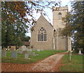
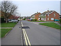
Photos of IP6 0DE


Area Information
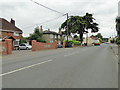
IP6 0DE is a small, tightly knit residential cluster in England, home to 1,669 residents spread over an area that supports a population density of 94 people per square kilometre. This postcode area is characterised by a quiet, settled atmosphere, with a median age of 47 and a majority of residents aged between 30 and 64. The community is predominantly home-owning, with 84% of households owning their properties, and most homes are traditional houses rather than flats. Daily life here is defined by proximity to essential services, including five retail outlets such as Lidl Ipswich and Budgens Great, and five railway stations like Westerfield Railway Station. The area’s low crime risk score of 84 and minimal environmental constraints make it appealing for families seeking stability. While it lacks large-scale amenities, its compact size ensures convenience for local errands and commuting. The absence of protected natural sites or flood risks adds to its practicality, though the broadband score of 65 suggests mid-range digital connectivity. For those prioritising safety, affordability, and a slower pace of life, IP6 0DE offers a straightforward, no-frills living experience.
- Area Type
- Postcode
- Area Size
- Not available
- Population
- 1669
- Population Density
- 94 people/km²
The property market in IP6 0DE is dominated by owner-occupied homes, with 84% of residents living in houses rather than flats or rented accommodation. This suggests a mature market where properties are likely to be long-term investments rather than short-term rentals. The prevalence of houses indicates a focus on family-friendly living, with larger homes and gardens typical of suburban or semi-rural settings. However, the small size of the area means the housing stock is limited, and buyers may need to consider nearby postcodes for more options. The high home ownership rate also implies limited rental availability, which could be a challenge for those seeking tenancies. For buyers, this area is suited to those prioritising security, stability, and a quiet lifestyle over high-density urban living. The compact nature of the postcode means property values may be influenced by local amenities and transport links, such as nearby railway stations.
House Prices in IP6 0DE
No properties found in this postcode.
Energy Efficiency in IP6 0DE
Living in IP6 0DE offers access to a modest selection of local amenities, including five retail outlets such as East of England Co-operative Co and Lidl Ipswich, which cater to daily shopping needs. The presence of multiple railway stations, like Entrance2 and Westerfield Railway Station, ensures connectivity to broader regional networks, facilitating both commuting and travel. While the area lacks large leisure or entertainment venues, the compact layout ensures that essential services are within practical reach. The retail options suggest a focus on convenience over luxury, with supermarkets and local shops meeting basic needs. For those valuing self-sufficiency, the proximity of these amenities reduces the need for long journeys. The lifestyle here is defined by simplicity, with an emphasis on functional living rather than high-end conveniences.
Amenities
Schools
The nearest school to IP6 0DE is Henley Primary School, a primary institution with an Ofsted rating of ‘good’. This school serves the local community, providing education for younger children in the area. The absence of secondary schools or other educational institutions within the data suggests that families may need to travel to nearby postcodes for secondary education. However, the presence of a well-rated primary school is a significant draw for families prioritising early education quality. The single school listed indicates a limited range of educational options, which could be a consideration for parents seeking diverse schooling opportunities. For those requiring secondary education, the nearest options would likely be in adjacent areas, though the data does not specify these locations.
| Rank | School | Type | Entry gender | Ages |
|---|---|---|---|---|
| 1 | Henley Primary School | primary | N/A | N/A |
| 2 | Henley Primary School | primary | N/A | N/A |
Explore more schools in this area
Go to Schools tabDemographics
The population of IP6 0DE is skewed towards middle-aged adults, with a median age of 47 and 84% of residents falling into the 30-64 age range. This suggests a community of established professionals and families, rather than a younger or elderly demographic. Home ownership is high at 84%, indicating a stable, long-term resident base. The area is predominantly composed of houses, reflecting a preference for detached or semi-detached properties over flats. The predominant ethnic group is White, with no data provided on other ethnicities, though the absence of specific diversity metrics means the area’s cultural composition remains largely unexplored in the data. The low population density of 94 people per square kilometre implies spacious living conditions, though the small size of the area means amenities are concentrated. This demographic profile aligns with a community prioritising security, property value retention, and proximity to essential services over urban vibrancy.
Household Size
Accommodation Type
Tenure
Ethnic Group
Religion
Household Composition
Age
Household Deprivation
NS-SEC
Explore more demographic insights in this area
Go to Demographics tabPlanning
Planning Constraints
- Flood RiskPremium
- Ramsar Wetland SitesPremium
- Area of Outstanding Natural BeautyPremium
- Protected Nature ReservePremium
- Protected WoodlandPremium
- Crime RiskPremium