Area Overview for IP4 5RY
Photos of IP4 5RY
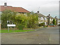

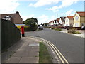
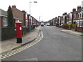
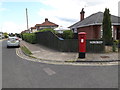
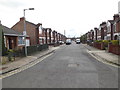
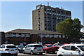
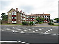
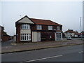
63 photos from this area
Area Information
Key information about the IP4 5RY including its size, population, and administrative classification.
- Area Type
- Postcode
- Area Size
- 9329 m²
- Population
- 1465
- Population Density
- 2649 people/km²
House Prices in IP4 5RY
15
Properties
£237,583
Average Sold Price
£57,000
Lowest Price
£382,000
Highest Price
Showing 15 properties
| Address | Type | Beds | Baths | Last Sale Price | Last Sale Date | |
|---|---|---|---|---|---|---|
| 47 Heath Road, Ipswich, IP4 5RY | Semi-detached | 3 | 2 | £346,000 | Oct 2025 | |
| 71 Heath Road, Ipswich, IP4 5RY | Semi-detached | 3 | 1 | £370,000 | Jun 2025 | |
| 67 Heath Road, Ipswich, IP4 5RY | Semi-detached | 3 | - | £382,000 | Sep 2021 | |
| 63 Heath Road, Ipswich, IP4 5RY | Semi-detached | 5 | 3 | £365,000 | Feb 2020 | |
| 65 Heath Road, Ipswich, IP4 5RY | Semi-detached | 4 | - | £283,000 | Aug 2015 | |
| 55 Heath Road, Ipswich, IP4 5RY | Semi-detached | 3 | - | £232,000 | May 2015 | |
| 51 Heath Road, Ipswich, IP4 5RY | house | - | - | £185,000 | Sep 2009 | |
| 69 Heath Road, Ipswich, IP4 5RY | house | - | - | £173,000 | May 2008 | |
| 59 Heath Road, Ipswich, IP4 5RY | Semi-detached | - | - | £205,000 | Mar 2008 | |
| 73 Heath Road, Ipswich, IP4 5RY | Semi-detached | - | - | £124,995 | Sep 2002 |
Page 1 of 2
Energy Efficiency in IP4 5RY
Amenities
Schools
| Rank | School | Type | Entry gender | Ages |
|---|
Explore more schools in this area
Go to Schools tabDemographics
Household Size
Two person
most common
Accommodation Type
Houses
most common
Tenure
89
majority
Ethnic Group
White
most common
Religion
N/A
most common
Household Composition
N/A
most common
Age
47
median
Adults (30-64 years)
most common
Household Deprivation
N/A
with no deprivation
NS-SEC
37
in Lower managerial occupations
Explore more demographic insights in this area
Go to Demographics tabPlanning
Planning Constraints
- Flood RiskPremium
- Ramsar Wetland SitesPremium
- Area of Outstanding Natural BeautyPremium
- Protected Nature ReservePremium
- Protected WoodlandPremium