Area Overview for IP4 5PD
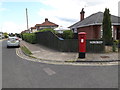
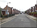
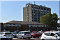
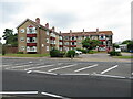
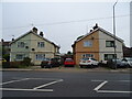
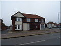
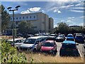
Photos of IP4 5PD

Area Information
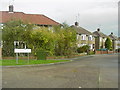
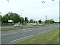
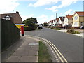
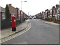
Living in IP4 5PD means being part of a tightly knit residential cluster in England, where 1,465 people reside across just 6.1 hectares. The area’s high population density — 24,025 people per square kilometre — suggests a compact, community-oriented environment. This postcode is not a sprawling suburb but a focused neighbourhood, likely centred around local amenities and transport links. Daily life here is shaped by proximity to retail and rail infrastructure, with five nearby shops including Morrisons and East of England Co-operative Co, and five railway stations such as Derby Road Railway Station. The area’s small size means residents are close to essential services, though the density could influence the pace of life. With a median age of 47 and a population skewed toward adults aged 30–64, this is a mature community, possibly with long-term residents and families. The high home ownership rate of 89% suggests stability, with most properties being houses rather than flats. For buyers, this area offers a blend of practicality and convenience, though its compact nature may limit expansion.
- Area Type
- Postcode
- Area Size
- 6.1 hectares
- Population
- 1465
- Population Density
- 2649 people/km²
The property market in IP4 5PD is defined by high home ownership — 89% of residents own their homes — and a predominance of houses over flats. This suggests a stable, long-term community with limited rental activity. The small area size of 6.1 hectares means the housing stock is likely limited, with most properties concentrated within the postcode’s boundaries. Buyers should consider the immediate surrounding areas for more options, though the compact nature of IP4 5PD may offer a sense of exclusivity or convenience. The focus on houses rather than flats implies a family-friendly or traditional housing profile, which could appeal to those seeking larger living spaces. However, the high crime risk score of 29 may influence property values or desirability, requiring buyers to assess security measures and local safety trends. For those prioritising proximity to retail and rail services, this area’s compact layout ensures minimal travel to key amenities.
House Prices in IP4 5PD
Showing 9 properties
Energy Efficiency in IP4 5PD
Residents of IP4 5PD have access to a range of nearby amenities within practical reach, enhancing daily life. The retail sector includes notable stores such as Morrisons Daily and East of England Co-operative Co, providing essential shopping options for groceries and household goods. M&S Ipswich NHS Hospital SF adds a layer of healthcare accessibility, though its primary function may be more clinical than retail. The area’s rail network is well-developed, with five stations — including Derby Road Railway Station — offering convenient links to broader transport routes. While the data does not specify parks or leisure facilities, the proximity to retail and transport suggests a functional, service-oriented lifestyle. The compact nature of the area means amenities are closely clustered, reducing travel time but potentially limiting variety. For those prioritising convenience over expansive recreational spaces, IP4 5PD offers a pragmatic, community-focused environment.
Amenities
Schools
| Rank | School | Type | Entry gender | Ages |
|---|
Explore more schools in this area
Go to Schools tabDemographics
The community in IP4 5PD is predominantly composed of adults aged 30–64, with a median age of 47. This suggests a population of working-age individuals and families, likely with established careers and long-term commitments to the area. Home ownership is exceptionally high at 89%, indicating a stable, owner-occupied demographic rather than a rental market. Most properties are houses, which aligns with the area’s compact, residential character. The predominant ethnic group is White, reflecting a homogenous demographic profile. While no specific deprivation data is provided, the high home ownership and mature age profile may correlate with lower economic vulnerability. However, the high crime risk score of 29 — well below the average — raises practical concerns for residents, particularly regarding personal safety and property security. These factors should be weighed against the area’s proximity to amenities and transport links.
Household Size
Accommodation Type
Tenure
Ethnic Group
Religion
Household Composition
Age
Household Deprivation
NS-SEC
Explore more demographic insights in this area
Go to Demographics tabPlanning
Planning Constraints
- Flood RiskPremium
- Ramsar Wetland SitesPremium
- Area of Outstanding Natural BeautyPremium
- Protected Nature ReservePremium
- Protected WoodlandPremium