Area Overview for IP4 3LZ
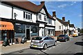
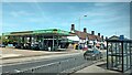
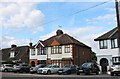
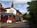
Photos of IP4 3LZ


Area Information
IP4 3LZ is a small residential postcode area in England, home to 1,619 residents. It is a compact cluster of homes, predominantly occupied by owner-occupiers, with a median age of 47. The area’s character is defined by its stability, with most residents falling within the 30-64 age range. Daily life here is shaped by the proximity of essential services and a low crime rate, which contributes to a sense of security. The area’s safety profile is strong, with a crime risk score of 84—well below average—indicating a secure environment for families and individuals. Residents benefit from excellent broadband connectivity, rated 99 out of 100, ensuring reliable internet for work and leisure. While the area does not border protected natural sites, its low flood risk and absence of planning constraints make it a practical choice for homebuyers seeking a balance between safety and accessibility. The small population and residential focus mean the community is tight-knit, with amenities and services within practical reach.
- Area Type
- Postcode
- Area Size
- Not available
- Population
- 1619
- Population Density
- 2263 people/km²
The property market in IP4 3LZ is characterised by a high rate of home ownership—90%—with houses being the primary accommodation type. This suggests a market skewed towards owner-occupiers rather than renters, which is typical of smaller, established residential areas. The dominance of houses over flats or apartments may appeal to families seeking space and privacy. Given the area’s small size, the housing stock is likely limited, meaning buyers should consider nearby areas for more options. The high home ownership rate also implies a stable market, with properties potentially holding value over time. For buyers, this means a focus on individual homes rather than rental properties, though the lack of detailed data on property prices or listings means further local research would be necessary for precise market insights.
House Prices in IP4 3LZ
No properties found in this postcode.
Energy Efficiency in IP4 3LZ
Living in IP4 3LZ offers access to a range of nearby amenities, including retail and transport hubs. The area is within practical reach of East of England Co-operative Co, Morrisons Daily, and other retail outlets, providing convenience for grocery shopping and daily needs. Rail services, including Derby Road Railway Station, connect residents to broader networks, facilitating commuting or travel. While the data does not detail parks or leisure facilities, the absence of planning constraints and low flood risk suggests the area is not encumbered by environmental restrictions that might limit recreational spaces. The combination of retail access and rail connectivity contributes to a lifestyle that balances practicality with ease of movement, though further local investigation would be needed to explore leisure opportunities in more depth.
Amenities
Schools
The nearest schools to IP4 3LZ include St Alban’s Catholic High School, listed as both a primary school and an academy with an Ofsted rating of ‘good’. This dual listing suggests a continuity of education for families, with the primary school providing early years education and the academy offering secondary schooling. The ‘good’ Ofsted rating indicates that the school meets quality standards in teaching and student outcomes. For families prioritising education, the presence of a Catholic school may align with specific values or religious preferences. The proximity of these schools within the area reduces commuting times, making it a practical choice for parents. However, the absence of additional schools in the data means further research would be needed to assess the full range of educational options available.
| Rank | School | Type | Entry gender | Ages |
|---|
Explore more schools in this area
Go to Schools tabDemographics
The population of IP4 3LZ is 1,619, with a median age of 47. The majority of residents fall within the 30-64 age range, reflecting a mature, established community. Home ownership is high, at 90%, with the predominant accommodation type being houses. This suggests a stable, long-term resident base rather than a transient population. The predominant ethnic group is White, which aligns with broader regional demographics. The low deprivation levels, inferred from high home ownership and the absence of significant planning constraints, indicate a quality of life that supports both daily living and long-term residency. The age profile suggests a community with a strong presence of middle-aged adults, likely with families, contributing to a steady demand for local schools and amenities.
Household Size
Accommodation Type
Tenure
Ethnic Group
Religion
Household Composition
Age
Household Deprivation
NS-SEC
Explore more demographic insights in this area
Go to Demographics tabPlanning
Planning Constraints
- Flood RiskPremium
- Ramsar Wetland SitesPremium
- Area of Outstanding Natural BeautyPremium
- Protected Nature ReservePremium
- Protected WoodlandPremium