Area Overview for IP4 3AL
Photos of IP4 3AL

Area Information
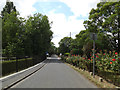
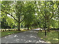
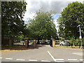
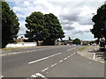
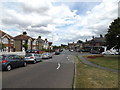
Living in IP4 3AL means being part of a compact, residential postcode area in England with a population of 1565 people. The area’s high population density of 1092 people per square kilometre suggests a tightly knit community, where proximity to amenities and services is key. This small cluster of homes is characterised by a mature demographic, with a median age of 47 and a strong presence of adults aged 30–64. Daily life here is shaped by its practical size and the availability of nearby retail and transport links. The postcode’s low flood risk and absence of environmental constraints like protected woodlands or AONB areas make it a stable, straightforward place to live. With excellent broadband connectivity and a nearby railway station at Westerfield, residents enjoy both modern convenience and traditional infrastructure. The area’s safety is notable, with a crime risk score of 94, reflecting a secure environment. For those seeking a quiet, well-connected residential spot, IP4 3AL offers a blend of practicality and accessibility.
- Area Type
- Postcode
- Area Size
- Not available
- Population
- 1565
- Population Density
- 1092 people/km²
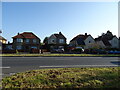
The property market in IP4 3AL is dominated by owner-occupied homes, with 85% of properties in private hands. This high rate of home ownership points to a community of long-term residents rather than a transient rental market. The accommodation type is primarily houses, which, given the area’s small size, likely includes a mix of detached and semi-detached properties. This suggests a traditional, family-friendly housing stock that may appeal to buyers seeking stability and space. The compact nature of the postcode means the housing market is limited in scale, with little scope for new developments. For buyers, this implies a focus on existing properties and proximity to amenities like the nearby retail outlets and rail links. The area’s practical size and strong connectivity make it an attractive option for those prioritising convenience over expansive living spaces.
House Prices in IP4 3AL
No properties found in this postcode.
Energy Efficiency in IP4 3AL
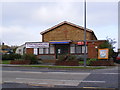
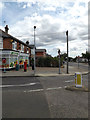
Residents of IP4 3AL have access to a range of nearby amenities, including five retail outlets, notably three branches of the East of England Co-operative Co. These shops provide essential services and local shopping options, contributing to a practical, self-sufficient lifestyle. The area’s rail connectivity, with stations like Westerfield Railway Station, offers easy access to commuting and regional travel. While the postcode lacks major parks or leisure facilities, the proximity to rail and retail suggests a focus on functional living rather than expansive recreational spaces. The presence of multiple retail points and transport links indicates a community designed for convenience, where daily needs can be met without long commutes. For those valuing accessibility over sprawling amenities, IP4 3AL delivers a straightforward, efficient lifestyle.
Amenities
Schools
| Rank | School | Type | Entry gender | Ages |
|---|
Explore more schools in this area
Go to Schools tabDemographics
IP4 3AL has a median age of 47, with the majority of residents falling into the 30–64 age range. This suggests a community of established adults, many of whom may be in their prime working or family years. Home ownership is high at 85%, indicating a strong presence of long-term residents and a stable housing market. The accommodation type is predominantly houses, which aligns with the area’s compact layout and residential focus. The predominant ethnic group is White, reflecting a homogenous demographic profile. With a population of 1565, the area is small but densely populated, creating a close-knit environment. The lack of specific data on deprivation means this aspect of quality of life remains unquantified, but the high home ownership and low crime risk suggest a generally secure and settled community.
Household Size
Accommodation Type
Tenure
Ethnic Group
Religion
Household Composition
Age
Household Deprivation
NS-SEC
Explore more demographic insights in this area
Go to Demographics tabPlanning
Planning Constraints
- Flood RiskPremium
- Ramsar Wetland SitesPremium
- Area of Outstanding Natural BeautyPremium
- Protected Nature ReservePremium
- Protected WoodlandPremium
- Crime RiskPremium