Area Overview for IP4 3AG
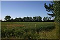
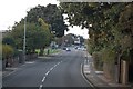
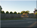
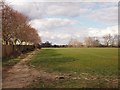
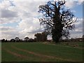
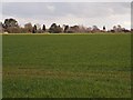
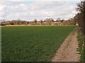
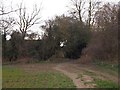
Photos of IP4 3AG


Area Information
IP4 3AG is a small, densely populated residential cluster in England, home to 1347 people across a compact area. With a population density of 1292 people per square kilometre, this postcode area reflects a tight-knit community where proximity to essential services is a defining feature. The area’s character is shaped by its predominantly older residents, with a median age of 47 and a strong presence of adults aged 30–64. This demographic suggests a stable, established neighbourhood where many residents are likely to be long-term homeowners. The low flood risk and absence of protected natural sites mean development constraints are minimal, allowing for straightforward living. Nearby, five retail outlets—including multiple East of England Co-operative Co locations—offer daily convenience, while five rail stations, including Westerfield Railway Station, provide reliable connections to surrounding areas. For those seeking a balance between suburban comfort and practical accessibility, IP4 3AG presents a compact, functional living environment with minimal environmental risk.
- Area Type
- Postcode
- Area Size
- Not available
- Population
- 1347
- Population Density
- 1292 people/km²
The property market in IP4 3AG is characterised by high home ownership—79% of residents are homeowners—indicating a strong preference for long-term residency over rental tenancies. The predominant accommodation type is houses, which suggests a market skewed towards owner-occupied properties rather than flats or apartments. This aligns with the area’s small, residential nature, where the density of 1292 people per square kilometre implies limited space for larger developments. For buyers, this means a focus on individual homes rather than shared or rental units. The compact size of the area means properties are likely to be closely spaced, with limited scope for expansion. Given the low crime risk and absence of environmental constraints, the area may appeal to those seeking a secure, stable home with minimal planning restrictions. However, the small size also means the market is niche, with limited options for those prioritising larger estates or newer developments.
House Prices in IP4 3AG
No properties found in this postcode.
Energy Efficiency in IP4 3AG
Living in IP4 3AG offers a mix of practical convenience and local amenities. The area’s retail landscape includes five outlets, with multiple branches of the East of England Co-operative Co providing essential shopping options. While dining and leisure venues are not explicitly listed, the proximity to rail stations like Westerfield Railway Station suggests access to broader entertainment and service networks beyond the immediate postcode. The absence of named parks or recreational spaces means outdoor activities may require travel to nearby areas, but the compact nature of the community ensures that daily errands and social interactions remain within walking or short driving distance. The combination of retail accessibility and rail connectivity creates a lifestyle where convenience and mobility are prioritised, supporting a routine that balances local needs with regional opportunities.
Amenities
Schools
| Rank | School | Type | Entry gender | Ages |
|---|
Explore more schools in this area
Go to Schools tabDemographics
The community in IP4 3AG is predominantly composed of adults aged 30–64, with a median age of 47. This suggests a mature, settled population where many residents are likely to be in their peak working years or nearing retirement. Home ownership is high, with 79% of properties occupied by owners rather than renters, indicating a stable housing market. The accommodation type is primarily houses, reflecting a preference for single-family homes over flats or apartments. The predominant ethnic group is White, which aligns with broader regional trends but underscores the area’s homogeneity. With no data on deprivation levels, it is unclear how economic pressures might affect quality of life, but the high home ownership rate and low crime risk suggest a generally secure environment. The absence of younger households or diverse age groups may influence the social dynamics, making this a community more focused on established routines than evolving family needs.
Household Size
Accommodation Type
Tenure
Ethnic Group
Religion
Household Composition
Age
Household Deprivation
NS-SEC
Explore more demographic insights in this area
Go to Demographics tabPlanning
Planning Constraints
- Flood RiskPremium
- Ramsar Wetland SitesPremium
- Area of Outstanding Natural BeautyPremium
- Protected Nature ReservePremium
- Protected WoodlandPremium
- Crime RiskPremium