Area Overview for IP4 2TD
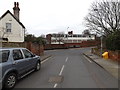
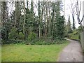
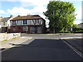
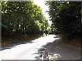
Photos of IP4 2TD


Area Information
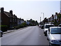
Living in IP4 2TD means being part of a tightly knit residential cluster in England, where 1,565 people reside across a compact area. The population density of 1,092 people per square kilometre suggests a closely spaced community, ideal for those seeking proximity to local amenities without the sprawl of larger towns. This area is defined by its modest scale, with homes predominantly in private ownership and a median age of 47, reflecting a mature demographic. Daily life here balances quiet residential living with practical access to nearby services. The absence of significant environmental constraints, such as protected woodlands or AONB designations, means development pressures are minimal. Residents benefit from a low crime risk score of 94, ensuring a secure environment. The area’s small footprint means it is well-suited to those prioritising community cohesion and straightforward commuting options, though its limited size may restrict expansion. For buyers, IP4 2TD offers a snapshot of traditional English suburbia, with a focus on stability and low maintenance.
- Area Type
- Postcode
- Area Size
- Not available
- Population
- 1565
- Population Density
- 1092 people/km²
The property market in IP4 2TD is characterised by high home ownership, with 85% of residents living in owner-occupied homes. This suggests a market dominated by private residences rather than rental properties, which is typical of smaller, established communities. The accommodation type is predominantly houses, reflecting a preference for standalone properties over flats or apartments. Given the area’s small size, the housing stock is likely limited, with few new developments. Buyers should consider that the market may not cater to those seeking larger or more modern properties, as the existing stock is likely to be older and more traditional in design. The high home ownership rate also implies that properties may be held long-term, reducing availability for purchase. For those prioritising a quiet, low-density living environment, IP4 2TD offers a niche opportunity, though its limited scale may restrict options for buyers seeking specific features.
House Prices in IP4 2TD
No properties found in this postcode.
Energy Efficiency in IP4 2TD
Residents of IP4 2TD have access to a range of nearby amenities, including retail options such as the East of England Co-operative Co and Iceland Ipswich, which provide essential shopping and grocery services. The presence of multiple rail stations, including Westerfield Railway Station, ensures convenient commuting to nearby areas, supporting both work and leisure travel. While the area does not feature large parks or recreational facilities, the absence of environmental constraints like protected woodlands or AONB designations may indicate open spaces for informal use. The compact nature of the postcode means amenities are within practical reach, reducing the need for long journeys. The retail and transport options suggest a lifestyle focused on convenience, with daily needs met locally. However, the limited data on leisure facilities means it is unclear whether the area offers dedicated spaces for recreation or community events.
Amenities
Schools
| Rank | School | Type | Entry gender | Ages |
|---|
Explore more schools in this area
Go to Schools tabDemographics
The community in IP4 2TD is predominantly composed of adults aged 30–64, with a median age of 47. This suggests a population skewed towards middle-aged individuals, likely including families and professionals in their prime working years. Home ownership is high, at 85%, indicating a strong preference for long-term residency over rental properties. The accommodation type is largely houses, rather than flats, which aligns with the area’s residential character. The predominant ethnic group is White, with no specific data on other demographics provided. The absence of detailed diversity statistics means the community profile is not explicitly multicultural, though this does not necessarily imply homogeneity. The high home ownership rate and mature age profile suggest a stable, low-turnover environment. For prospective buyers, this demographic structure may appeal to those seeking a settled, family-friendly setting with minimal disruption.
Household Size
Accommodation Type
Tenure
Ethnic Group
Religion
Household Composition
Age
Household Deprivation
NS-SEC
Explore more demographic insights in this area
Go to Demographics tabPlanning
Planning Constraints
- Flood RiskPremium
- Ramsar Wetland SitesPremium
- Area of Outstanding Natural BeautyPremium
- Protected Nature ReservePremium
- Protected WoodlandPremium
- Crime RiskPremium