Area Overview for IP4 2DG
Photos of IP4 2DG


Area Information
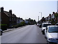
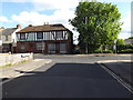
Living in IP4 2DG means being part of a small, tightly knit residential cluster in eastern England. With a population of just over 1,900, the area feels intimate, offering a quieter alternative to larger towns. The postcode covers a compact network of homes, primarily houses rather than flats, which suits families and those seeking more space. The median age of 47 suggests a stable community, with adults aged 30–64 forming the majority. This is a place where daily life is shaped by proximity to essential services, including retail outlets like Tesco and Iceland, and rail access via Derby Road and nearby stations. The presence of St Margaret’s Church of England Primary School, rated good by Ofsted, adds to the appeal for families. While the area lacks natural beauty designations, its low flood risk and straightforward planning constraints make it practical for living. For those prioritising connectivity, broadband scores are near perfect, and mobile coverage is solid. IP4 2DG is not for those seeking a fast-paced urban life but offers a balanced, low-maintenance existence.
- Area Type
- Postcode
- Area Size
- Not available
- Population
- 1972
- Population Density
- 4496 people/km²
The property market in IP4 2DG is defined by its low home ownership rate of 38%, which indicates that a significant portion of the housing stock is rented out. This contrasts with areas where owner-occupation dominates, suggesting a rental market that may cater to both long-term tenants and short-term investors. The accommodation type is primarily houses, which are more common than flats in this postcode. This preference for houses aligns with the area’s small, residential character, offering more space and privacy than apartment blocks. For buyers, the limited number of properties means competition could be fierce, particularly for those seeking family homes. The low population density also means the surrounding areas are likely to have similar housing stock, limiting options for expansion. However, the presence of rail links and retail amenities nearby may offset the need for larger properties, making IP4 2DG a viable choice for those prioritising convenience over size.
House Prices in IP4 2DG
No properties found in this postcode.
Energy Efficiency in IP4 2DG
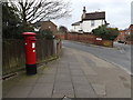
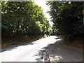
Daily life in IP4 2DG is shaped by its proximity to essential amenities, including retail outlets such as Tesco, Iceland, and the East of England Co-operative. These stores provide convenient access to groceries, household goods, and other necessities, reducing the need for long trips to larger centres. The rail network, with stations like Derby Road and nearby Entrances 2 and 3, offers reliable transport options for commuting or leisure travel. While the area lacks extensive parks or leisure facilities, the presence of retail and transport hubs ensures a functional lifestyle. The small population means the community is likely to be close-knit, with local shops and services fostering a sense of familiarity. For those who enjoy convenience over sprawling amenities, IP4 2DG delivers a practical, no-frills existence with minimal effort required to access daily needs.
Amenities
Schools
The nearest school to IP4 2DG is St Margaret’s Church of England Voluntary Aided Primary School in Ipswich, which serves the local community with a primary education offering. Rated ‘good’ by Ofsted, the school provides a solid foundation for young learners, though it does not extend to secondary education. Families requiring a broader range of schooling may need to look further afield, as no secondary schools are listed in the data. The presence of a single primary school suggests that the area’s population of 1,972 is sufficient to support basic educational needs but may not cater to larger family households with multiple children. For parents, the school’s rating offers reassurance about the quality of teaching, though the lack of secondary options could influence long-term decisions about where to live.
| Rank | School | Type | Entry gender | Ages |
|---|---|---|---|---|
| 1 | St Margaret's Church of England Voluntary Aided Primary School, Ipswich | primary | N/A | N/A |
Explore more schools in this area
Go to Schools tabDemographics
The community in IP4 2DG is predominantly composed of adults aged 30–64, with a median age of 47. This suggests a mature, established population, likely with strong ties to the local area. Home ownership stands at 38%, indicating a mix of owner-occupied properties and rental homes. The accommodation type is largely houses, which aligns with the area’s character as a residential cluster rather than a high-density development. The predominant ethnic group is White, reflecting the broader demographic trends in the region. While no specific data on deprivation is provided, the relatively low home ownership rate could imply a higher proportion of renters, which may influence local dynamics. The absence of detailed diversity metrics means the community’s composition is largely homogenous, though this does not necessarily detract from its quality of life. The age profile suggests a stable population with fewer young children, which may affect local amenities and services tailored to families.
Household Size
Accommodation Type
Tenure
Ethnic Group
Religion
Household Composition
Age
Household Deprivation
NS-SEC
Explore more demographic insights in this area
Go to Demographics tabPlanning
Planning Constraints
- Flood RiskPremium
- Ramsar Wetland SitesPremium
- Area of Outstanding Natural BeautyPremium
- Protected Nature ReservePremium
- Protected WoodlandPremium
- Crime RiskPremium