Area Overview for IP33 3TF
Photos of IP33 3TF

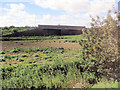

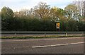


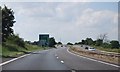

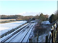
11 photos from this area
Area Information
Key information about the IP33 3TF including its size, population, and administrative classification.
- Area Type
- Postcode
- Area Size
- 4.5 hectares
- Population
- 1596
- Population Density
- 1718 people/km²
House Prices in IP33 3TF
33
Properties
£232,469
Average Sold Price
£81,000
Lowest Price
£350,000
Highest Price
Showing 33 properties
| Address | Type | Beds | Baths | Last Sale Price | Last Sale Date | |
|---|---|---|---|---|---|---|
| 124 Newmarket Road, Bury St Edmunds, IP33 3TF | house | 3 | 2 | £306,000 | Jul 2024 | |
| 128 Newmarket Road, Bury St Edmunds, IP33 3TF | Chalet | 4 | 1 | £275,000 | Feb 2023 | |
| 116 Newmarket Road, Bury St Edmunds, IP33 3TF | Bungalow | 3 | 1 | £250,000 | Jan 2023 | |
| 114 Newmarket Road, Bury St Edmunds, IP33 3TF | house | 1 | 1 | £253,000 | Sep 2018 | |
| 134 Newmarket Road, Bury St Edmunds, IP33 3TF | Bungalow | - | - | £250,000 | Sep 2016 | |
| 96 Newmarket Road, Bury St Edmunds, IP33 3TF | Bungalow | 3 | - | £307,500 | Mar 2015 | |
| 94 Newmarket Road, Bury St Edmunds, IP33 3TF | Bungalow | - | - | £350,000 | Jul 2014 | |
| 108A Newmarket Road, Bury St Edmunds, IP33 3TF | house | - | - | £250,000 | May 2014 | |
| 102 Newmarket Road, Bury St Edmunds, IP33 3TF | Bungalow | 4 | 2 | £154,000 | Dec 2012 | |
| 126 Newmarket Road, Bury St Edmunds, IP33 3TF | house | - | - | £215,000 | Aug 2011 |
Page 1 of 4
Energy Efficiency in IP33 3TF
Amenities
Schools
| Rank | School | Type | Entry gender | Ages |
|---|
Explore more schools in this area
Go to Schools tabDemographics
Household Size
Two person
most common
Accommodation Type
Houses
most common
Tenure
79
majority
Ethnic Group
White
most common
Religion
N/A
most common
Household Composition
N/A
most common
Age
47
median
Adults (30-64 years)
most common
Household Deprivation
N/A
with no deprivation
NS-SEC
38
in Lower managerial occupations
Explore more demographic insights in this area
Go to Demographics tabPlanning
Planning Constraints
- Flood RiskPremium
- Ramsar Wetland SitesPremium
- Area of Outstanding Natural BeautyPremium
- Protected Nature ReservePremium
- Protected WoodlandPremium