Area Overview for IP33 3BH
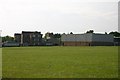
Photos of IP33 3BH
Area Information
Living in IP33 3BH means inhabiting a compact, densely populated residential cluster of just 3.3 hectares, home to 1,150 people. The area’s population density of 35,223 people per square kilometre reflects its small, tightly knit character. This is a community where daily life revolves around local amenities and nearby towns. With a median age of 47, the area is predominantly inhabited by adults aged 30–64, suggesting a stable, established population. The presence of 47% owner-occupied homes indicates a mix of long-term residents and renters, though the majority of properties are houses rather than flats. This small postcode area is not a high-rise or urban sprawl but a focused, residential enclave. Its proximity to Bury St Edmunds and surrounding towns offers easy access to broader services while maintaining a quiet, localised feel. The area’s small size means it is not a destination for large-scale development but a place where community ties are likely strong. For those seeking a home in IP33 3BH, the challenge lies in its limited housing stock, but the compact nature ensures amenities and transport links are within practical reach.
- Area Type
- Postcode
- Area Size
- 3.3 hectares
- Population
- 1150
- Population Density
- 4150 people/km²
IP33 3BH is a small area with a housing stock primarily composed of houses, rather than flats or apartments. The 47% home ownership rate indicates that nearly half of properties are rented, suggesting a mix of owner-occupied and rental homes. This dynamic may reflect a balance between long-term residents and those seeking temporary accommodation, though the area’s limited size means the overall property market is constrained. For buyers, the challenge lies in the area’s compact nature—there are few homes available, and the immediate surroundings may offer more options. The predominance of houses could appeal to families or those preferring larger living spaces, but the lack of high-rise or commercial development means property choices are limited. Buyers should consider the area’s proximity to nearby towns, where more extensive housing markets exist, while recognising that IP33 3BH itself is not a hub for property investment but a niche, residential postcode.
House Prices in IP33 3BH
Showing 1 properties
| Address | Type | Beds | Baths | Last Sale Price | Last Sale Date | |
|---|---|---|---|---|---|---|
| Kitchen, King Edward Vi Upper School, Grove Road, Bury St Edmunds, IP33 3BH | commercial | - | - | - | - |
Energy Efficiency in IP33 3BH
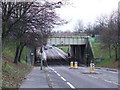
Residents of IP33 3BH benefit from a range of nearby amenities, including five retail outlets such as East of England Co-operative Co, Asda Bury, and Tesco Bury. These shops provide access to groceries, household goods, and other essentials, reducing the need for long trips. The area’s proximity to rail stations like Bury St Edmunds and Thurston enhances mobility, allowing easy travel to surrounding towns for leisure, work, or services. While the postcode itself is small, the surrounding region likely offers additional parks, leisure facilities, and dining options. The compact nature of the area means amenities are within practical reach, contributing to a convenient lifestyle. However, the lack of specific data on parks or recreational spaces means residents may need to explore nearby towns for broader leisure opportunities. Overall, the mix of retail, transport, and nearby towns creates a functional, accessible environment.
Amenities
Schools
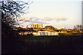
Residents of IP33 3BH have access to three primary schools: St Edmundsbury Church of England Voluntary Aided Primary School, King Edward VI CEVC School (rated ‘good’ by Ofsted), and St Edmundsbury CofE Primary Academy. These institutions provide a range of educational options, though the absence of secondary schools means families may need to look further afield for secondary education. The presence of two ‘good’-rated schools suggests a generally strong local offering, which could be a key consideration for families. The concentration of primary schools in the area reflects its role as a residential hub for households with young children. However, the lack of secondary schooling may impact long-term family planning, requiring parents to factor in commuting times or school choices beyond the immediate postcode. For those prioritising primary education, the schools in IP33 3BH offer a solid foundation, but secondary education remains a practical consideration.
| Rank | School | Type | Entry gender | Ages |
|---|
Explore more schools in this area
Go to Schools tabDemographics
The population of IP33 3BH is predominantly adults aged 30–64, with a median age of 47. This suggests a community of middle-aged residents, likely with families or those in established careers. Home ownership is at 47%, meaning nearly half of residents rent, which could indicate a balance between owner-occupied properties and rental demand. The area’s accommodation is primarily houses, which may reflect a preference for family homes or those seeking more space than flats. The predominant ethnic group is White, though specific diversity statistics are not provided. The high population density—35,223 people per square kilometre—raises questions about living conditions, though the area’s small size means this density is concentrated within a limited footprint. For quality of life, the demographic profile suggests a stable, low-turnover community, but the lack of data on deprivation or income levels means broader socioeconomic context remains unclear.
Household Size
Accommodation Type
Tenure
Ethnic Group
Religion
Household Composition
Age
Household Deprivation
NS-SEC
Explore more demographic insights in this area
Go to Demographics tabPlanning
Planning Constraints
- Flood RiskPremium
- Ramsar Wetland SitesPremium
- Area of Outstanding Natural BeautyPremium
- Protected Nature ReservePremium
- Protected WoodlandPremium