Area Overview for IP33 2PJ
Photos of IP33 2PJ
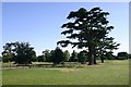
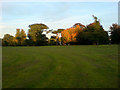
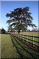
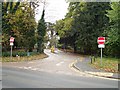
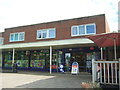
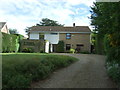
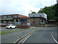
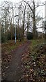
61 photos from this area
Area Information
Key information about the IP33 2PJ including its size, population, and administrative classification.
- Area Type
- Postcode
- Area Size
- 1.4 hectares
- Population
- 1411
- Population Density
- 4666 people/km²
House Prices in IP33 2PJ
35
Properties
£192,184
Average Sold Price
£49,000
Lowest Price
£297,500
Highest Price
Showing 35 properties
| Address | Type | Beds | Baths | Last Sale Price | Last Sale Date | |
|---|---|---|---|---|---|---|
| 19 Caie Walk, Bury St Edmunds, IP33 2PJ | Terraced | 3 | 1 | £254,000 | Feb 2024 | |
| 63 Caie Walk, Bury St Edmunds, IP33 2PJ | Terraced | 3 | 1 | £225,000 | Nov 2023 | |
| 37 Caie Walk, Bury St Edmunds, IP33 2PJ | Flat | 1 | 1 | £130,000 | May 2023 | |
| 25 Caie Walk, Bury St Edmunds, IP33 2PJ | Retail | 3 | 2 | £295,000 | Sep 2022 | |
| 49 Caie Walk, Bury St Edmunds, IP33 2PJ | Retail | 3 | 2 | £297,500 | Jul 2022 | |
| 53 Caie Walk, Bury St Edmunds, IP33 2PJ | Terraced | 3 | 1 | £227,000 | Apr 2020 | |
| 73 Caie Walk, Bury St Edmunds, IP33 2PJ | house | - | - | £213,500 | Mar 2020 | |
| 69 Caie Walk, Bury St Edmunds, IP33 2PJ | house | - | - | £225,000 | Sep 2018 | |
| 23 Caie Walk, Bury St Edmunds, IP33 2PJ | Terraced | 3 | 2 | £229,500 | Oct 2017 | |
| 55 Caie Walk, Bury St Edmunds, IP33 2PJ | Terraced | 3 | 2 | £213,000 | Aug 2017 |
Page 1 of 4
Energy Efficiency in IP33 2PJ
Amenities
Schools
| Rank | School | Type | Entry gender | Ages |
|---|
Explore more schools in this area
Go to Schools tabDemographics
Household Size
One person
most common
Accommodation Type
Houses
most common
Tenure
56
majority
Ethnic Group
White
most common
Religion
N/A
most common
Household Composition
N/A
most common
Age
47
median
Adults (30-64 years)
most common
Household Deprivation
N/A
with no deprivation
NS-SEC
30
in Lower managerial occupations
Explore more demographic insights in this area
Go to Demographics tabPlanning
Planning Constraints
- Flood RiskPremium
- Ramsar Wetland SitesPremium
- Area of Outstanding Natural BeautyPremium
- Protected Nature ReservePremium
- Protected WoodlandPremium