Area Overview for IP33 2LW
Photos of IP33 2LW
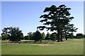
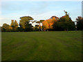
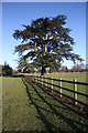
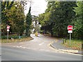
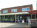
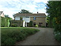
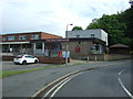
61 photos from this area
Area Information
Key information about the IP33 2LW including its size, population, and administrative classification.
- Area Type
- Postcode
- Area Size
- 2.8 hectares
- Population
- 1624
- Population Density
- 935 people/km²
House Prices in IP33 2LW
39
Properties
£333,581
Average Sold Price
£69,950
Lowest Price
£783,500
Highest Price
Showing 39 properties
| Address | Type | Beds | Baths | Last Sale Price | Last Sale Date | |
|---|---|---|---|---|---|---|
| 26 Barons Road, Bury St Edmunds, IP33 2LW | Bungalow | 3 | 2 | £620,000 | Oct 2024 | |
| 72 Barons Road, Bury St Edmunds, IP33 2LW | Bungalow | 3 | 1 | £435,000 | Dec 2023 | |
| 35 Barons Road, Bury St Edmunds, IP33 2LW | house | - | - | £315,000 | Nov 2023 | |
| 28A Barons Road, Bury St Edmunds, IP33 2LW | house | - | - | £783,500 | Aug 2023 | |
| 50 Barons Road, Bury St Edmunds, IP33 2LW | house | 3 | 1 | £436,000 | Jul 2022 | |
| 58 Barons Road, Bury St Edmunds, IP33 2LW | Retail | 3 | - | £345,000 | Jun 2022 | |
| 31 Barons Road, Bury St Edmunds, IP33 2LW | house | - | - | £282,000 | Feb 2021 | |
| 36 Barons Road, Bury St Edmunds, IP33 2LW | Bungalow | - | - | £350,000 | Jun 2019 | |
| 64 Barons Road, Bury St Edmunds, IP33 2LW | house | - | - | £350,000 | Jun 2019 | |
| 29 Barons Road, Bury St Edmunds, IP33 2LW | Detached | 4 | 2 | £465,000 | Sep 2018 |
Page 1 of 4
Energy Efficiency in IP33 2LW
Amenities
Schools
| Rank | School | Type | Entry gender | Ages |
|---|
Explore more schools in this area
Go to Schools tabDemographics
Household Size
Two person
most common
Accommodation Type
Houses
most common
Tenure
82
majority
Ethnic Group
White
most common
Religion
N/A
most common
Household Composition
N/A
most common
Age
47
median
Adults (30-64 years)
most common
Household Deprivation
N/A
with no deprivation
NS-SEC
48
in Lower managerial occupations
Explore more demographic insights in this area
Go to Demographics tabPlanning
Planning Constraints
- Flood RiskPremium
- Ramsar Wetland SitesPremium
- Area of Outstanding Natural BeautyPremium
- Protected Nature ReservePremium
- Protected WoodlandPremium