Area Overview for IP33 2EG
Photos of IP33 2EG
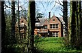
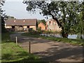
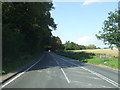
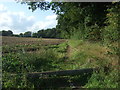

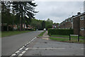
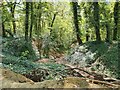


15 photos from this area
Area Information
Key information about the IP33 2EG including its size, population, and administrative classification.
- Area Type
- Postcode
- Area Size
- 3264 m²
- Population
- 1451
- Population Density
- 3122 people/km²
House Prices in IP33 2EG
12
Properties
£146,722
Average Sold Price
£52,500
Lowest Price
£217,500
Highest Price
Showing 12 properties
| Address | Type | Beds | Baths | Last Sale Price | Last Sale Date | |
|---|---|---|---|---|---|---|
| 7 Lindisfarne Road, Bury St Edmunds, IP33 2EG | Semi-detached | 3 | 1 | £217,500 | Aug 2020 | |
| 11 Lindisfarne Road, Bury St Edmunds, IP33 2EG | Semi-detached | - | - | £192,000 | Apr 2018 | |
| 9 Lindisfarne Road, Bury St Edmunds, IP33 2EG | house | - | - | £180,000 | Sep 2016 | |
| 4 Lindisfarne Road, Bury St Edmunds, IP33 2EG | Semi-detached | 3 | - | £170,000 | Jun 2014 | |
| 2 Lindisfarne Road, Bury St Edmunds, IP33 2EG | house | 3 | - | £161,000 | Mar 2010 | |
| 1 Lindisfarne Road, Bury St Edmunds, IP33 2EG | Semi-detached | 3 | 1 | £130,000 | Apr 2009 | |
| 10 Lindisfarne Road, Bury St Edmunds, IP33 2EG | Semi-detached | - | - | £165,000 | Sep 2004 | |
| 12 Lindisfarne Road, Bury St Edmunds, IP33 2EG | Semi-detached | - | - | £52,500 | Feb 1998 | |
| 6 Lindisfarne Road, Bury St Edmunds, IP33 2EG | Semi-detached | - | - | £52,500 | May 1997 | |
| 8 Lindisfarne Road, Bury St Edmunds, IP33 2EG | Semi-detached | 3 | 1 | - | - |
Page 1 of 2
Energy Efficiency in IP33 2EG
Amenities
Schools
| Rank | School | Type | Entry gender | Ages |
|---|
Explore more schools in this area
Go to Schools tabDemographics
Household Size
Two person
most common
Accommodation Type
Houses
most common
Tenure
86
majority
Ethnic Group
White
most common
Religion
N/A
most common
Household Composition
N/A
most common
Age
47
median
Adults (30-64 years)
most common
Household Deprivation
N/A
with no deprivation
NS-SEC
35
in Lower managerial occupations
Explore more demographic insights in this area
Go to Demographics tabPlanning
Planning Constraints
- Flood RiskPremium
- Ramsar Wetland SitesPremium
- Area of Outstanding Natural BeautyPremium
- Protected Nature ReservePremium
- Protected WoodlandPremium