Area Overview for IP33 2BN
Photos of IP33 2BN
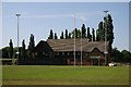
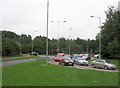
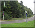
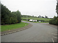
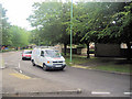
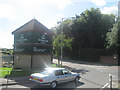
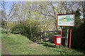

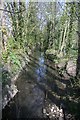
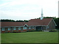
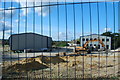
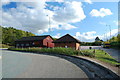
59 photos from this area
Area Information
Key information about the IP33 2BN including its size, population, and administrative classification.
- Area Type
- Postcode
- Area Size
- 2.0 hectares
- Population
- 1267
- Population Density
- 918 people/km²
House Prices in IP33 2BN
23
Properties
£392,938
Average Sold Price
£200,000
Lowest Price
£615,000
Highest Price
Showing 23 properties
| Address | Type | Beds | Baths | Last Sale Price | Last Sale Date | |
|---|---|---|---|---|---|---|
| Poplars, Sicklesmere Road, Bury St Edmunds, IP33 2BN | Bungalow | 4 | 3 | £425,000 | Mar 2025 | |
| Larrissa, Sicklesmere Road, Bury St Edmunds, IP33 2BN | Bungalow | 4 | 1 | £295,000 | Nov 2024 | |
| Shepherd House, 7 Sicklesmere Road, Bury St Edmunds, IP33 2BN | Detached | 4 | 2 | £615,000 | Sep 2022 | |
| 17 Sicklesmere Road, Bury St Edmunds, IP33 2BN | Detached | 5 | 3 | £470,000 | Jun 2018 | |
| 11 Sicklesmere Road, Bury St Edmunds, IP33 2BN | Detached | 5 | - | £550,000 | Oct 2015 | |
| Sicklesmere Lodge, 17A Sicklesmere Road, Bury St Edmunds, IP33 2BN | Detached | 3 | 1 | £223,500 | May 2013 | |
| 15 Sicklesmere Road, Bury St Edmunds, IP33 2BN | Terraced | 2 | 1 | £200,000 | May 2011 | |
| Fortlands, Sicklesmere Road, Bury St Edmunds, IP33 2BN | house | 4 | - | £365,000 | Dec 2008 | |
| 1, The Gateway, Sicklesmere Road, Bury St Edmunds, IP33 2BN | Terraced | 3 | 2 | - | - | |
| The Fort, Sicklesmere Road, Bury St Edmunds, IP33 2BN | Detached | 5 | 1 | - | - |
Page 1 of 3
Energy Efficiency in IP33 2BN
Amenities
Schools
| Rank | School | Type | Entry gender | Ages |
|---|
Explore more schools in this area
Go to Schools tabDemographics
Household Size
Two person
most common
Accommodation Type
Houses
most common
Tenure
79
majority
Ethnic Group
White
most common
Religion
N/A
most common
Household Composition
N/A
most common
Age
47
median
Adults (30-64 years)
most common
Household Deprivation
N/A
with no deprivation
NS-SEC
34
in Lower managerial occupations
Explore more demographic insights in this area
Go to Demographics tabPlanning
Planning Constraints
- Flood RiskPremium
- Ramsar Wetland SitesPremium
- Area of Outstanding Natural BeautyPremium
- Protected Nature ReservePremium
- Protected WoodlandPremium