Area Overview for IP33 1TH
Photos of IP33 1TH
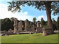

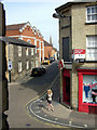
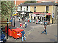
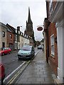
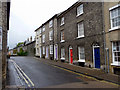
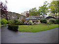
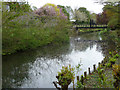
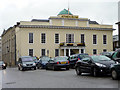
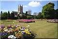
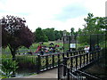
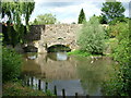
100 photos from this area
Area Information
Key information about the IP33 1TH including its size, population, and administrative classification.
- Area Type
- Postcode
- Area Size
- 9059 m²
- Population
- 1078
- Population Density
- 7201 people/km²
House Prices in IP33 1TH
38
Properties
£238,859
Average Sold Price
£90,000
Lowest Price
£375,500
Highest Price
Showing 38 properties
| Address | Type | Beds | Baths | Last Sale Price | Last Sale Date | |
|---|---|---|---|---|---|---|
| 45A St Andrews Street North, Bury St Edmunds, IP33 1TH | Terraced | 3 | 2 | £280,000 | Jul 2017 | |
| 45 St Andrews Street North, Bury St Edmunds, IP33 1TH | house | 3 | - | £275,000 | Jun 2017 | |
| 47 St Andrews Street North, Bury St Edmunds, IP33 1TH | Semi-detached | 3 | 2 | £300,000 | Dec 2016 | |
| 44 St Andrews Street North, Bury St Edmunds, IP33 1TH | Terraced | 3 | - | £280,000 | Oct 2016 | |
| 46 St Andrews Street North, Bury St Edmunds, IP33 1TH | house | - | - | £281,000 | Mar 2016 | |
| 19 St Andrews Street North, Bury St Edmunds, IP33 1TH | house | - | - | £375,500 | Aug 2014 | |
| 26 St Andrews Street North, Bury St Edmunds, IP33 1TH | Terraced | 4 | - | £323,500 | Jun 2014 | |
| 18 St Andrews Street North, Bury St Edmunds, IP33 1TH | Semi-detached | 3 | - | £237,750 | Feb 2014 | |
| 25 St Andrews Street North, Bury St Edmunds, IP33 1TH | Terraced | 3 | - | £201,000 | Jul 2012 | |
| 50 St Andrews Street North, Bury St Edmunds, IP33 1TH | house | 3 | - | £195,000 | Dec 2011 |
Page 1 of 4
Energy Efficiency in IP33 1TH
Amenities
Schools
| Rank | School | Type | Entry gender | Ages |
|---|
Explore more schools in this area
Go to Schools tabDemographics
Household Size
One person
most common
Accommodation Type
Flats
most common
Tenure
34
majority
Ethnic Group
White
most common
Religion
N/A
most common
Household Composition
N/A
most common
Age
47
median
Adults (30-64 years)
most common
Household Deprivation
N/A
with no deprivation
NS-SEC
32
in Lower managerial occupations
Explore more demographic insights in this area
Go to Demographics tabPlanning
Planning Constraints
- Flood RiskPremium
- Ramsar Wetland SitesPremium
- Area of Outstanding Natural BeautyPremium
- Protected Nature ReservePremium
- Protected WoodlandPremium