Area Overview for IP32 7GQ
Photos of IP32 7GQ
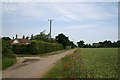
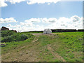
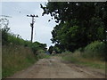
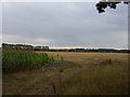
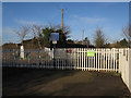
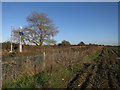
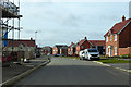
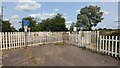


12 photos from this area
Area Information
Key information about the IP32 7GQ including its size, population, and administrative classification.
- Area Type
- Postcode
- Area Size
- 2.2 hectares
- Population
- 1403
- Population Density
- 4579 people/km²
House Prices in IP32 7GQ
52
Properties
£218,729
Average Sold Price
£113,045
Lowest Price
£380,000
Highest Price
Showing 52 properties
| Address | Type | Beds | Baths | Last Sale Price | Last Sale Date | |
|---|---|---|---|---|---|---|
| 33 Blackbird Drive, Bury St Edmunds, IP32 7GQ | Terraced | 3 | 1 | £280,000 | May 2024 | |
| 11 Blackbird Drive, Bury St Edmunds, IP32 7GQ | Maisonette | 2 | 1 | £218,500 | Oct 2022 | |
| 39 Blackbird Drive, Bury St Edmunds, IP32 7GQ | Maisonette | 1 | 1 | £165,000 | Jul 2022 | |
| 29 Blackbird Drive, Bury St Edmunds, IP32 7GQ | Flat | 2 | - | £150,000 | May 2022 | |
| 34 Blackbird Drive, Bury St Edmunds, IP32 7GQ | house | 3 | 1 | £308,000 | Apr 2022 | |
| 37 Blackbird Drive, Bury St Edmunds, IP32 7GQ | Terraced | 3 | 1 | £248,750 | Sep 2021 | |
| 57 Blackbird Drive, Bury St Edmunds, IP32 7GQ | house | 3 | 2 | £290,000 | May 2021 | |
| 17 Blackbird Drive, Bury St Edmunds, IP32 7GQ | house | 3 | 1 | £285,000 | Dec 2020 | |
| 36 Blackbird Drive, Bury St Edmunds, IP32 7GQ | Semi-detached | 4 | 2 | £320,000 | Jan 2020 | |
| 16 Blackbird Drive, Bury St Edmunds, IP32 7GQ | Semi-detached | 3 | 2 | £268,500 | Jan 2020 |
Page 1 of 6
Energy Efficiency in IP32 7GQ
Amenities
Schools
| Rank | School | Type | Entry gender | Ages |
|---|
Explore more schools in this area
Go to Schools tabDemographics
Household Size
Family (3-5 people)
most common
Accommodation Type
Houses
most common
Tenure
58
majority
Ethnic Group
White
most common
Religion
N/A
most common
Household Composition
N/A
most common
Age
47
median
Adults (30-64 years)
most common
Household Deprivation
N/A
with no deprivation
NS-SEC
41
in Lower managerial occupations
Explore more demographic insights in this area
Go to Demographics tabPlanning
Planning Constraints
- Flood RiskPremium
- Ramsar Wetland SitesPremium
- Area of Outstanding Natural BeautyPremium
- Protected Nature ReservePremium
- Protected WoodlandPremium