Area Overview for IP32 7ES
Photos of IP32 7ES
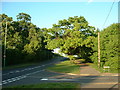
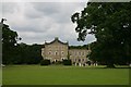


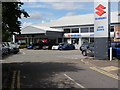
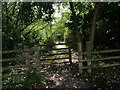
30 photos from this area
Area Information
Key information about the IP32 7ES including its size, population, and administrative classification.
- Area Type
- Postcode
- Area Size
- 4.6 hectares
- Population
- 1211
- Population Density
- 1581 people/km²
House Prices in IP32 7ES
51
Properties
£212,005
Average Sold Price
£59,000
Lowest Price
£350,000
Highest Price
Showing 51 properties
| Address | Type | Beds | Baths | Last Sale Price | Last Sale Date | |
|---|---|---|---|---|---|---|
| 85 Heldhaw Road, Bury St Edmunds, IP32 7ES | Semi-detached | 3 | 1 | £322,500 | Jun 2023 | |
| 36 Heldhaw Road, Bury St Edmunds, IP32 7ES | Detached | 3 | 1 | £350,000 | Jun 2023 | |
| 41 Heldhaw Road, Bury St Edmunds, IP32 7ES | house | - | - | £295,000 | Aug 2021 | |
| 81 Heldhaw Road, Bury St Edmunds, IP32 7ES | house | - | - | £250,000 | Sep 2020 | |
| 75 Heldhaw Road, Bury St Edmunds, IP32 7ES | house | - | - | £260,000 | Sep 2020 | |
| 40 Heldhaw Road, Bury St Edmunds, IP32 7ES | Semi-detached | 2 | - | £244,000 | Oct 2019 | |
| 46 Heldhaw Road, Bury St Edmunds, IP32 7ES | house | - | - | £305,000 | Nov 2018 | |
| 64 Heldhaw Road, Bury St Edmunds, IP32 7ES | Semi-detached | 3 | 1 | £260,000 | Oct 2018 | |
| 43 Heldhaw Road, Bury St Edmunds, IP32 7ES | house | - | - | £265,000 | Feb 2018 | |
| 56 Heldhaw Road, Bury St Edmunds, IP32 7ES | Detached | 3 | - | £277,000 | Apr 2017 |
Page 1 of 6
Energy Efficiency in IP32 7ES
Amenities
Schools
| Rank | School | Type | Entry gender | Ages |
|---|
Explore more schools in this area
Go to Schools tabDemographics
Household Size
Family (3-5 people)
most common
Accommodation Type
Houses
most common
Tenure
68
majority
Ethnic Group
White
most common
Religion
N/A
most common
Household Composition
N/A
most common
Age
47
median
Adults (30-64 years)
most common
Household Deprivation
N/A
with no deprivation
NS-SEC
46
in Lower managerial occupations
Explore more demographic insights in this area
Go to Demographics tabPlanning
Planning Constraints
- Flood RiskPremium
- Ramsar Wetland SitesPremium
- Area of Outstanding Natural BeautyPremium
- Protected Nature ReservePremium
- Protected WoodlandPremium