Area Overview for IP32 7EF
Photos of IP32 7EF
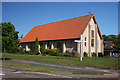
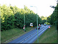
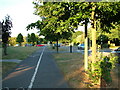
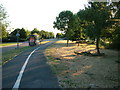


30 photos from this area
Area Information
Key information about the IP32 7EF including its size, population, and administrative classification.
- Area Type
- Postcode
- Area Size
- 8966 m²
- Population
- 1211
- Population Density
- 1581 people/km²
House Prices in IP32 7EF
20
Properties
£202,977
Average Sold Price
£60,000
Lowest Price
£315,000
Highest Price
Showing 20 properties
| Address | Type | Beds | Baths | Last Sale Price | Last Sale Date | |
|---|---|---|---|---|---|---|
| 10 Kembold Close, Bury St Edmunds, IP32 7EF | Semi-detached | 2 | 1 | £255,000 | Nov 2024 | |
| 11 Kembold Close, Bury St Edmunds, IP32 7EF | Semi-detached | 3 | 1 | £278,200 | Feb 2024 | |
| 4 Kembold Close, Bury St Edmunds, IP32 7EF | house | - | - | £315,000 | Jul 2020 | |
| 16 Kembold Close, Bury St Edmunds, IP32 7EF | Detached | 3 | 1 | £265,000 | Jul 2018 | |
| 5 Kembold Close, Bury St Edmunds, IP32 7EF | Detached | 3 | - | £270,000 | Jul 2014 | |
| 3 Kembold Close, Bury St Edmunds, IP32 7EF | Detached | 4 | - | £238,000 | Feb 2013 | |
| 22 Kembold Close, Bury St Edmunds, IP32 7EF | house | - | - | £215,000 | May 2007 | |
| 20 Kembold Close, Bury St Edmunds, IP32 7EF | Semi-detached | - | - | £209,000 | Sep 2004 | |
| 9 Kembold Close, Bury St Edmunds, IP32 7EF | Detached | - | - | £207,500 | Feb 2004 | |
| 2 Kembold Close, Bury St Edmunds, IP32 7EF | Detached | - | - | £118,000 | Jan 2001 |
Page 1 of 2
Energy Efficiency in IP32 7EF
Amenities
Schools
| Rank | School | Type | Entry gender | Ages |
|---|
Explore more schools in this area
Go to Schools tabDemographics
Household Size
Family (3-5 people)
most common
Accommodation Type
Houses
most common
Tenure
68
majority
Ethnic Group
White
most common
Religion
N/A
most common
Household Composition
N/A
most common
Age
47
median
Adults (30-64 years)
most common
Household Deprivation
N/A
with no deprivation
NS-SEC
46
in Lower managerial occupations
Explore more demographic insights in this area
Go to Demographics tabPlanning
Planning Constraints
- Flood RiskPremium
- Ramsar Wetland SitesPremium
- Area of Outstanding Natural BeautyPremium
- Protected Nature ReservePremium
- Protected WoodlandPremium