Area Overview for IP30 9ND
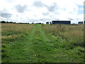
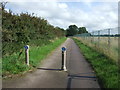
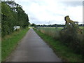
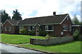
Photos of IP30 9ND


Area Information
Living in IP30 9ND means being part of a small, tightly knit residential cluster in eastern England. The area spans 55.3 hectares and is home to 2,450 people, resulting in a low population density of 57 people per square kilometre. This suggests a quiet, less congested environment, ideal for those seeking a balance between rural tranquillity and proximity to essential services. The community is predominantly composed of adults aged 30–64, with a median age of 47, indicating a stable population with strong family ties. Most residents own their homes, with 71% of properties in private ownership, and the accommodation is largely houses rather than flats. The area’s compact size means daily life revolves around a handful of local amenities, with nearby shops, schools, and transport links within practical reach. While the population is small, the presence of multiple schools and retail outlets suggests a functional, self-contained community. For those prioritising safety and a slower pace of life, IP30 9ND offers a straightforward, unpretentious living experience without the pressures of larger urban centres.
- Area Type
- Postcode
- Area Size
- 55.3 hectares
- Population
- 2450
- Population Density
- 57 people/km²
The property market in IP30 9ND is defined by a high rate of home ownership, with 71% of properties privately owned. This suggests a community where residents are likely to have long-term ties to the area, rather than a transient rental market. The accommodation type is predominantly houses, which is consistent with the low population density and the overall size of the area. Given the small size of IP30 9ND—just 55.3 hectares—the housing stock is limited, meaning the market is likely to be niche and competitive. Buyers should consider the scarcity of properties, as the area’s compact nature limits expansion. The focus on owner-occupied homes also implies that rental availability may be constrained, potentially making it harder for new buyers to enter the market. For those seeking a stable, low-maintenance property in a quiet setting, IP30 9ND’s housing stock offers a straightforward option, though the small size of the area means prospective buyers should act decisively to secure a property.
House Prices in IP30 9ND
Showing 22 properties
| Address | Type | Beds | Baths | Last Sale Price | Last Sale Date | |
|---|---|---|---|---|---|---|
| The Rave Bus, Fred Castle Way, Rougham Industrial Estate, Rougham, IP30 9ND | Mobile Home | - | - | £678,000 | May 2024 | |
| P & F Safepac Co Ltd, Maxwell Road, Rougham, IP30 9ND | warehouse | - | - | - | - | |
| Thomas Ridley & Sons Ltd, Unit 3A, Maxwell Road, Rougham, IP30 9ND | warehouse | - | - | - | - | |
| Fornham Hall Furniture, Woodlands Business Park, Woodlands Road, Rougham Industrial Estate, Rougham, IP30 9ND | office_workshop | - | - | - | - | |
| Dunlops, 1-2 Woodlands Road, Rougham Industrial Estate, Rougham, IP30 9ND | Industrial | - | - | - | - | |
| Unit B, Woodlands Road, Rougham Industrial Estate, Rougham, IP30 9ND | office_workshop | - | - | - | - | |
| Gaia Climate Solutions, Unit A, Maxwell Road, Rougham, IP30 9ND | Industrial | - | - | - | - | |
| Marton Geotechnical, Mgs, Maxwell Road, Rougham, IP30 9ND | Industrial | - | - | - | - | |
| Thomas Ridley And Son Ltd, Perkins Road, Rougham Industrial Estate, Rougham, IP30 9ND | retail_financial | - | - | - | - | |
| Thomas Ridley & Son Ltd, Warehouse 2, Maxwell Road, Rougham, IP30 9ND | warehouse | - | - | - | - |
Energy Efficiency in IP30 9ND
Daily life in IP30 9ND is shaped by its proximity to essential retail and transport hubs. The area’s nearest retail outlets include Sainsburys and Tesco in Bury St Edmunds, as well as Co-op in Thurston, all within practical reach. These supermarkets and shops provide access to groceries, household goods, and everyday conveniences. The rail network, with stations such as Thurston Railway Station, offers connectivity to nearby towns, facilitating commuting or weekend trips. While the area itself is small, its location ensures that larger amenities are accessible without significant travel. The presence of multiple schools and the low population density suggest a community-oriented lifestyle, where local interactions and family needs are prioritised. For those who enjoy a balance between self-sufficiency and regional access, IP30 9ND offers a straightforward, practical lifestyle with minimal urban complications.
Amenities
Schools
The schools near IP30 9ND cater to a range of educational needs, with a focus on primary education and a single academy. Rougham Church of England Voluntary Controlled Primary School and Rougham Church of England Primary School both provide primary education and hold Ofsted ratings of ‘good’. These schools are likely to serve the local community’s younger residents, offering a familiar, church-affiliated option. Sybil Andrews Academy, an academy with a ‘good’ Ofsted rating, provides secondary education. The presence of two primary schools and one academy suggests a structured educational pathway for families, though the absence of higher education institutions means students may need to travel for further studies. The consistent ‘good’ ratings across all listed schools indicate a reliable standard of education, which is a key consideration for families prioritising school quality. The mix of school types also allows parents to choose between traditional and academically focused environments.
| Rank | School | Type | Entry gender | Ages |
|---|
Explore more schools in this area
Go to Schools tabDemographics
The demographic profile of IP30 9ND reflects a mature, family-oriented population. With a median age of 47 and the majority of residents falling within the 30–64 age range, the area is characterised by a stable, middle-aged demographic. Home ownership is high, at 71%, suggesting a long-term commitment to the area. The accommodation type is predominantly houses, which aligns with the low population density and the presence of larger properties. The predominant ethnic group is White, though no further breakdown of diversity is provided in the data. This age group and ownership pattern indicate a community with established households, likely with children in local schools. The absence of specific deprivation data means the area’s economic conditions cannot be assessed, but the high home ownership rate and low population density suggest a relatively affluent or stable socioeconomic environment. For buyers, this demographic profile implies a neighbourhood with minimal turnover and a focus on long-term residency rather than transient populations.
Household Size
Accommodation Type
Tenure
Ethnic Group
Religion
Household Composition
Age
Household Deprivation
NS-SEC
Explore more demographic insights in this area
Go to Demographics tabPlanning
Planning Constraints
- Flood RiskPremium
- Ramsar Wetland SitesPremium
- Area of Outstanding Natural BeautyPremium
- Protected Nature ReservePremium
- Protected WoodlandPremium