Area Overview for IP30 9LX
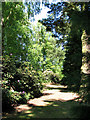
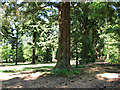
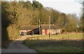
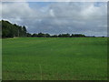
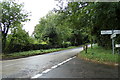
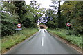
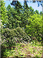
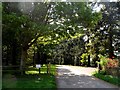
Photos of IP30 9LX


Area Information
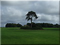
Living in IP30 9LX means being part of a small, tightly knit residential cluster in England. Covering 28.4 hectares, the area is home to 2,450 people, translating to a low population density of 57 people per square kilometre. This suggests a quiet, spacious environment where homes are spread out, offering privacy and a sense of community. The area’s character is shaped by its modest size and the demographics of its residents, who are predominantly adults aged 30–64. With 71% of homes owned by their occupants, the community feels stable, with a focus on long-term residency. Daily life here is likely to revolve around local amenities, schools, and the nearby railway network. While the area is not densely populated, it is well-connected to surrounding towns via rail, making it accessible for commuters. The mix of housing types—primarily houses—suggests a family-oriented environment, though the small scale means the area is not suited to large-scale development. For those seeking a peaceful, low-density living experience with a strong local identity, IP30 9LX offers a distinct alternative to urban centres.
- Area Type
- Postcode
- Area Size
- 28.4 hectares
- Population
- 2450
- Population Density
- 57 people/km²
The property market in IP30 9LX is defined by a high rate of home ownership—71% of properties are owner-occupied—suggesting a community of long-term residents rather than a transient rental market. The predominant accommodation type is houses, which contrasts with areas where flats or apartments dominate. This indicates a focus on family homes, likely with gardens and more space, catering to those prioritising privacy and living room. The small area size of 28.4 hectares means the housing stock is limited, which could make the market competitive for buyers. Proximity to nearby towns via rail and access to local schools may enhance the area’s appeal, though the modest scale of the area means there is little scope for large-scale development. For buyers, the market offers a blend of stability and space, though the limited supply may mean properties are in demand.
House Prices in IP30 9LX
Showing 5 properties
| Address | Type | Beds | Baths | Last Sale Price | Last Sale Date | |
|---|---|---|---|---|---|---|
| 2, The Old Stables, Rougham Park, Ipswich Road, Rougham, IP30 9LX | house | - | - | - | - | |
| Hall Bungalow, Rougham Park, Ipswich Road, Rougham, IP30 9LX | Bungalow | 3 | 2 | - | - | |
| 1, Stableyard Cottages, Rougham Park, Ipswich Road, Rougham, IP30 9LX | house | - | - | - | - | |
| The Coach House, Rougham Park, Ipswich Road, Rougham, IP30 9LX | Semi-detached | 2 | - | - | - | |
| The Clocktower, Rougham Park, Ipswich Road, Rougham, IP30 9LX | house | - | - | - | - |
Energy Efficiency in IP30 9LX
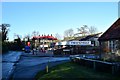
The lifestyle in IP30 9LX is shaped by its proximity to essential amenities and a modest scale of living. Within practical reach are five railway stations, including Thurston Railway Station, offering convenient access to nearby towns and employment hubs. Retail options are plentiful, with major supermarkets like Sainsburys and Tesco in Bury St Edmunds, along with the local Co-op in Thurston. These shops provide everyday necessities, reducing the need for long journeys. While the data does not mention parks or leisure facilities, the area’s low density and residential character suggest a focus on private spaces and quiet living. The combination of rail access and nearby shopping makes daily life practical, though the lack of detailed information on leisure options means the area’s recreational offerings remain unclear.
Amenities
Schools
Residents of IP30 9LX have access to three schools within practical reach. Rougham Church of England Voluntary Controlled Primary School and Rougham Church of England Primary School are both primary schools with Ofsted ratings of “good,” offering a solid foundation for younger children. Sybil Andrews Academy, an academy with an “outstanding” Ofsted rating, provides secondary education. The mix of primary and academy schools gives families a range of options, from faith-based education to state-run institutions with strong performance. The presence of two primary schools in the same area may reduce travel times for families with multiple children. The high Ofsted ratings suggest that educational standards are generally strong, which is a key consideration for homebuyers prioritising school quality.
| Rank | School | Type | Entry gender | Ages |
|---|
Explore more schools in this area
Go to Schools tabDemographics
The community in IP30 9LX is predominantly composed of adults aged 30–64, with a median age of 47. This indicates a mature population, likely with established careers and families. Home ownership is high, with 71% of properties owned outright, suggesting a stable and long-term resident base. The area is characterised by houses rather than flats, which aligns with the demographic profile of older, settled households. The predominant ethnic group is White, though no specific data on diversity or deprivation is provided. The low population density of 57 people per square kilometre implies a spread-out, less congested environment, which may appeal to those seeking space and quiet. The absence of detailed information on household types or income levels means the area’s socio-economic profile remains partially opaque, but the high home ownership rate and age distribution point to a community prioritising stability and family life.
Household Size
Accommodation Type
Tenure
Ethnic Group
Religion
Household Composition
Age
Household Deprivation
NS-SEC
Explore more demographic insights in this area
Go to Demographics tabPlanning
Planning Constraints
- Flood RiskPremium
- Ramsar Wetland SitesPremium
- Area of Outstanding Natural BeautyPremium
- Protected Nature ReservePremium
- Protected WoodlandPremium