Area Overview for IP30 9LN
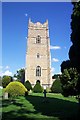
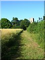
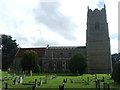
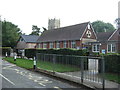
Photos of IP30 9LN


Area Information
Living in IP30 9LN means inhabiting a compact, residential cluster in England’s East of England region. The area spans 24.4 hectares and is home to 2,450 residents, with a population density of 57 people per square kilometre. This small postcode area is defined by its quiet, established character, with a median age of 47 and a majority of residents aged 30–64. The community leans heavily on home ownership, with 71% of properties owner-occupied, and most homes are traditional houses rather than flats or apartments. The area’s proximity to nearby towns and its blend of local amenities make it appealing for those seeking a balanced lifestyle. Residents benefit from access to primary schools with strong Ofsted ratings, nearby rail links, and a selection of retail outlets. While the population is predominantly White, the area’s modest size means it fosters a close-knit feel. For buyers, IP30 9LN offers a snapshot of rural living with practical connectivity, though its small scale means it is best suited to those prioritising community over urban vibrancy.
- Area Type
- Postcode
- Area Size
- 24.4 hectares
- Population
- 2450
- Population Density
- 57 people/km²
The property market in IP30 9LN is characterised by a high proportion of owner-occupied homes, with 71% of properties owned by residents rather than rented. This suggests a stable, long-term market with limited turnover, as the area’s small size and established character may deter speculative investment. The accommodation type is predominantly houses, which are more common than flats or apartments. This housing stock is likely to appeal to families or individuals seeking traditional, spacious living. However, the small size of the postcode area means the market is limited in scale, with fewer options for buyers compared to larger towns. Those considering the area should note that property availability may be constrained by the localised nature of the postcode. The high home ownership rate also implies that rental opportunities are scarce, making IP30 9LN a less viable option for those seeking short-term housing.
House Prices in IP30 9LN
Showing 3 properties
| Address | Type | Beds | Baths | Last Sale Price | Last Sale Date | |
|---|---|---|---|---|---|---|
| 26 High Rougham, Rougham, IP30 9LN | Detached | 4 | 2 | £555,000 | Mar 2025 | |
| Flint Cottage, 25 High Rougham, Rougham, IP30 9LN | Detached | - | - | - | - | |
| Rojanda, High Rougham, Rougham, IP30 9LN | Detached | - | - | - | - |
Energy Efficiency in IP30 9LN
The lifestyle in IP30 9LN is shaped by its proximity to essential amenities. Residents have access to five rail stations, including Thurston Railway Station, offering connectivity to nearby towns. Retail options are plentiful, with Co-op Thurston, Sainsburys Bury St Edmunds, and Tesco Bury St Edmunds within easy reach, ensuring daily shopping needs are met. While the area does not list parks or leisure facilities explicitly, the presence of rail and retail hubs suggests a practical, community-focused lifestyle. The small postcode size means amenities are concentrated, requiring minimal travel for essentials. This setup is ideal for those prioritising convenience over expansive recreational spaces. The blend of local shops and transport links creates a self-contained environment, though residents may need to travel further for specialist services or entertainment.
Amenities
Schools
Residents of IP30 9LN have access to a range of educational institutions, including Rougham Church of England Voluntary Controlled Primary School and Rougham Church of England Primary School, both of which hold ‘good’ Ofsted ratings. These primary schools provide a solid foundation for young learners, with a focus on community-led education. Additionally, Sybil Andrews Academy, an academy with a ‘good’ rating, serves the area’s secondary education needs. The mix of school types ensures a variety of educational approaches, from faith-based primary schools to academies with broader curricula. For families, the presence of multiple schools with strong Ofsted ratings is a significant advantage, offering choice and reassurance about educational quality. However, the area’s small size means these schools serve a broader catchment beyond IP30 9LN, which may impact local demand for housing near them.
| Rank | School | Type | Entry gender | Ages |
|---|
Explore more schools in this area
Go to Schools tabDemographics
The demographic profile of IP30 9LN is shaped by its mature population, with a median age of 47 and the majority of residents falling within the 30–64 age range. This suggests a community of established professionals and families, rather than a younger or retired demographic. Home ownership is high at 71%, reflecting a stable, long-term resident base. The accommodation type is predominantly houses, which aligns with the area’s residential character and lower population density. The predominant ethnic group is White, though no specific data on diversity or minority representation is provided. The low population density of 57 people per square kilometre indicates a spread-out, low-rise settlement pattern. This combination of age, ownership, and housing type suggests a community focused on stability and family living, with fewer transient residents. The area’s demographics imply a relatively low demand for rental properties, with most homes serving owner-occupied needs.
Household Size
Accommodation Type
Tenure
Ethnic Group
Religion
Household Composition
Age
Household Deprivation
NS-SEC
Explore more demographic insights in this area
Go to Demographics tabPlanning
Planning Constraints
- Flood RiskPremium
- Ramsar Wetland SitesPremium
- Area of Outstanding Natural BeautyPremium
- Protected Nature ReservePremium
- Protected WoodlandPremium