Area Overview for IP30 9JL
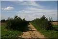
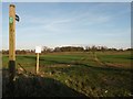
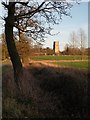
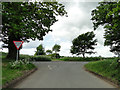
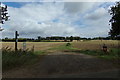
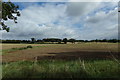
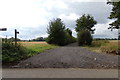
Photos of IP30 9JL

Area Information
Living in IP30 9JL offers a quiet, compact residential experience in a small cluster of homes spread across 20.1 hectares. With a population of 2,450 and a density of 57 people per square kilometre, the area feels unassuming yet well-defined. The community is predominantly composed of adults aged 30–64, reflecting a mature demographic with a strong presence of homeowners. Daily life here is shaped by proximity to local amenities, including retail outlets and rail access, though the area remains low-key compared to larger towns. The postcode’s small size means it is tightly integrated with surrounding villages, offering a blend of rural tranquillity and practical connectivity. Residents benefit from a low crime risk, with a safety score of 76, and no significant environmental hazards such as flood zones or protected landscapes. The presence of two primary schools and an academy within reach makes it appealing for families, while the modest broadband score of 45 may require consideration for those reliant on high-speed internet. IP30 9JL is a place where simplicity and stability are prioritised, with little of the urban sprawl or congestion found elsewhere.
- Area Type
- Postcode
- Area Size
- 20.1 hectares
- Population
- 2450
- Population Density
- 57 people/km²
IP30 9JL is a predominantly owner-occupied area, with 71% of homes owned by residents rather than rented. The housing stock is largely composed of houses, which is typical for smaller, rural postcode areas. This contrasts with urban centres where flats or apartments dominate, and suggests a community focused on family homes and long-term residency. The small size of the area—just 20.1 hectares—means the property market is limited in scale, with fewer options than larger towns or cities. Buyers should consider the proximity to nearby villages, as the immediate surroundings may offer additional choices. The high home ownership rate implies a stable market with little turnover, which can be advantageous for those seeking a settled environment. However, the modest broadband score of 45 may be a consideration for remote workers or those requiring reliable internet access.
House Prices in IP30 9JL
Showing 14 properties
| Address | Type | Beds | Baths | Last Sale Price | Last Sale Date | |
|---|---|---|---|---|---|---|
| 8, James Stiff Cottages, Almshouse Road, Rougham, IP30 9JL | Detached | - | - | - | - | |
| 12, James Stiff Cottages, Almshouse Road, Rougham, IP30 9JL | Detached | - | - | - | - | |
| 10, James Stiff Cottages, Almshouse Road, Rougham, IP30 9JL | Detached | - | - | - | - | |
| 13, James Stiff Cottages, Almshouse Road, Rougham, IP30 9JL | Detached | - | - | - | - | |
| 9, James Stiff Cottages, Almshouse Road, Rougham, IP30 9JL | Terraced | - | - | - | - | |
| 14, James Stiff Cottages, Almshouse Road, Rougham, IP30 9JL | Detached | - | - | - | - | |
| 11, James Stiff Cottages, Almshouse Road, Rougham, IP30 9JL | Detached | - | - | - | - | |
| 4, James Stiff Cottages, Almshouse Road, Rougham, IP30 9JL | Bungalow | - | - | - | - | |
| 2, James Stiff Cottages, Almshouse Road, Rougham, IP30 9JL | Bungalow | - | - | - | - | |
| 3, James Stiff Cottages, Almshouse Road, Rougham, IP30 9JL | Bungalow | - | - | - | - |
Energy Efficiency in IP30 9JL
The lifestyle in IP30 9JL is defined by proximity to essential amenities within walking or short driving distance. Retail options include Sainsburys in Bury St Edmunds and Co-op in Thurston, offering everyday shopping needs. The area’s rail stations, such as Thurston Railway Station, provide access to nearby towns, enhancing connectivity for leisure and commuting. While the data does not mention parks or recreational spaces, the absence of environmental constraints like protected woodlands or AONBs suggests open spaces may be available in surrounding areas. The character of daily life here is shaped by a balance of local convenience and rural calm, with no indication of overcrowded or congested environments. The modest scale of the area means amenities are not sprawling, but they are sufficient for a small community focused on practicality and stability.
Amenities
Schools
Residents of IP30 9JL have access to three schools within practical reach. Rougham Church of England Voluntary Controlled Primary School and Rougham Church of England Primary School both offer primary education, with the latter rated ‘good’ by Ofsted. Sybil Andrews Academy, an academy school, also serves the area and holds a ‘good’ rating. This mix of primary and academy schools provides families with options, though no secondary schools are listed in the data. The presence of two primary schools with strong ratings suggests a focus on early education, which could be a draw for families prioritising school quality. However, the absence of secondary education within the postcode means students may need to travel to nearby villages for further schooling.
| Rank | School | Type | Entry gender | Ages |
|---|
Explore more schools in this area
Go to Schools tabDemographics
The population of IP30 9JL is 2,450, with a median age of 47 and the majority of residents falling within the 30–64 age range. This suggests a community of established adults, likely with families and long-term ties to the area. Home ownership is high at 71%, indicating a stable, owner-occupied environment rather than a rental market. The predominant accommodation type is houses, reflecting a more traditional, spread-out housing stock. The ethnic composition is largely White, though no further breakdown is provided. The low population density of 57 people per square kilometre means the area avoids the overcrowding and strain of more densely populated regions. With no data on deprivation levels, it is unclear how economic disparities might affect quality of life, but the absence of environmental constraints and the safety profile suggest a relatively secure, low-stress living environment.
Household Size
Accommodation Type
Tenure
Ethnic Group
Religion
Household Composition
Age
Household Deprivation
NS-SEC
Explore more demographic insights in this area
Go to Demographics tabPlanning
Planning Constraints
- Flood RiskPremium
- Ramsar Wetland SitesPremium
- Area of Outstanding Natural BeautyPremium
- Protected Nature ReservePremium
- Protected WoodlandPremium