Area Overview for IP30 9EX
Photos of IP30 9EX


Area Information
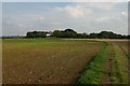
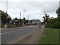
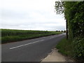
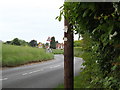
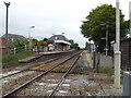
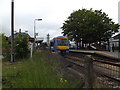
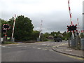
IP30 9EX is a small, tightly knit residential area in England, covering just 1.4 hectares and home to 2,393 people. Its compact size means it is a quiet, localised community with a strong sense of place. The area’s population density of 1,739 people per square kilometre reflects a mix of established residents and families, with the median age at 47 suggesting a mature demographic. Daily life here is shaped by proximity to essential services and natural amenities. Residents benefit from nearby rail links, including Elmswell Railway Station, which connects to broader regional networks. The area’s low crime risk score of 82 and absence of environmental constraints like flood zones or protected landscapes make it appealing for those prioritising safety and stability. With schools, shops, and transport options within practical reach, IP30 9EX offers a balanced lifestyle for those seeking a compact, well-serviced home without the pressures of urban density.
- Area Type
- Postcode
- Area Size
- 1.4 hectares
- Population
- 2393
- Population Density
- 1739 people/km²
The property market in IP30 9EX is dominated by owner-occupied homes, with 83% of properties in private ownership. This contrasts with rental markets, where buy-to-let or investor activity is more common. The area’s housing stock consists primarily of houses, which may appeal to families or those seeking more space than flats. Given the small size of the postcode area, the available housing is likely limited to a few dozen properties, making it a niche market. Buyers should consider the proximity to amenities such as Elmswell Railway Station and the nearby retail outlets, which enhance the area’s practicality. However, the compact nature of the postcode means that property values may be influenced more by location-specific factors, such as school catchment areas or transport links, than by broader regional trends.
House Prices in IP30 9EX
No properties found in this postcode.
Energy Efficiency in IP30 9EX
Living in IP30 9EX offers access to a range of local amenities within walking or short driving distance. The area includes five retail outlets, notably three branches of East of England Co-operative Co, providing essential shopping and services. The presence of Elmswell Railway Station enhances mobility, connecting residents to regional transport networks. While the data does not specify parks or leisure facilities, the absence of environmental constraints like protected woodlands or AONB designations suggests that the area is free from restrictive planning policies that might limit development. The compact nature of the postcode means that amenities are closely clustered, fostering a convenient, self-contained lifestyle. However, the lack of named parks or recreational spaces in the data implies that outdoor activities may require travel to nearby towns.
Amenities
Schools
The nearest school to IP30 9EX is Elmswell Community Primary School, which serves the local area with a good Ofsted rating. This primary school provides education for younger children, though no secondary schools are listed in the data. The presence of a well-rated primary school is a key consideration for families with young children, offering a stable educational foundation. However, parents seeking secondary education for older children may need to look beyond the immediate vicinity. The single school listed suggests a focus on primary education within the area, which could be advantageous for families prioritising early schooling but may require additional planning for long-term educational needs.
| Rank | School | Type | Entry gender | Ages |
|---|---|---|---|---|
| 1 | Elmswell Community Primary School | primary | N/A | N/A |
Explore more schools in this area
Go to Schools tabDemographics
The community in IP30 9EX is predominantly composed of adults aged 30–64, with a median age of 47. This suggests a population of working-age individuals and families, many of whom own their homes—83% of properties are owner-occupied. The area is largely residential, with houses as the main accommodation type. The predominant ethnic group is White, reflecting a homogenous demographic profile. The high population density of 1,739 people per square kilometre indicates a closely packed community, which may influence the character of local interactions and the availability of shared spaces. While no specific data on deprivation is provided, the high home ownership rate and low crime risk suggest a stable, low-pressure environment. However, the absence of diverse age groups or ethnic backgrounds may limit the range of community activities or social dynamics.
Household Size
Accommodation Type
Tenure
Ethnic Group
Religion
Household Composition
Age
Household Deprivation
NS-SEC
Explore more demographic insights in this area
Go to Demographics tabPlanning
Planning Constraints
- Flood RiskPremium
- Ramsar Wetland SitesPremium
- Area of Outstanding Natural BeautyPremium
- Protected Nature ReservePremium
- Protected WoodlandPremium
- Crime RiskPremium