Area Overview for IP30 0RN
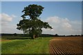
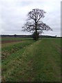
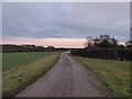
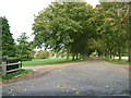
Photos of IP30 0RN
Area Information
IP30 0RN is a small, residential postcode area in England, spanning just 1.7 km² and home to 2149 residents. Its low population density of 69 people per square kilometre suggests a quiet, spread-out community, likely characterised by individual properties rather than high-density housing. The area is not a sprawling suburb but a compact cluster of homes, possibly with a rural or semi-rural feel given its size. Daily life here would revolve around local amenities, with a focus on proximity to essential services. The presence of nearby rail stations and a nearby airport, RAF Wattisham, hints at connectivity to larger towns or cities, though the area itself remains small and likely insular. With a median age of 47, the population skews towards middle-aged adults, suggesting a stable, perhaps family-oriented community. This is not a place for young professionals seeking fast-paced urban living but more for those prioritising tranquillity and established neighbourhoods. The area’s small size means residents are likely familiar with one another, creating a close-knit environment. For buyers, this could mean a slower-moving property market with limited options, but also a sense of security in a low-risk, low-density setting.
- Area Type
- Postcode
- Area Size
- 1.7 km²
- Population
- 2149
- Population Density
- 69 people/km²
The property market in IP30 0RN is dominated by owner-occupied homes, with 79% of residents living in properties they own. This high home ownership rate suggests a stable, long-term community with limited rental activity. The accommodation type is primarily houses, which aligns with the area’s low population density and likely semi-rural or suburban setting. Given the small size of the postcode area—just 1.7 km²—the housing stock is likely limited, meaning buyers may find few options within IP30 0RN itself. Those seeking properties may need to look beyond the immediate postcode to nearby areas, though the presence of nearby rail stations could indicate proximity to larger towns or cities. The focus on owner-occupied homes implies that the market is more about long-term investment than short-term rental opportunities. For buyers, this means a potentially slower-moving market with fewer listings but also a lower risk of speculative development or rapid price fluctuations. The predominance of houses also suggests that the area may cater to families or individuals seeking more space than apartments or terraced housing.
House Prices in IP30 0RN
Showing 11 properties
| Address | Type | Beds | Baths | Last Sale Price | Last Sale Date | |
|---|---|---|---|---|---|---|
| Clopton Hall, Clopton Green, Rattlesden, IP30 0RN | Detached | - | - | £1,250,000 | Feb 2020 | |
| CLOPTON GREEN FARM, CLOPTON GREEN, Rattlesden, IP30 0RN | Detached | - | - | £15,150,000 | Oct 2017 | |
| The Farmhouse, Clopton Green Farm, Clopton Green, Rattlesden, IP30 0RN | Detached | - | - | - | - | |
| 6 Clopton Green, Rattlesden, IP30 0RN | house | - | - | - | - | |
| 5 Clopton Green, Rattlesden, IP30 0RN | house | - | - | - | - | |
| 1 Clopton Green, Rattlesden, IP30 0RN | house | - | - | - | - | |
| 7 Clopton Green, Rattlesden, IP30 0RN | house | - | - | - | - | |
| 3 Clopton Green, Rattlesden, IP30 0RN | house | - | - | - | - | |
| Clopton Dower House, Clopton Green, Rattlesden, IP30 0RN | house | 5 | - | - | - | |
| Annexe, Clopton Dower House, Clopton Green, Rattlesden, IP30 0RN | Maisonette | - | - | - | - |
Energy Efficiency in IP30 0RN
The lifestyle in IP30 0RN is shaped by its proximity to a limited but practical range of amenities. Retail options include five venues, with the East of England Co-operative Co appearing multiple times, suggesting a focus on local, community-run shops. These could provide essentials such as groceries, household goods, and local services. The area’s rail connections, including Elmswell Railway Station, offer access to regional transport networks, facilitating travel to nearby towns or cities for work, shopping, or leisure. The nearby RAF Wattisham airport, while likely a military facility, may contribute to the area’s character, though it is not a civilian airport. For leisure, the data does not mention parks or recreational spaces, but the low population density and absence of protected natural areas suggest that open space may be limited. Residents may need to travel further for dedicated parks or outdoor activities. The combination of retail, rail, and limited local amenities creates a lifestyle that balances self-sufficiency with the need to venture beyond the immediate area for more diverse options.
Amenities
Schools
Residents of IP30 0RN have access to two primary schools: Rattlesden Church of England Voluntary Controlled School and Rattlesden Church of England Primary Academy. Both are primary institutions, catering to younger children, and the latter holds an Ofsted rating of ‘good’. This combination of schools provides families with options for early education, though no secondary schools are listed in the data. The presence of two primary schools in the area suggests a focus on local education, with both institutions likely serving the surrounding communities. The ‘good’ Ofsted rating indicates that at least one school meets or exceeds standards in areas such as teaching quality and pupil outcomes. For families prioritising education, this is a positive sign, though the absence of secondary schools may require parents to look further afield for secondary education. The proximity of these schools to IP30 0RN reinforces the area’s appeal to families seeking a stable, well-served environment for their children’s schooling.
| Rank | School | Type | Entry gender | Ages |
|---|
Explore more schools in this area
Go to Schools tabDemographics
The population of IP30 0RN is predominantly middle-aged, with a median age of 47 and the largest age group being adults aged 30–64. This suggests a community with a strong presence of families and individuals in their prime working years. Home ownership is high at 79%, indicating that most residents live in properties they own rather than rent. The accommodation type is primarily houses, which aligns with the area’s low density and likely suburban or rural character. The predominant ethnic group is White, though no specific data on diversity or minority populations is provided. The absence of detailed deprivation data means it’s unclear how economic challenges might affect quality of life, but the high home ownership rate and stable age profile suggest a relatively affluent or stable community. With 2149 residents spread over 1.7 km², the area is not densely populated, which could contribute to a quieter, more private lifestyle. The demographic profile implies a focus on long-term residency rather than transient populations, reinforcing the idea of a settled, family-oriented neighbourhood.
Household Size
Accommodation Type
Tenure
Ethnic Group
Religion
Household Composition
Age
Household Deprivation
NS-SEC
Explore more demographic insights in this area
Go to Demographics tabPlanning
Planning Constraints
- Flood RiskPremium
- Ramsar Wetland SitesPremium
- Area of Outstanding Natural BeautyPremium
- Protected Nature ReservePremium
- Protected WoodlandPremium