Area Overview for IP30 0NR
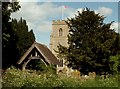
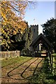
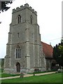
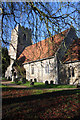
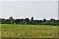
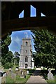
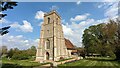
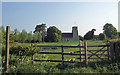
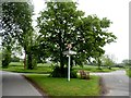
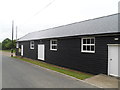
Photos of IP30 0NR

Area Information
IP30 0NR is a small residential cluster in England covering 62.8 hectares, home to 2309 residents. With a population density of 42 people per square kilometre, it is a low-density area characterised by a quiet, community-focused lifestyle. The area’s modest size means it is compact enough for daily errands to be manageable on foot or by bike, yet spacious enough to offer a sense of openness. The median age of 47 suggests a mature population, with adults aged 30–64 forming the largest demographic group. This reflects a stable, established community where many residents are likely to have lived for years. The area is predominantly owner-occupied, with 75% of homes owned by their occupants, and most properties are houses rather than flats. This mix creates a residential environment that prioritises privacy and space. Living in IP30 0NR means access to local amenities, schools, and a low-crime environment, all within a manageable radius. The area’s small scale ensures a close-knit feel, though its limited size may mean fewer large-scale developments or commercial hubs nearby.
- Area Type
- Postcode
- Area Size
- 62.8 hectares
- Population
- 2309
- Population Density
- 42 people/km²
The property market in IP30 0NR is dominated by owner-occupied homes, with 75% of properties owned by their occupants. This high rate of home ownership suggests a stable, long-term resident base, with limited rental activity. The accommodation type is predominantly houses, indicating a lack of high-density housing such as flats or apartments. This makes the area more suited to families or individuals seeking larger living spaces rather than urban-style living. Given the small size of the postcode area, the housing stock is likely limited to a few hundred properties, creating a niche market with limited scope for new developments. Buyers should consider that the area’s compact nature may restrict options for those seeking a wider range of property types. However, the combination of low crime rates and proximity to local amenities could make it attractive for those prioritising safety and convenience over large-scale urban features.
House Prices in IP30 0NR
Showing 20 properties
| Address | Type | Beds | Baths | Last Sale Price | Last Sale Date | |
|---|---|---|---|---|---|---|
| 8 Bury Road, Thorpe Morieux, IP30 0NR | house | 3 | 1 | £300,000 | Aug 2025 | |
| Wheelwrights, Bury Road, Thorpe Morieux, IP30 0NR | Cottage | 4 | 4 | £475,000 | Dec 2019 | |
| 7 Bury Road, Thorpe Morieux, IP30 0NR | house | - | - | £154,950 | Nov 2009 | |
| Woodview, Bury Road, Thorpe Morieux, IP30 0NR | Detached | 4 | 3 | £220,000 | Mar 2004 | |
| 5 Bury Road, Thorpe Morieux, IP30 0NR | Semi-detached | 3 | 1 | - | - | |
| 2 Bury Road, Thorpe Morieux, IP30 0NR | Semi-detached | 3 | 1 | - | - | |
| 1 Bury Road, Thorpe Morieux, IP30 0NR | Semi-detached | 4 | - | - | - | |
| Woodlands, Bury Road, Thorpe Morieux, IP30 0NR | Detached | - | - | - | - | |
| 4 Bury Road, Thorpe Morieux, IP30 0NR | house | - | - | - | - | |
| 6 Bury Road, Thorpe Morieux, IP30 0NR | house | - | - | - | - |
Energy Efficiency in IP30 0NR
The lifestyle in IP30 0NR is shaped by its small size and limited amenities. Within practical reach, residents have access to three retail outlets, including Co-op Lavenham and East of England Co-operative Co, which likely provide basic grocery and household goods. The presence of RAF Wattisham, an airport, adds a unique element to the area, though its role in daily life is unclear. The absence of parks, leisure facilities, or dining venues suggests that residents may need to travel to nearby towns for more varied entertainment or social activities. This creates a quiet, low-key lifestyle focused on local essentials rather than urban conveniences. The limited retail options mean that shopping trips may require visiting larger centres, but the compact nature of the area reduces travel time. For those prioritising simplicity and a close-knit community, this lifestyle may be appealing, though it lacks the vibrancy of more densely populated regions.
Amenities
Schools
Residents of IP30 0NR have access to three primary schools within practical reach: Cockfield Church of England Voluntary Controlled Primary School, Monks Eleigh Church of England Voluntary Controlled Primary School, and Cockfield Church of England Primary School. All three are primary schools, catering to children aged 4–11. While no Ofsted ratings are provided, the presence of multiple primary schools suggests a focus on local education, which is crucial for families with young children. The repetition of the name "Cockfield Church of England" in two schools may indicate a shared governance structure or historical ties. This cluster of primary schools ensures that children in the area have several options for schooling, reducing the need for long commutes. However, the absence of secondary schools or further education facilities within the postcode means families may need to consider nearby towns for higher-level education.
| Rank | School | Type | Entry gender | Ages |
|---|
Explore more schools in this area
Go to Schools tabDemographics
The population of IP30 0NR is predominantly adults aged 30–64, with a median age of 47. This suggests a community of middle-aged residents, many of whom may be in their peak working years or nearing retirement. The high home ownership rate of 75% indicates a stable housing market, with most residents living in properties they own rather than renting. The accommodation type is predominantly houses, reflecting a preference for detached or semi-detached homes over flats or apartments. The predominant ethnic group is White, though no specific data on diversity or minority representation is provided. The low population density of 42 people per square kilometre implies a spread-out, less crowded environment. While no deprivation statistics are available, the combination of high home ownership and a mature population suggests a relatively affluent or stable community. This profile may appeal to buyers seeking a quiet, established neighbourhood with long-term residential value.
Household Size
Accommodation Type
Tenure
Ethnic Group
Religion
Household Composition
Age
Household Deprivation
NS-SEC
Explore more demographic insights in this area
Go to Demographics tabPlanning
Planning Constraints
- Flood RiskPremium
- Ramsar Wetland SitesPremium
- Area of Outstanding Natural BeautyPremium
- Protected Nature ReservePremium
- Protected WoodlandPremium