Area Overview for IP30 0HA
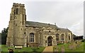
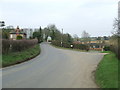
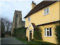
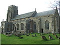
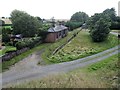
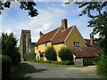
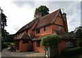
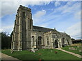
Photos of IP30 0HA
Area Information
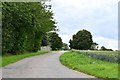
Living in IP30 0HA means inhabiting a compact, residential cluster in eastern England. The area spans 47.9 hectares and is home to 2,309 people, giving it a low population density of 42 people per square kilometre. This small postcode area is characterised by its quiet, low-density housing stock, with most properties being houses rather than flats. The community is predominantly middle-aged, with a median age of 47 and a strong presence of adults aged 30–64. Daily life here is likely to be calm and localised, with residents relying on nearby amenities and a low crime rate. The area’s proximity to retail outlets and primary schools suggests a focus on family living, though its small size means it is not a hub for broader urban services. For those seeking a peaceful, self-contained environment with minimal urban pressure, IP30 0HA offers a snapshot of rural England’s quieter corners, where community ties and low crime rates are notable features.
- Area Type
- Postcode
- Area Size
- 47.9 hectares
- Population
- 2309
- Population Density
- 42 people/km²
The property market in IP30 0HA is dominated by owner-occupied homes, with 75% of properties being owned by their residents. This high home ownership rate suggests a stable, long-term community rather than a rental market. The accommodation type is exclusively houses, which is unusual for areas with higher population densities but aligns with the area’s low population density of 42 people per square kilometre. This housing stock likely includes family homes, given the median age of 47 and the presence of primary schools nearby. For buyers, the small size of the area means that property choices are limited to the immediate cluster, with little scope for expansion or development. The focus on houses rather than flats may appeal to those seeking space and privacy, though the compact nature of the postcode means that buyers must consider proximity to nearby towns for broader amenities.
House Prices in IP30 0HA
Showing 28 properties
| Address | Type | Beds | Baths | Last Sale Price | Last Sale Date | |
|---|---|---|---|---|---|---|
| Marseillette, Howe Lane, Cockfield, IP30 0HA | Detached | 5 | 4 | £775,000 | Apr 2025 | |
| Etna Cottage, Howe Lane, Cockfield, IP30 0HA | Semi-detached | - | - | £300,000 | Feb 2025 | |
| Chiltern House, Howe Lane, Cockfield, IP30 0HA | house | - | - | £729,000 | Nov 2018 | |
| 3 Howe Lane, Cockfield, IP30 0HA | house | - | - | £320,000 | Mar 2018 | |
| Clovelly, Howe Lane, Cockfield, IP30 0HA | Detached | 5 | - | £46,000 | Aug 2017 | |
| Town House, Howe Lane, Cockfield, IP30 0HA | Cottage | 3 | - | £405,000 | Aug 2013 | |
| Pentewan, Howe Lane, Cockfield, IP30 0HA | house | 3 | 1 | £233,000 | Oct 2012 | |
| Green Ridge, Howe Lane, Cockfield, IP30 0HA | Bungalow | 3 | - | £385,000 | Nov 2011 | |
| Craufurd House, Howe Lane, Cockfield, IP30 0HA | Detached | - | - | £400,000 | Oct 2008 | |
| Sunnyside, Howe Lane, Cockfield, IP30 0HA | Detached | - | - | £225,000 | May 2007 |
Energy Efficiency in IP30 0HA
Residents of IP30 0HA have access to nearby retail amenities, including Co-op Lavenham, East of England Co-operative Co, and Morrisons Daily Bury. These shops suggest a basic retail offering, suitable for everyday needs but not extensive. The area’s small size means that leisure and recreational facilities are likely limited to local parks or open spaces, though no specific names are provided in the data. The presence of three primary schools indicates that the community is family-oriented, with amenities tailored to children’s needs. For those seeking a quiet lifestyle, the area’s low population density and low crime rate contribute to a sense of safety and seclusion. However, the lack of detailed information on parks, dining, or cultural facilities means that buyers should consider proximity to larger towns for more varied leisure options.
Amenities
Schools
Residents of IP30 0HA have access to three primary schools within practical reach: Cockfield Church of England Voluntary Controlled Primary School, Monks Eleigh Church of England Voluntary Controlled Primary School, and Cockfield Church of England Primary School. All three are primary institutions, though no Ofsted ratings are provided in the data. The presence of multiple primary schools suggests a focus on local education, which is typical for smaller, residential areas. Families with young children may benefit from the proximity of these schools, though the absence of secondary schools means that students will need to travel to nearby towns for further education. The concentration of Church of England schools indicates a specific religious affiliation among some residents, but the data does not specify the proportion of the community that attends these institutions.
| Rank | School | Type | Entry gender | Ages |
|---|
Explore more schools in this area
Go to Schools tabDemographics
The population of IP30 0HA is 2,309, with a median age of 47. This places the area firmly in the adult age range, with 30–64-year-olds making up the majority of residents. Home ownership is high, at 75%, indicating a stable, long-term community. The accommodation type is predominantly houses, reflecting a residential character that contrasts with more densely populated areas. The predominant ethnic group is White, though no specific data on diversity or deprivation levels is provided. The low population density of 42 people per square kilometre suggests a spread-out, possibly rural or semi-rural setting. For buyers, this demographic profile implies a mature, settled population with a focus on long-term residency rather than transient or rental-driven housing. The area’s safety record, with a crime risk score of 95 (low risk), further supports its appeal as a place with minimal social or economic pressures.
Household Size
Accommodation Type
Tenure
Ethnic Group
Religion
Household Composition
Age
Household Deprivation
NS-SEC
Explore more demographic insights in this area
Go to Demographics tabPlanning
Planning Constraints
- Flood RiskPremium
- Ramsar Wetland SitesPremium
- Area of Outstanding Natural BeautyPremium
- Protected Nature ReservePremium
- Protected WoodlandPremium