Area Overview for IP30 0BG
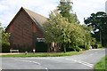
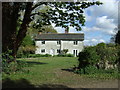
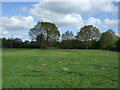
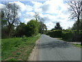
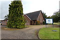
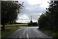
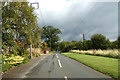
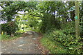
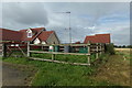
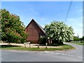
Photos of IP30 0BG


Area Information
Living in IP30 0BG means being part of a small, tightly knit residential cluster in England. The area spans 7.8 hectares and is home to 2,450 residents, with a population density of 57 people per square kilometre. This compact community feels quiet and unassuming, yet it is conveniently located near essential services and transport links. The demographic profile suggests a mature, stable population, with a median age of 47 and a strong presence of adults aged 30–64. Daily life here is likely characterised by a slower pace, with local amenities and schools within practical reach. The area’s proximity to Thurston Railway Station and nearby retail outlets like Co-op and Sainsburys ensures connectivity to broader networks. For those seeking a peaceful, family-oriented environment with low crime rates and minimal environmental risks, IP30 0BG offers a straightforward, no-frills lifestyle. Its small size means a close-knit community feel, though buyers should consider the limited housing stock and the need to commute for more specialised services.
- Area Type
- Postcode
- Area Size
- 7.8 hectares
- Population
- 2450
- Population Density
- 57 people/km²
The property market in IP30 0BG is dominated by owner-occupied homes, with 71% of residents living in properties they own. The accommodation type is predominantly houses, which is typical for a low-density, residential area. This suggests a market skewed towards established homeowners rather than renters, though the small size of the area may limit the availability of new builds or rental properties. Buyers should expect a limited selection of homes, as the area’s compact size and focus on single-family residences mean fewer options compared to larger towns. The high home ownership rate indicates a stable market with potential for long-term value retention. However, the absence of data on property prices or recent developments means buyers must consider the area’s small footprint and the need to commute for more amenities.
House Prices in IP30 0BG
Showing 6 properties
| Address | Type | Beds | Baths | Last Sale Price | Last Sale Date | |
|---|---|---|---|---|---|---|
| Meadowside, Church Road, Bradfield St George, IP30 0BG | Detached | 4 | 2 | £680,000 | Jun 2020 | |
| White Cottage, Church Road, Bradfield St George, IP30 0BG | Detached | 4 | - | £537,500 | Feb 2015 | |
| Yeomans Acre, Church Road, Bradfield St George, IP30 0BG | house | - | - | £450,000 | Sep 2010 | |
| Teran, Church Road, Bradfield St George, IP30 0BG | Detached | - | - | - | - | |
| Greenway House, Church Road, Bradfield St George, IP30 0BG | Detached | - | - | - | - | |
| Roydann, Church Road, Bradfield St George, IP30 0BG | Detached | - | - | - | - |
Energy Efficiency in IP30 0BG
The lifestyle in IP30 0BG is shaped by its proximity to essential amenities and quiet residential character. Within practical reach are retail outlets like Co-op Thurston and Sainsburys in Bury St Edmunds, offering everyday shopping needs. The area’s rail connections, including Thurston Railway Station, provide access to larger towns and cities, supporting both commuting and leisure travel. While the area itself is small, the surrounding region likely offers more diverse options for dining, leisure, and socialising. The presence of multiple schools and low crime rates contributes to a family-friendly environment. However, the limited local amenities mean residents may need to travel for specialised services, such as healthcare or entertainment. The small size of IP30 0BG fosters a close-knit community but may lack the vibrancy of larger urban areas.
Amenities
Schools
IP30 0BG is served by three schools, all of which are rated as good by Ofsted. Rougham Church of England Voluntary Controlled Primary School and Rougham Church of England Primary School are both primary schools, providing local education for younger children. Sybil Andrews Academy, an academy school, offers secondary education. The presence of two primary schools with good ratings ensures families have multiple options for early education, while the academy provides a structured secondary phase. This mix of school types supports a seamless educational journey for children living in the area. The high Ofsted ratings indicate quality teaching and facilities, though parents should verify if these schools meet their specific needs, such as curriculum focus or extracurricular opportunities.
| Rank | School | Type | Entry gender | Ages |
|---|
Explore more schools in this area
Go to Schools tabDemographics
The community in IP30 0BG is predominantly composed of adults aged 30–64, with a median age of 47. This suggests a mature population, likely with established careers and families. Home ownership is high, with 71% of residents owning their homes, reflecting a stable, long-term demographic. The accommodation type is primarily houses, which aligns with the area’s low population density and residential character. The predominant ethnic group is White, though specific data on diversity or deprivation is not provided. The age profile indicates a community that may be nearing retirement or in their prime working years, with fewer young families or elderly residents compared to other areas. The absence of data on income or deprivation means the quality of life cannot be fully assessed, but the high home ownership and low crime rates suggest a relatively secure environment.
Household Size
Accommodation Type
Tenure
Ethnic Group
Religion
Household Composition
Age
Household Deprivation
NS-SEC
Explore more demographic insights in this area
Go to Demographics tabPlanning
Planning Constraints
- Flood RiskPremium
- Ramsar Wetland SitesPremium
- Area of Outstanding Natural BeautyPremium
- Protected Nature ReservePremium
- Protected WoodlandPremium