Area Overview for IP3 9UP
Photos of IP3 9UP
Area Information
IP3 9UP is a small, compact postcode area in England, spanning 2,526 square metres and home to 1,685 residents. Its population density of 793 people per square kilometre suggests a tightly knit community, typical of a residential cluster. This area is characterised by its focus on housing, with a predominance of family homes and a median age of 47, indicating a stable, mature demographic. Daily life here is likely shaped by proximity to local amenities, including five retail outlets and rail access, which connects residents to nearby towns. The area’s low flood risk and absence of environmental constraints like protected woodlands or AONB designations suggest a practical, unobstructed living environment. However, the high crime risk score of 33/100 highlights a need for caution. For those seeking a quiet, residential setting with accessible transport, IP3 9UP offers a blend of simplicity and connectivity, though its small size means every decision about living here carries a distinct local flavour.
- Area Type
- Postcode
- Area Size
- 2526 m²
- Population
- 1685
- Population Density
- 793 people/km²
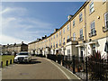
IP3 9UP is a housing-focused area, with 53% of properties owner-occupied and the rest likely rented. The accommodation type is predominantly houses, suggesting a market skewed towards family homes rather than flats or apartments. Given the area’s small size and high population density, the housing stock is likely limited, making it a niche market for buyers seeking specific properties. The absence of large-scale developments or commercial zones means the property landscape is intimate, with homes concentrated in a compact cluster. For buyers, this implies competition for available houses and a need to consider proximity to nearby amenities like rail stations and retail outlets. The lack of data on rental prices or property types beyond houses means potential buyers should investigate local listings closely, as the market may cater more to owner-occupiers than investors.
House Prices in IP3 9UP
Showing 14 properties
| Address | Type | Beds | Baths | Last Sale Price | Last Sale Date | |
|---|---|---|---|---|---|---|
| 24 Lackford Place, Ipswich, IP3 9UP | Flat | - | - | - | - | |
| 4 Lackford Place, Ipswich, IP3 9UP | Flat | - | - | - | - | |
| 8 Lackford Place, Ipswich, IP3 9UP | Flat | - | - | - | - | |
| 22 Lackford Place, Ipswich, IP3 9UP | Flat | - | - | - | - | |
| 26 Lackford Place, Ipswich, IP3 9UP | Flat | - | - | - | - | |
| 30 Lackford Place, Ipswich, IP3 9UP | Flat | - | - | - | - | |
| 28 Lackford Place, Ipswich, IP3 9UP | Flat | - | - | - | - | |
| 2 Lackford Place, Ipswich, IP3 9UP | Flat | - | - | - | - | |
| 6 Lackford Place, Ipswich, IP3 9UP | Flat | - | - | - | - | |
| 14 Lackford Place, Ipswich, IP3 9UP | Flat | - | - | - | - |
Energy Efficiency in IP3 9UP
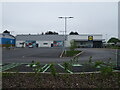
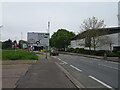
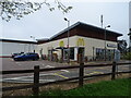
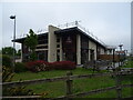
Living in IP3 9UP offers access to a range of local amenities within practical reach. The area includes five retail outlets, such as Lidl Crane and East of England Co-operative Co, providing everyday shopping options. Rail connectivity is strong, with Derby Road Railway Station and other nearby stations facilitating travel to urban centres. A ferry service at Shotley Point Marina Ferry Landing adds a unique dimension, linking residents to the marina and potentially to leisure activities on water. While the area lacks large parks or entertainment hubs, the presence of multiple retail and transport points suggests a functional, community-oriented lifestyle. The compact nature of the postcode means amenities are closely clustered, reducing the need for long commutes. This setup is ideal for those prioritising convenience over expansive recreational spaces.
Amenities
Schools
| Rank | School | Type | Entry gender | Ages |
|---|
Explore more schools in this area
Go to Schools tabDemographics
The population of IP3 9UP is predominantly adults aged 30–64, with a median age of 47. This suggests a community of established professionals and families, rather than students or retirees. Home ownership stands at 53%, indicating a mix of owner-occupied properties and rentals, though the exact proportion of renters is not specified. The area is composed largely of houses, which aligns with the demographic profile of families requiring more space. The predominant ethnic group is White, though no data on other ethnicities is provided. The high population density of 793 people per square kilometre, combined with the age range, implies a compact, possibly suburban setting where most residents are settled in long-term housing. This demographic structure may influence local services and amenities, tailored to the needs of middle-aged households.
Household Size
Accommodation Type
Tenure
Ethnic Group
Religion
Household Composition
Age
Household Deprivation
NS-SEC
Explore more demographic insights in this area
Go to Demographics tabPlanning
Planning Constraints
- Flood RiskPremium
- Ramsar Wetland SitesPremium
- Area of Outstanding Natural BeautyPremium
- Protected Nature ReservePremium
- Protected WoodlandPremium