Area Overview for IP3 9JF
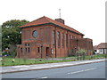
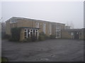
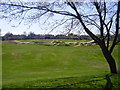
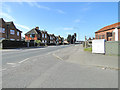
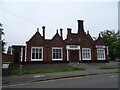
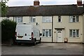
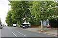
Photos of IP3 9JF

Area Information
Living in IP3 9JF means being part of a small, tightly knit residential cluster in England, home to 1,647 residents. This area is defined by its compact size and straightforward layout, with a focus on single-family homes. The community is predominantly composed of adults aged 30–64, reflecting a mature demographic with established lives. Daily life here is shaped by proximity to essential services, including five retail outlets such as Tesco Ipswich and East of England Co-operative Co, and five railway stations, including Derby Road Railway Station. While the area lacks large-scale amenities, its practical connectivity to nearby towns via rail and its excellent broadband infrastructure make it appealing for commuters and remote workers. The low flood risk and absence of environmental constraints like AONB or protected woodlands suggest a stable, low-maintenance living environment. However, the moderate crime risk score of 58 means residents should take standard precautions. IP3 9JF is a quiet, functional area suited to those prioritising convenience over urban vibrancy.
- Area Type
- Postcode
- Area Size
- Not available
- Population
- 1647
- Population Density
- 5260 people/km²
IP3 9JF is primarily a housing area with a focus on single-family homes, though only 36% of residents own their properties. This suggests a market where rental properties outnumber owner-occupied homes, possibly due to the area’s small size and limited new developments. The dominance of houses over flats or apartments indicates a low-density, suburban feel, which may appeal to those seeking space and privacy. However, the limited number of homes and the lack of data on property prices or availability mean buyers should consider the area’s restricted scope. For those seeking a broader range of options, nearby towns may offer more variety. The low flood risk and absence of environmental constraints make it a stable choice, but the moderate crime risk score of 58 means potential buyers should factor in local safety considerations.
House Prices in IP3 9JF
No properties found in this postcode.
Energy Efficiency in IP3 9JF
The lifestyle in IP3 9JF is shaped by its proximity to practical amenities. Five retail outlets, including Tesco Ipswich and East of England Co-operative Co, provide essential shopping options, while nearby rail stations like Derby Road Railway Station offer easy access to commuting and regional travel. Though the area lacks large parks or leisure facilities, the absence of environmental constraints like AONB or protected woodlands means residents can enjoy open spaces without regulatory restrictions. The compact nature of the area fosters a quiet, community-focused atmosphere, ideal for those seeking convenience over sprawling amenities. The combination of retail access, rail connectivity, and stable living conditions creates a functional lifestyle suited to commuters and those prioritising simplicity.
Amenities
Schools
Residents of IP3 9JF have access to two notable schools within practical reach. Holywells High School is a primary school, catering to younger children, while Sir Bobby Robson School is a special school, providing tailored education for students with specific needs. This combination of school types suggests a community that values inclusive education and supports families with diverse requirements. The presence of a special school may indicate a focus on accessibility and specialist services, though no Ofsted ratings are provided. For families prioritising a broad range of educational options, the mix of primary and special schools offers a practical solution. However, the absence of secondary schools nearby means parents may need to consider commuting to larger towns for further education.
| Rank | School | Type | Entry gender | Ages |
|---|
Explore more schools in this area
Go to Schools tabDemographics
The population of IP3 9JF is 1,647, with a median age of 47. This suggests a community of middle-aged adults, many of whom are likely in their peak working years. The most common age range is 30–64, indicating a stable, mature demographic. Home ownership here is relatively low at 36%, suggesting a higher proportion of renters compared to owner-occupied properties. The primary accommodation type is houses, which aligns with the area’s small, residential character. The predominant ethnic group is White, though no specific data on diversity or deprivation is provided. This demographic profile implies a community focused on established living, with fewer young families or transient populations. The age range and home ownership figures suggest a mix of long-term residents and those in rental properties, possibly including professionals or retirees.
Household Size
Accommodation Type
Tenure
Ethnic Group
Religion
Household Composition
Age
Household Deprivation
NS-SEC
Explore more demographic insights in this area
Go to Demographics tabPlanning
Planning Constraints
- Flood RiskPremium
- Ramsar Wetland SitesPremium
- Area of Outstanding Natural BeautyPremium
- Protected Nature ReservePremium
- Protected WoodlandPremium