Area Overview for IP3 9BE
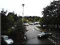
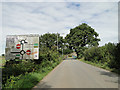
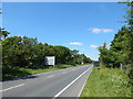
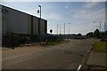
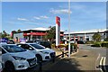
Photos of IP3 9BE


Area Information
Living in IP3 9BE offers a compact, residential experience in a small cluster of homes spread across 2.2 hectares. With a population of 1,685 and a density of 793 people per square kilometre, this area is characterised by its close-knit community feel. The median age of 47 suggests a mature demographic, with the majority of residents aged between 30 and 64. Daily life here is shaped by proximity to essential services: five retail outlets, including Makro Ipswich and Lidl Crane, and five rail stations, such as Derby Road Railway Station, provide practical connectivity. A ferry landing at Shotley Point Marina adds access to water-based travel. The area’s digital infrastructure is strong, with broadband rated excellent and mobile coverage good, supporting both remote work and everyday internet use. While the housing stock is primarily owner-occupied, the small size of the area means buyers must consider nearby surroundings for broader options. IP3 9BE balances residential tranquillity with accessible amenities, making it a viable choice for those seeking a settled, community-focused lifestyle.
- Area Type
- Postcode
- Area Size
- 2.2 hectares
- Population
- 1685
- Population Density
- 793 people/km²
The property market in IP3 9BE is defined by a 53% home ownership rate, with houses forming the primary accommodation type. This suggests a market skewed towards owner-occupied properties rather than rental demand. The small area size of 2.2 hectares means the housing stock is limited, requiring buyers to consider nearby zones for more options. The presence of houses implies a focus on family-friendly or long-term living, though the lack of specific data on property types (e.g., terraced or detached) leaves room for further inquiry. With a mature demographic and stable population, the market may offer predictable value retention. However, the limited size of the area could mean competition for available homes, particularly for those seeking specific features. Buyers should also consider proximity to transport links, as rail and ferry access may influence property desirability.
House Prices in IP3 9BE
No properties found in this postcode.
Energy Efficiency in IP3 9BE
Residents of IP3 9BE have access to a range of amenities within practical reach. Retail options include Makro Ipswich, Lidl Crane, and Iceland Ipswich, providing grocery and household needs. The five rail stations—such as Derby Road Railway Station—offer frequent services, facilitating travel to work, shopping, or leisure. The Shotley Point Marina Ferry Landing connects to water-based routes, adding versatility to transport. While the area lacks large-scale leisure facilities, the presence of multiple retail and transport hubs suggests a convenient lifestyle for daily errands and commuting. The compact nature of the area means amenities are closely clustered, reducing travel time. However, the absence of specific data on parks or recreational spaces means the extent of green spaces remains unclear. For those prioritising accessibility, the combination of retail, rail, and ferry access makes IP3 9BE a practical choice.
Amenities
Schools
| Rank | School | Type | Entry gender | Ages |
|---|
Explore more schools in this area
Go to Schools tabDemographics
The population of IP3 9BE is predominantly adults aged 30 to 64, with a median age of 47. This age group dominates, reflecting a community rooted in established households rather than younger families or retirees. Home ownership stands at 53%, indicating a mix of owner-occupied and rental properties. The accommodation type is largely houses, suggesting a preference for detached or semi-detached living. The predominant ethnic group is White, with no data provided on other demographics. The population density of 793 people per square kilometre implies a moderately populated area, though the small size of 2.2 hectares means residents are likely to know their neighbours. This profile suggests a stable, mature community with limited turnover, which can influence local services and amenities. The absence of specific data on deprivation means quality of life factors such as access to healthcare or social services are not quantified here.
Household Size
Accommodation Type
Tenure
Ethnic Group
Religion
Household Composition
Age
Household Deprivation
NS-SEC
Explore more demographic insights in this area
Go to Demographics tabPlanning
Planning Constraints
- Flood RiskPremium
- Ramsar Wetland SitesPremium
- Area of Outstanding Natural BeautyPremium
- Protected Nature ReservePremium
- Protected WoodlandPremium